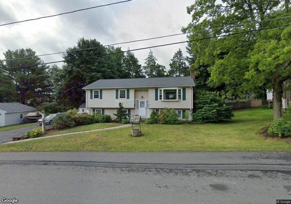
22 Barbara Ave Auburn, MA 01501
Downtown Auburn NeighborhoodEstimated Value: $456,000 - $565,000
3
Beds
3
Baths
1,302
Sq Ft
$390/Sq Ft
Est. Value
About This Home
This home is located at 22 Barbara Ave, Auburn, MA 01501 and is currently estimated at $507,204, approximately $389 per square foot. 22 Barbara Ave is a home located in Worcester County with nearby schools including Auburn Senior High School and Shrewsbury Montessori School - Auburn Campus.
Ownership History
Date
Name
Owned For
Owner Type
Purchase Details
Closed on
Jun 30, 1995
Sold by
Kennedy Thomas J and Kennedy Ann M
Bought by
Sturdevant Preston and Sturdenvant Marie L
Current Estimated Value
Home Financials for this Owner
Home Financials are based on the most recent Mortgage that was taken out on this home.
Original Mortgage
$113,600
Interest Rate
7.8%
Mortgage Type
Purchase Money Mortgage
Create a Home Valuation Report for This Property
The Home Valuation Report is an in-depth analysis detailing your home's value as well as a comparison with similar homes in the area
Home Values in the Area
Average Home Value in this Area
Purchase History
| Date | Buyer | Sale Price | Title Company |
|---|---|---|---|
| Sturdevant Preston | $142,000 | -- |
Source: Public Records
Mortgage History
| Date | Status | Borrower | Loan Amount |
|---|---|---|---|
| Open | Sturdevant Preston | $40,000 | |
| Closed | Sturdevant Preston | $113,600 | |
| Previous Owner | Sturdevant Preston | $90,000 |
Source: Public Records
Tax History
| Year | Tax Paid | Tax Assessment Tax Assessment Total Assessment is a certain percentage of the fair market value that is determined by local assessors to be the total taxable value of land and additions on the property. | Land | Improvement |
|---|---|---|---|---|
| 2025 | $60 | $420,900 | $138,000 | $282,900 |
| 2024 | $6,033 | $404,100 | $131,600 | $272,500 |
| 2023 | $5,768 | $363,200 | $119,600 | $243,600 |
| 2022 | $5,551 | $330,000 | $119,600 | $210,400 |
| 2021 | $386 | $294,500 | $105,600 | $188,900 |
| 2020 | $5,295 | $294,500 | $105,600 | $188,900 |
| 2019 | $5,222 | $283,500 | $104,500 | $179,000 |
| 2018 | $5,395 | $271,100 | $97,700 | $173,400 |
| 2017 | $4,743 | $258,600 | $88,600 | $170,000 |
| 2016 | $4,588 | $253,600 | $92,700 | $160,900 |
| 2015 | $4,320 | $250,300 | $92,700 | $157,600 |
| 2014 | $4,188 | $242,200 | $88,400 | $153,800 |
Source: Public Records
Map
Nearby Homes
- 61 School St
- 8 South Terrace
- 36 Central St
- 6 George St
- 137 South St
- 751 Washington St Unit 43A
- 166 Leicester St
- 33 Eastford Rd
- 328 Oxford St N
- 31 Walsh Ave
- 31-33 Walsh Ave
- 33 Walsh Ave
- 634 Oxford St S
- 40 Bryn Mawr Ave
- 35 Waterman Rd
- 19-20 Williams St
- 177 Oxford St N
- 1 Rockland Road Ct
- 1-9 Helens Way
- 49 Prospect St
- 20 Barbara Ave
- 23 Winchester Ave
- 24 Barbara Ave
- 25 Winchester Ave
- 23 Barbara Ave
- 21 Winchester Ave
- 21 Barbara Ave
- 18 Barbara Ave
- 25 Barbara Ave
- 27 Winchester Ave
- 19 Winchester Ave
- 26 Barbara Ave
- 19 Barbara Ave
- 22 Winchester Ave
- 27 Barbara Ave
- 24 Winchester Ave
- 29 Winchester Ave
- 16 Barbara Ave
- 17 Barbara Ave
- 28 Barbara Ave
Your Personal Tour Guide
Ask me questions while you tour the home.