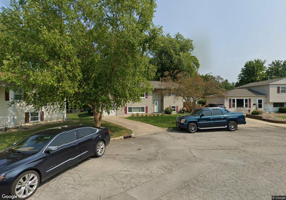
22 Barclay Ct Decatur, IL 62526
Estimated Value: $123,000 - $139,253
4
Beds
2
Baths
1,820
Sq Ft
$73/Sq Ft
Est. Value
About This Home
This home is located at 22 Barclay Ct, Decatur, IL 62526 and is currently estimated at $133,063, approximately $73 per square foot. 22 Barclay Ct is a home located in Macon County with nearby schools including Stephen Decatur Middle School, Robertson Charter School, and Northwest Christian Campus.
Ownership History
Date
Name
Owned For
Owner Type
Purchase Details
Closed on
Mar 28, 2008
Sold by
Conner Monica R and Conner Lonnie D
Bought by
Tondello Scott and Baker Sarah
Current Estimated Value
Home Financials for this Owner
Home Financials are based on the most recent Mortgage that was taken out on this home.
Original Mortgage
$96,500
Outstanding Balance
$60,997
Interest Rate
6.1%
Mortgage Type
New Conventional
Estimated Equity
$72,066
Purchase Details
Closed on
Jul 1, 1999
Create a Home Valuation Report for This Property
The Home Valuation Report is an in-depth analysis detailing your home's value as well as a comparison with similar homes in the area
Purchase History
| Date | Buyer | Sale Price | Title Company |
|---|---|---|---|
| Tondello Scott | $96,500 | None Available | |
| -- | $76,500 | -- |
Source: Public Records
Mortgage History
| Date | Status | Borrower | Loan Amount |
|---|---|---|---|
| Open | Tondello Scott | $96,500 |
Source: Public Records
Tax History
| Year | Tax Paid | Tax Assessment Tax Assessment Total Assessment is a certain percentage of the fair market value that is determined by local assessors to be the total taxable value of land and additions on the property. | Land | Improvement |
|---|---|---|---|---|
| 2024 | $3,761 | $44,852 | $4,410 | $40,442 |
| 2023 | $3,709 | $43,264 | $4,254 | $39,010 |
| 2022 | $3,511 | $40,332 | $4,234 | $36,098 |
| 2021 | $2,093 | $26,346 | $3,954 | $22,392 |
| 2020 | $2,033 | $25,122 | $3,770 | $21,352 |
| 2019 | $2,033 | $25,122 | $3,770 | $21,352 |
| 2018 | $1,822 | $23,340 | $4,382 | $18,958 |
| 2017 | $1,882 | $23,963 | $4,499 | $19,464 |
| 2016 | $1,924 | $24,208 | $4,545 | $19,663 |
| 2015 | $1,817 | $23,780 | $4,465 | $19,315 |
| 2014 | $1,682 | $23,545 | $4,421 | $19,124 |
| 2013 | $1,759 | $24,429 | $4,587 | $19,842 |
Source: Public Records
Map
Nearby Homes
- 1759 N Hunt Ct
- 2451 W Olive St
- 3525 W Center St
- 2218 Baker Ln
- 2275 & 2235 Baker Ln
- 1650 N Sunnyside Rd
- 2124 Home Park Ave
- 2198 Gary Ct
- 1720 N Sunnyside Rd
- 1051 Valley View Ct
- 2320 N Kenwood Ct
- 1990 W Cushing St
- 1094 N Westlawn Ave
- 1960 W Cushing St
- 1929 W Ravina Park Rd
- 3499 W Lafayette Ave
- 558 N Hillcrest Blvd
- 952 N Linden Ave
- 1650 N Dennis Ave
- 1415 N Dennis Ave
- 20 Barclay Ct
- 24 Barclay Ct
- 2731 W Hunt St
- 2739 W Hunt St
- 23 Barclay Ct
- 18 Barclay Ct
- 21 Barclay Ct
- 17 Barclay Ct
- 19 Barclay Ct
- 2723 W Hunt St
- 2832 W Center St
- 2761 W Hunt St
- 2840 W Center St
- 2844 W Center St
- 2715 W Hunt St
- 2664 W Gregory Ct
- 2777 W Hunt St
- 2730 W Hunt St
- 2820 W Center St
- 2816 W Center St
Your Personal Tour Guide
Ask me questions while you tour the home.