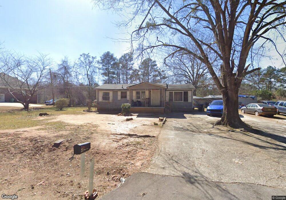
22 Barnes Dr Locust Grove, GA 30248
Estimated Value: $154,694 - $181,000
3
Beds
1
Bath
1,071
Sq Ft
$153/Sq Ft
Est. Value
About This Home
This home is located at 22 Barnes Dr, Locust Grove, GA 30248 and is currently estimated at $163,565, approximately $152 per square foot. 22 Barnes Dr is a home located in Henry County with nearby schools including Locust Grove Elementary School, Locust Grove Middle School, and Locust Grove High School.
Ownership History
Date
Name
Owned For
Owner Type
Purchase Details
Closed on
Sep 27, 2010
Sold by
Wade Harold
Bought by
Sellers Kay C
Current Estimated Value
Purchase Details
Closed on
Nov 20, 2008
Sold by
Sellers Kay C
Bought by
Sellers Kay C and Wade Harold
Purchase Details
Closed on
Jul 1, 2008
Sold by
Vincent Brett D
Bought by
Chase Home Fin Llc
Purchase Details
Closed on
May 4, 2006
Sold by
Tandem Cap Sources Inc
Bought by
Vincent Brett D
Home Financials for this Owner
Home Financials are based on the most recent Mortgage that was taken out on this home.
Original Mortgage
$72,000
Interest Rate
6.28%
Mortgage Type
New Conventional
Purchase Details
Closed on
Jun 4, 2003
Sold by
Evans Michael D and Evans Mary R
Bought by
Cain Betty
Home Financials for this Owner
Home Financials are based on the most recent Mortgage that was taken out on this home.
Original Mortgage
$68,524
Interest Rate
5.56%
Mortgage Type
FHA
Create a Home Valuation Report for This Property
The Home Valuation Report is an in-depth analysis detailing your home's value as well as a comparison with similar homes in the area
Home Values in the Area
Average Home Value in this Area
Purchase History
| Date | Buyer | Sale Price | Title Company |
|---|---|---|---|
| Sellers Kay C | -- | -- | |
| Sellers Kay C | -- | -- | |
| Sellers Kay C | -- | -- | |
| Chase Home Fin Llc | $80,345 | -- | |
| Vincent Brett D | $50,000 | -- | |
| Cain Betty | $69,600 | -- |
Source: Public Records
Mortgage History
| Date | Status | Borrower | Loan Amount |
|---|---|---|---|
| Previous Owner | Vincent Brett D | $72,000 | |
| Previous Owner | Cain Betty | $68,524 |
Source: Public Records
Tax History Compared to Growth
Tax History
| Year | Tax Paid | Tax Assessment Tax Assessment Total Assessment is a certain percentage of the fair market value that is determined by local assessors to be the total taxable value of land and additions on the property. | Land | Improvement |
|---|---|---|---|---|
| 2025 | $352 | $48,640 | $16,040 | $32,600 |
| 2024 | $352 | $51,920 | $14,440 | $37,480 |
| 2023 | $76 | $47,160 | $13,920 | $33,240 |
| 2022 | $151 | $34,680 | $12,840 | $21,840 |
| 2021 | $151 | $26,960 | $11,040 | $15,920 |
| 2020 | $138 | $22,920 | $10,400 | $12,520 |
| 2019 | $115 | $20,800 | $9,840 | $10,960 |
| 2018 | $72 | $17,640 | $9,120 | $8,520 |
| 2016 | $40 | $14,640 | $7,040 | $7,600 |
| 2015 | $40 | $11,880 | $7,480 | $4,400 |
| 2014 | $40 | $11,080 | $7,480 | $3,600 |
Source: Public Records
Map
Nearby Homes
- 50 Grove Rd
- 143 Massey Ln
- 149 Pristine Dr
- 878 Jackson St
- 4 Skyland Dr W
- 863 Jackson St
- 470 Louise Way
- 498 Louise Way
- 36 Highpoint Ln
- 239 Ferguson Ave
- 231 Ferguson Ave
- 77 Rosser Ln
- 149 Elkins Blvd
- 0 Rabbit Run Unit 10569153
- 26 Skyland Dr W
- 501 Grove Park Dr
- 1604 Lady Maria Ct
- 1524 Queen Elizabeth Dr
- 65 Grove Creek Dr
- 110 Ridge St
- 12 Barnes Dr
- 42 S Barnes Dr
- 4336 Highway 42
- 56 S Barnes Dr
- 30 Barnes Dr
- 4254 Highway 42 S
- 20 Barnes Dr
- 78 Barnes Dr
- 63 Barnes Dr
- 988 Jackson St
- 988 Jackson St Unit TRACT B6
- 972 Jackson St Unit TRACT B2
- 968 Jackson St Unit TRACT B1
- 976 Jackson St Unit TRACT B3
- 4244 Highway 42
- 4382 Highway 42
- 4382 Georgia 42
- 101 Barnes Dr
- 8 Barnes Dr
- 1144 Jackson St