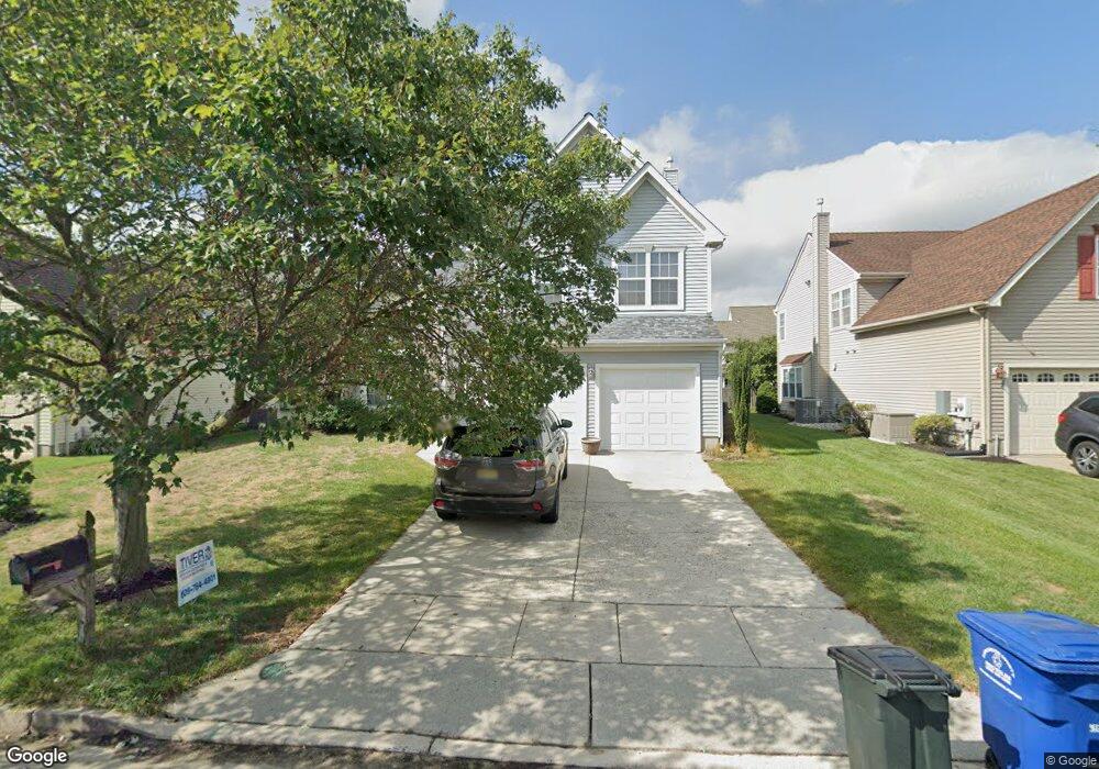
22 Barton Way Mount Laurel, NJ 08054
Estimated Value: $601,610 - $643,000
--
Bed
--
Bath
2,419
Sq Ft
$257/Sq Ft
Est. Value
About This Home
This home is located at 22 Barton Way, Mount Laurel, NJ 08054 and is currently estimated at $621,653, approximately $256 per square foot. 22 Barton Way is a home located in Burlington County with nearby schools including Countryside Elementary School, T.E. Harrington Middle School, and Mount Laurel Hartford School.
Ownership History
Date
Name
Owned For
Owner Type
Purchase Details
Closed on
Dec 11, 2002
Sold by
Cendant Mobility Financial Corp
Bought by
Peters Robert J and Palmunen Joan H
Current Estimated Value
Home Financials for this Owner
Home Financials are based on the most recent Mortgage that was taken out on this home.
Original Mortgage
$240,000
Outstanding Balance
$102,646
Interest Rate
6.18%
Estimated Equity
$519,007
Purchase Details
Closed on
Nov 26, 2002
Sold by
Baeza Richard R and Baeza Bonnie B
Bought by
Cendant Mobility Financial Corp
Home Financials for this Owner
Home Financials are based on the most recent Mortgage that was taken out on this home.
Original Mortgage
$240,000
Outstanding Balance
$102,646
Interest Rate
6.18%
Estimated Equity
$519,007
Purchase Details
Closed on
Dec 31, 1996
Sold by
Smith Michael and Smith Barbara L
Bought by
Baeza Richard E and Baeza Bonnie B
Create a Home Valuation Report for This Property
The Home Valuation Report is an in-depth analysis detailing your home's value as well as a comparison with similar homes in the area
Home Values in the Area
Average Home Value in this Area
Purchase History
| Date | Buyer | Sale Price | Title Company |
|---|---|---|---|
| Peters Robert J | $300,000 | Weichert Title Agency | |
| Cendant Mobility Financial Corp | $300,000 | Weichert Title Agency | |
| Baeza Richard E | $184,000 | -- |
Source: Public Records
Mortgage History
| Date | Status | Borrower | Loan Amount |
|---|---|---|---|
| Open | Peters Robert J | $240,000 | |
| Previous Owner | Cendant Mobility Financial Corp | $20,000 |
Source: Public Records
Tax History Compared to Growth
Tax History
| Year | Tax Paid | Tax Assessment Tax Assessment Total Assessment is a certain percentage of the fair market value that is determined by local assessors to be the total taxable value of land and additions on the property. | Land | Improvement |
|---|---|---|---|---|
| 2025 | $9,701 | $307,300 | $93,600 | $213,700 |
| 2024 | $9,336 | $307,300 | $93,600 | $213,700 |
| 2023 | $9,336 | $307,300 | $93,600 | $213,700 |
| 2022 | $9,130 | $307,300 | $93,600 | $213,700 |
| 2021 | $9,130 | $307,300 | $93,600 | $213,700 |
| 2020 | $8,952 | $307,300 | $93,600 | $213,700 |
| 2019 | $8,859 | $307,300 | $93,600 | $213,700 |
| 2018 | $8,792 | $307,300 | $93,600 | $213,700 |
| 2017 | $8,564 | $307,300 | $93,600 | $213,700 |
| 2016 | $8,435 | $307,300 | $93,600 | $213,700 |
| 2015 | $8,337 | $307,300 | $93,600 | $213,700 |
| 2014 | $8,254 | $307,300 | $93,600 | $213,700 |
Source: Public Records
Map
Nearby Homes
- 53 Saw Mill Dr
- 907A Oliphant Ln Unit 907A
- 6 Leighton Dr
- 205 Kirby Way Unit 205
- 603 Kirby Way Unit 603
- 2 Watson Dr
- 12 B E Daisy Ln
- 1201A Ginger Ct
- 705A Wharton Rd
- 1302 Ginger Dr
- 13 Village Ct Unit 13
- 130B Birchfield Ct Unit 130B
- 123A Birchfield Ct Unit 123A
- 124 W Berwin Way
- 11 E Berwin Way
- 112B W Bluebell Ln Unit 112B
- 40 E Oleander Dr
- 6 E Azalea Ln
- 70B Sumac Ct Unit 70B
- 23 E Oleander Dr