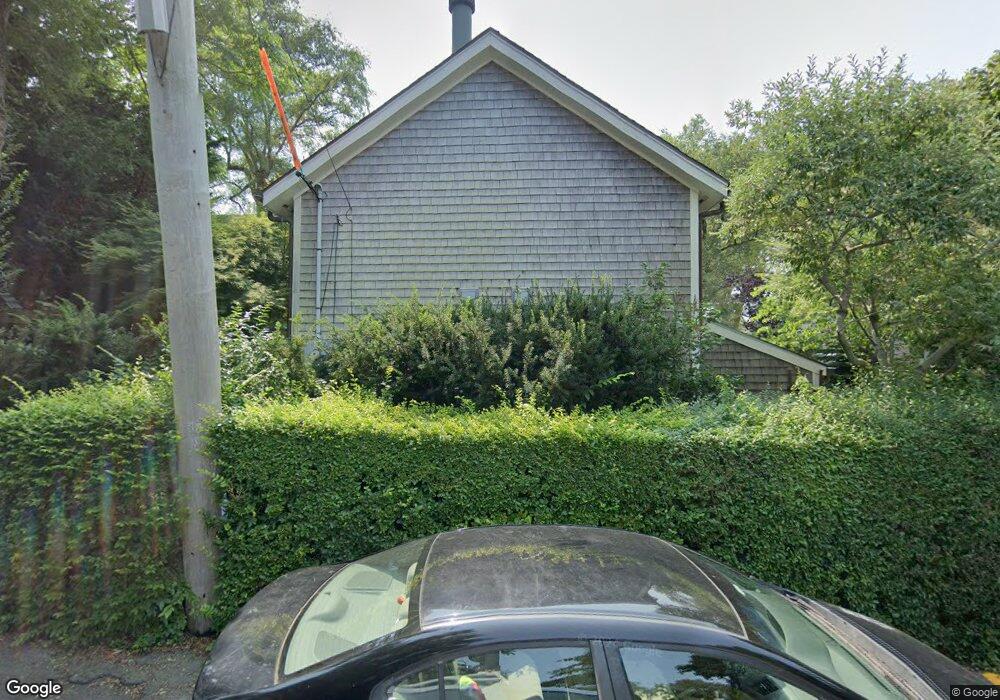
22 Brewster St Provincetown, MA 02657
Estimated Value: $2,229,173 - $2,483,000
3
Beds
2
Baths
2,200
Sq Ft
$1,050/Sq Ft
Est. Value
About This Home
This home is located at 22 Brewster St, Provincetown, MA 02657 and is currently estimated at $2,310,793, approximately $1,050 per square foot. 22 Brewster St is a home located in Barnstable County with nearby schools including Provincetown Schools.
Ownership History
Date
Name
Owned For
Owner Type
Purchase Details
Closed on
Nov 30, 2009
Sold by
Crepeau Jerome C and Lima Louis L
Bought by
Dusek Edward L and Kelly Paul A
Current Estimated Value
Home Financials for this Owner
Home Financials are based on the most recent Mortgage that was taken out on this home.
Original Mortgage
$250,000
Outstanding Balance
$161,908
Interest Rate
4.92%
Mortgage Type
Purchase Money Mortgage
Estimated Equity
$2,148,885
Purchase Details
Closed on
Feb 16, 2005
Sold by
Streib Harlan J and Streib Lois G
Bought by
Crepeau Jerome C and Lima Louis L
Create a Home Valuation Report for This Property
The Home Valuation Report is an in-depth analysis detailing your home's value as well as a comparison with similar homes in the area
Home Values in the Area
Average Home Value in this Area
Purchase History
| Date | Buyer | Sale Price | Title Company |
|---|---|---|---|
| Dusek Edward L | $800,000 | -- | |
| Dusek Edward L | $800,000 | -- | |
| Dusek Edward L | $800,000 | -- | |
| Crepeau Jerome C | $575,000 | -- | |
| Crepeau Jerome C | $575,000 | -- |
Source: Public Records
Mortgage History
| Date | Status | Borrower | Loan Amount |
|---|---|---|---|
| Open | Dusek Edward L | $250,000 | |
| Closed | Dusek Edward L | $250,000 | |
| Previous Owner | Crepeau Jerome C | $85,000 |
Source: Public Records
Tax History
| Year | Tax Paid | Tax Assessment Tax Assessment Total Assessment is a certain percentage of the fair market value that is determined by local assessors to be the total taxable value of land and additions on the property. | Land | Improvement |
|---|---|---|---|---|
| 2025 | $10,890 | $1,944,600 | $559,800 | $1,384,800 |
| 2024 | $10,453 | $1,873,300 | $533,500 | $1,339,800 |
| 2023 | $9,557 | $1,598,200 | $464,000 | $1,134,200 |
| 2022 | $8,677 | $1,302,900 | $433,600 | $869,300 |
| 2021 | $8,189 | $1,156,600 | $394,200 | $762,400 |
| 2020 | $7,419 | $1,120,700 | $394,200 | $726,500 |
| 2019 | $7,486 | $1,060,400 | $382,700 | $677,700 |
| 2018 | $6,929 | $930,000 | $381,500 | $548,500 |
| 2017 | $6,748 | $875,200 | $374,000 | $501,200 |
| 2016 | $6,866 | $880,300 | $403,500 | $476,800 |
| 2015 | $6,348 | $860,100 | $395,500 | $464,600 |
Source: Public Records
Map
Nearby Homes
- 37 Pearl St
- 9A Conwell St Unit 4
- 16 Conwell St Unit 3
- 184 Bradford St Unit 1
- 286A Bradford St Unit 5
- 16 Off Conwell St
- 33 Conwell St Unit 5B
- 405 Commercial St Unit 5
- 441 Commercial St Unit B
- 361b Commercial St Unit U3
- 208 Bradford St Unit 7
- 86 Harry Kemp Way Unit B
- 333 Commercial St Unit 9
- 100 Alden St Unit 203
- 488 Commercial St Unit 14
- 50 Nelson Ave Unit 6
- 495 Commercial St Unit 9
- 495 Commercial St Unit 11
- 294 Commercial St
- 116 Bradford St Unit 1
- 39 Pearl St
- 39 Pearl St Unit 2
- 18 Brewster St
- 2 Standish Way
- 44 Pearl St Unit 44C
- 44 Pearl St Unit 44B
- 44 Pearl St Unit 44A
- 44 Pearl St
- 44 Pearl St Unit 1
- 44 Pearl St Unit C
- 44 Pearl St Unit B
- 44 Pearl St Unit A
- 4 Standish Way
- 23 Brewster St
- 23 Brewster St Unit 1-2
- 21 Brewster St
- 19 Brewster St Unit F
- 19 Brewster St Unit E
- 19 Brewster St Unit D
- 19 Brewster St Unit C
Your Personal Tour Guide
Ask me questions while you tour the home.