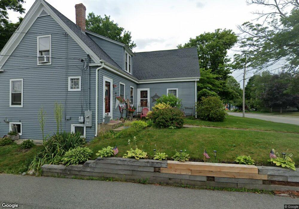
22 Broad St Whitman, MA 02382
Estimated Value: $495,866 - $541,000
3
Beds
1
Bath
1,370
Sq Ft
$376/Sq Ft
Est. Value
About This Home
This home is located at 22 Broad St, Whitman, MA 02382 and is currently estimated at $514,467, approximately $375 per square foot. 22 Broad St is a home located in Plymouth County with nearby schools including St Bridget School.
Ownership History
Date
Name
Owned For
Owner Type
Purchase Details
Closed on
Nov 24, 1989
Sold by
Crudup Pamela D
Bought by
Hatfield John R
Current Estimated Value
Home Financials for this Owner
Home Financials are based on the most recent Mortgage that was taken out on this home.
Original Mortgage
$115,434
Interest Rate
9.83%
Mortgage Type
Purchase Money Mortgage
Create a Home Valuation Report for This Property
The Home Valuation Report is an in-depth analysis detailing your home's value as well as a comparison with similar homes in the area
Home Values in the Area
Average Home Value in this Area
Purchase History
| Date | Buyer | Sale Price | Title Company |
|---|---|---|---|
| Hatfield John R | $125,500 | -- |
Source: Public Records
Mortgage History
| Date | Status | Borrower | Loan Amount |
|---|---|---|---|
| Open | Hatfield John R | $90,000 | |
| Open | Hatfield John R | $188,000 | |
| Closed | Hatfield John R | $160,000 | |
| Closed | Hatfield John R | $115,434 |
Source: Public Records
Tax History Compared to Growth
Tax History
| Year | Tax Paid | Tax Assessment Tax Assessment Total Assessment is a certain percentage of the fair market value that is determined by local assessors to be the total taxable value of land and additions on the property. | Land | Improvement |
|---|---|---|---|---|
| 2025 | $5,412 | $412,500 | $203,900 | $208,600 |
| 2024 | $5,107 | $400,900 | $199,900 | $201,000 |
| 2023 | $4,891 | $360,400 | $173,400 | $187,000 |
| 2022 | $4,821 | $331,100 | $157,600 | $173,500 |
| 2021 | $4,645 | $299,700 | $144,800 | $154,900 |
| 2020 | $4,444 | $280,400 | $131,000 | $149,400 |
| 2019 | $4,188 | $272,300 | $131,000 | $141,300 |
| 2018 | $3,905 | $243,900 | $124,100 | $119,800 |
| 2017 | $3,678 | $243,900 | $124,100 | $119,800 |
| 2016 | $3,562 | $228,500 | $118,200 | $110,300 |
| 2015 | $3,567 | $228,500 | $118,200 | $110,300 |
Source: Public Records
Map
Nearby Homes
- 532 Washington St
- 48 Day St
- 20 Elm Place
- 110 South Ave Unit 14
- 110 South Ave
- 53 Temple St
- 135-137 Temple St
- 150 Harvard St
- 164 Warren Ave
- 159 Auburn St
- 154 Auburn St
- 63 Dewey Ave
- 604 Bedford St Unit 5
- 22 Old Coach Rd
- 23 Reed Place
- 66 Belmont St
- 501 Auburn St Unit 404
- 501 Auburn St Unit 201
- 501 Auburn St Unit 401
- 170 Pleasant St
- 46 Church St
- 46 Church St Unit 2
- 30 Broad St
- 45 Central St
- 40 Church St
- 41-43 Central St
- 29 Broad St Unit 1
- 29 Broad St Unit C-2
- 29 Broad St Unit 3
- 29 Broad St
- 41 Central St Unit 43
- 41 Central St Unit 2
- 41 Central St Unit 3
- 43 Central St Unit 1
- 36 Church St
- 489 Washington St
- 37 Central St
- 44 Broad St
- 27 Broad St
- 27 Broad St Unit 3