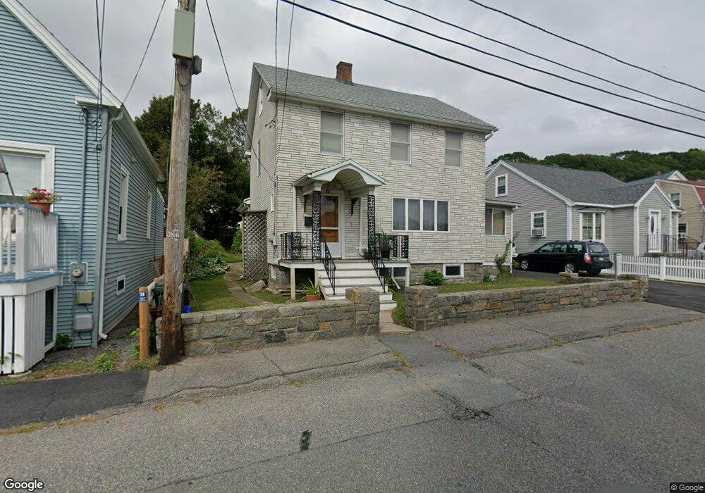
22 Burnham St Gloucester, MA 01930
Central Gloucester NeighborhoodEstimated Value: $548,000 - $659,000
3
Beds
2
Baths
1,738
Sq Ft
$349/Sq Ft
Est. Value
About This Home
This home is located at 22 Burnham St, Gloucester, MA 01930 and is currently estimated at $606,387, approximately $348 per square foot. 22 Burnham St is a home located in Essex County with nearby schools including East Veterans Memorial Elementary, Ralph B O'maley Middle School, and Gloucester High School.
Create a Home Valuation Report for This Property
The Home Valuation Report is an in-depth analysis detailing your home's value as well as a comparison with similar homes in the area
Home Values in the Area
Average Home Value in this Area
Tax History
| Year | Tax Paid | Tax Assessment Tax Assessment Total Assessment is a certain percentage of the fair market value that is determined by local assessors to be the total taxable value of land and additions on the property. | Land | Improvement |
|---|---|---|---|---|
| 2025 | $4,991 | $513,500 | $139,700 | $373,800 |
| 2024 | $4,932 | $506,900 | $133,100 | $373,800 |
| 2023 | $4,679 | $441,800 | $118,800 | $323,000 |
| 2022 | $4,524 | $385,700 | $103,300 | $282,400 |
| 2021 | $4,363 | $350,700 | $93,900 | $256,800 |
| 2020 | $4,323 | $350,600 | $93,900 | $256,700 |
| 2019 | $4,101 | $323,200 | $93,900 | $229,300 |
| 2018 | $4,127 | $319,200 | $93,900 | $225,300 |
| 2017 | $3,931 | $298,000 | $84,600 | $213,400 |
| 2016 | $3,754 | $275,800 | $84,600 | $191,200 |
| 2015 | $3,560 | $260,800 | $84,600 | $176,200 |
Source: Public Records
Map
Nearby Homes
- 10 Oak St Unit 3
- 19 Trask St Unit 2
- 40 Sargent St
- 33 Maplewood Ave Unit 16
- 160 Prospect St Unit 3
- 16 Cleveland Place Unit 11
- 191 Main St Unit 3
- 191 Main St Unit 2A
- 98 Maplewood Ave
- 33 Middle St
- 20 Beacon St Unit 2
- 20 Beacon St Unit 1
- 6 Monroe Ct
- 84 Centennial Ave
- 55 Mansfield St Unit A
- 55 Mansfield St Unit B
- 55 Mansfield St
- 15 Harvard St
- 73 Rocky Neck Ave Unit 2
- 197 E Main St Unit 1
Your Personal Tour Guide
Ask me questions while you tour the home.