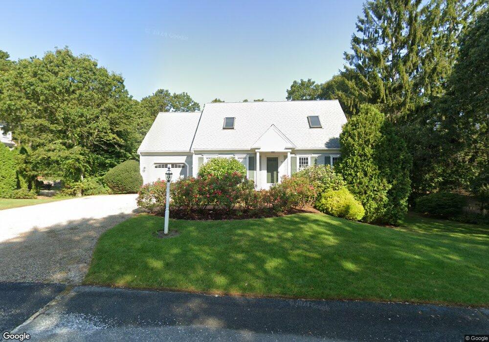
22 Captain Isiahs Rd Cotuit, MA 02635
Cotuit NeighborhoodEstimated Value: $792,042 - $936,000
3
Beds
3
Baths
1,745
Sq Ft
$491/Sq Ft
Est. Value
About This Home
This home is located at 22 Captain Isiahs Rd, Cotuit, MA 02635 and is currently estimated at $856,511, approximately $490 per square foot. 22 Captain Isiahs Rd is a home located in Barnstable County with nearby schools including West Villages Elementary School, Barnstable United Elementary School, and Barnstable Intermediate School.
Ownership History
Date
Name
Owned For
Owner Type
Purchase Details
Closed on
May 22, 1997
Sold by
Capn Isiahs Rd Nt
Bought by
Wade Lester J and Wade Anne C
Current Estimated Value
Home Financials for this Owner
Home Financials are based on the most recent Mortgage that was taken out on this home.
Original Mortgage
$159,300
Interest Rate
8.08%
Mortgage Type
Purchase Money Mortgage
Purchase Details
Closed on
Feb 14, 1997
Sold by
Savery Judith Ann
Bought by
Capn Isiahs Rd Nt
Purchase Details
Closed on
Jan 17, 1991
Sold by
Wade Lester J
Bought by
Homeowners Sv Bk
Create a Home Valuation Report for This Property
The Home Valuation Report is an in-depth analysis detailing your home's value as well as a comparison with similar homes in the area
Home Values in the Area
Average Home Value in this Area
Purchase History
| Date | Buyer | Sale Price | Title Company |
|---|---|---|---|
| Wade Lester J | $177,000 | -- | |
| Capn Isiahs Rd Nt | $38,000 | -- | |
| Homeowners Sv Bk | $105,000 | -- |
Source: Public Records
Mortgage History
| Date | Status | Borrower | Loan Amount |
|---|---|---|---|
| Open | Homeowners Sv Bk | $258,400 | |
| Closed | Homeowners Sv Bk | $136,000 | |
| Closed | Wade Lester J | $159,300 |
Source: Public Records
Tax History
| Year | Tax Paid | Tax Assessment Tax Assessment Total Assessment is a certain percentage of the fair market value that is determined by local assessors to be the total taxable value of land and additions on the property. | Land | Improvement |
|---|---|---|---|---|
| 2025 | $5,732 | $686,500 | $194,400 | $492,100 |
| 2024 | $5,157 | $654,500 | $194,400 | $460,100 |
| 2023 | $5,077 | $606,600 | $192,100 | $414,500 |
| 2022 | $5,038 | $487,200 | $136,600 | $350,600 |
| 2021 | $4,869 | $441,000 | $136,600 | $304,400 |
| 2020 | $5,086 | $434,300 | $136,600 | $297,700 |
| 2019 | $4,821 | $405,800 | $136,600 | $269,200 |
| 2018 | $4,512 | $383,700 | $149,800 | $233,900 |
| 2017 | $4,423 | $374,800 | $149,800 | $225,000 |
| 2016 | $4,274 | $371,300 | $146,300 | $225,000 |
| 2015 | $3,971 | $344,700 | $148,300 | $196,400 |
Source: Public Records
Map
Nearby Homes
- 602 Putnam Ave
- 564 Cotuit Bay Dr
- 564 Cotuit Bay Dr
- 135 Putnam Avenue (Land)
- 835 Old Post Rd
- 165 Baxter Neck Rd
- 804 Main St
- 15 Geraldine Rd
- 1415 Old Post Rd
- 71 Sand Point
- 916 Main St
- 33 Oyster Place Rd
- 1456 Santuit-Newtown Rd
- 75 Bob White Run
- 239 Oxford Dr
- 359 Baxter Neck Rd
- 25 Oyster Way
- 226 Dunrobin Rd
- 170 Forest Hills Rd
- 440 Grand Island Dr
- 21 Capt Isiah
- 36 Captain Isiahs Rd
- 462 Putnam Ave
- 9 Captain Isiahs Rd
- 21 Captain Isiahs Rd
- 21 Captain Isiah's Rd
- 21 Cap'N Isiah's Rd
- 21 Captain Isiah's
- 476 Putnam Ave
- 35 Captain Isiahs Rd
- 49 Cap'N Isiahs Rd
- 31 Cap'N Carletons Rd
- 48 Captain Isiahs Rd
- 490 Putnam Ave
- 430 Putnam Ave
- 49 Captain Isaiah Rd
- 31 Captain Carltons Rd
- 49 Captain Isiahs Rd
- 48 Captain Isaiah Rd
Your Personal Tour Guide
Ask me questions while you tour the home.