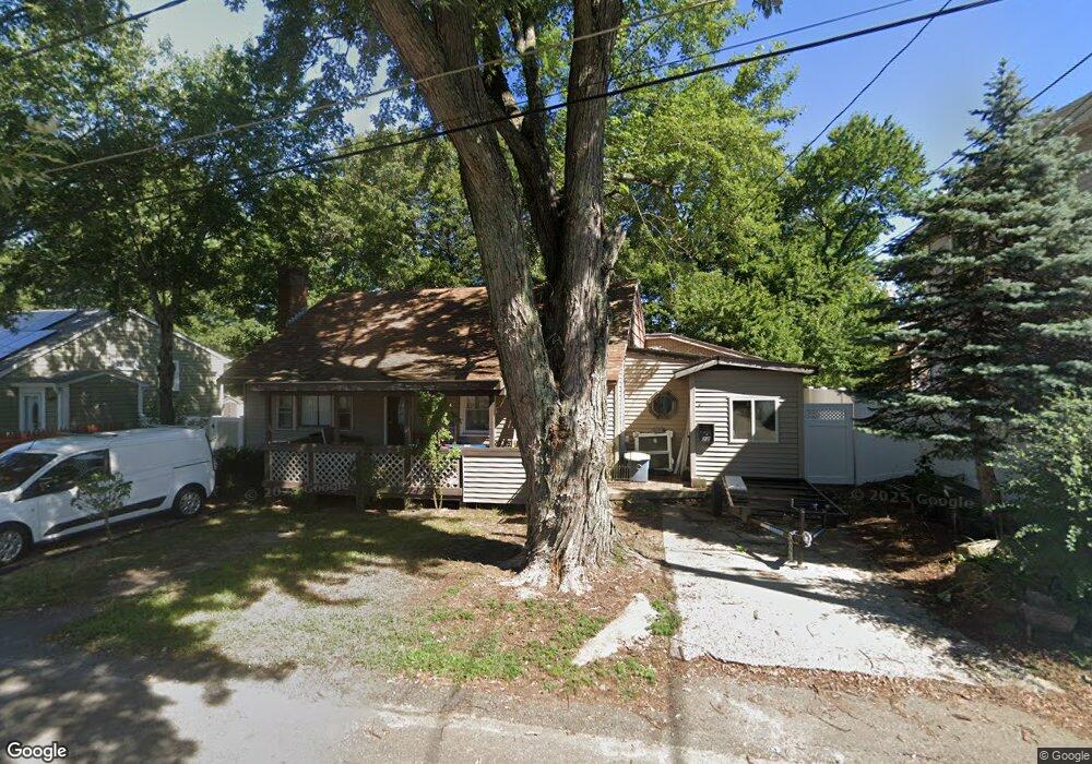
22 Carter St Brockton, MA 02302
Estimated Value: $479,000 - $555,000
3
Beds
1
Bath
1,818
Sq Ft
$278/Sq Ft
Est. Value
About This Home
This home is located at 22 Carter St, Brockton, MA 02302 and is currently estimated at $505,113, approximately $277 per square foot. 22 Carter St is a home located in Plymouth County with nearby schools including Brookfield Elementary School, Mary E. Baker Elementary School, and Downey Elementary School.
Create a Home Valuation Report for This Property
The Home Valuation Report is an in-depth analysis detailing your home's value as well as a comparison with similar homes in the area
Tax History
| Year | Tax Paid | Tax Assessment Tax Assessment Total Assessment is a certain percentage of the fair market value that is determined by local assessors to be the total taxable value of land and additions on the property. | Land | Improvement |
|---|---|---|---|---|
| 2025 | $5,114 | $422,300 | $137,100 | $285,200 |
| 2024 | $5,062 | $421,100 | $137,100 | $284,000 |
| 2023 | $5,056 | $389,500 | $102,400 | $287,100 |
| 2022 | $4,706 | $336,900 | $92,900 | $244,000 |
| 2021 | $4,501 | $310,400 | $76,900 | $233,500 |
| 2020 | $4,215 | $278,200 | $72,400 | $205,800 |
| 2019 | $4,227 | $272,000 | $70,100 | $201,900 |
| 2018 | $3,994 | $248,700 | $70,100 | $178,600 |
| 2017 | $3,413 | $212,000 | $70,100 | $141,900 |
| 2016 | $3,415 | $196,700 | $67,900 | $128,800 |
| 2015 | $3,205 | $176,600 | $67,900 | $108,700 |
| 2014 | $3,358 | $185,200 | $67,900 | $117,300 |
Source: Public Records
Map
Nearby Homes
- 14 Emmet St
- 30 Elliot St
- 24 E Ashland St
- 146 Court St Unit 108
- 0 Prospect St
- 13 Standish St
- 35 Huntington St
- 39 Huntington St
- 560 N Montello St
- 69 Beacon Park
- 271 Ames St
- 7 Main St Unit 203
- 7 Main St Unit 102
- 129 Anawan St
- 97 Huntington St
- 18 Walnut St
- 29 Saint Casimir Ave
- 44 Hobson St
- 56 N Warren Ave
- 90 Cherry St
Your Personal Tour Guide
Ask me questions while you tour the home.