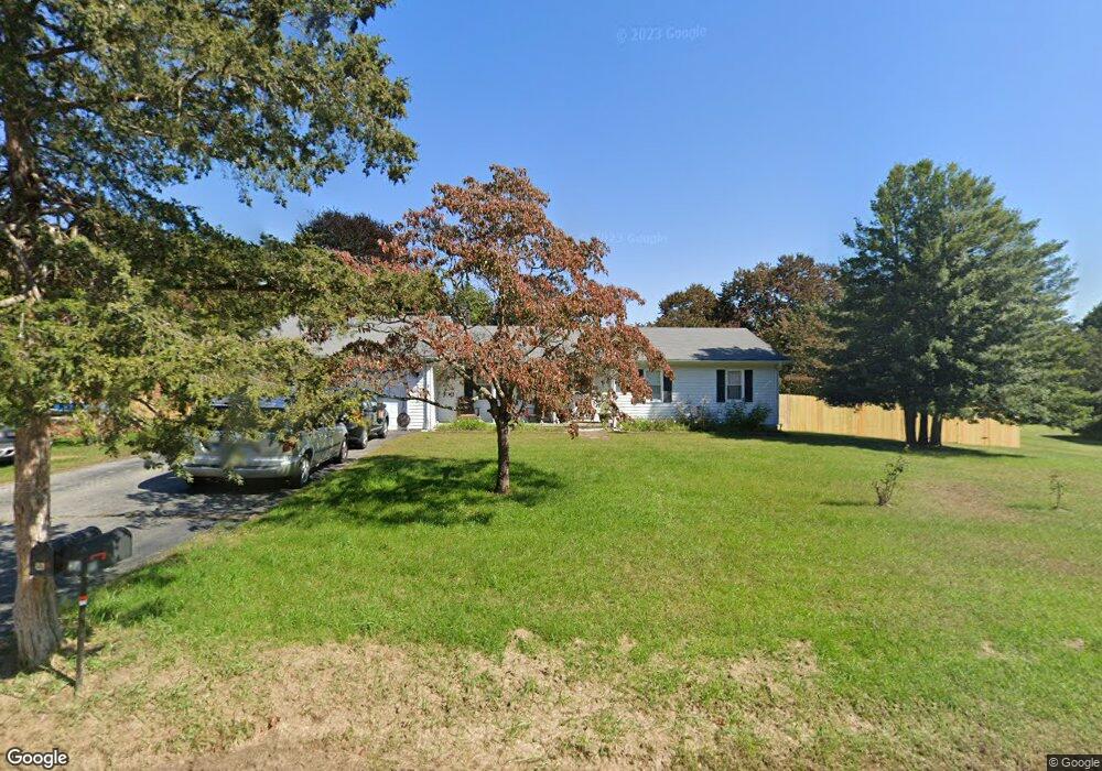
22 Clear View Dr Mansfield Center, CT 06250
Estimated Value: $361,000 - $407,000
3
Beds
1
Bath
1,356
Sq Ft
$278/Sq Ft
Est. Value
About This Home
This home is located at 22 Clear View Dr, Mansfield Center, CT 06250 and is currently estimated at $377,026, approximately $278 per square foot. 22 Clear View Dr is a home located in Tolland County with nearby schools including Mansfield Elementary School, Mansfield Middle School, and E.O. Smith High School.
Ownership History
Date
Name
Owned For
Owner Type
Purchase Details
Closed on
Aug 18, 2011
Sold by
Kokoska Richard
Bought by
Nieforth Kraig and Pantas Georgia
Current Estimated Value
Home Financials for this Owner
Home Financials are based on the most recent Mortgage that was taken out on this home.
Original Mortgage
$198,340
Outstanding Balance
$132,763
Interest Rate
3.87%
Mortgage Type
FHA
Estimated Equity
$244,263
Purchase Details
Closed on
Jan 24, 2008
Sold by
James Winifred L
Bought by
Kokoska Richard
Home Financials for this Owner
Home Financials are based on the most recent Mortgage that was taken out on this home.
Original Mortgage
$236,134
Interest Rate
6.17%
Create a Home Valuation Report for This Property
The Home Valuation Report is an in-depth analysis detailing your home's value as well as a comparison with similar homes in the area
Home Values in the Area
Average Home Value in this Area
Purchase History
| Date | Buyer | Sale Price | Title Company |
|---|---|---|---|
| Nieforth Kraig | $203,500 | -- | |
| Nieforth Kraig | $203,500 | -- | |
| Kokoska Richard | $238,000 | -- | |
| Kokoska Richard | $238,000 | -- |
Source: Public Records
Mortgage History
| Date | Status | Borrower | Loan Amount |
|---|---|---|---|
| Open | Kokoska Richard | $198,340 | |
| Closed | Kokoska Richard | $198,340 | |
| Previous Owner | Kokoska Richard | $236,134 |
Source: Public Records
Tax History
| Year | Tax Paid | Tax Assessment Tax Assessment Total Assessment is a certain percentage of the fair market value that is determined by local assessors to be the total taxable value of land and additions on the property. | Land | Improvement |
|---|---|---|---|---|
| 2025 | $4,634 | $231,700 | $45,900 | $185,800 |
| 2024 | $4,084 | $133,800 | $43,200 | $90,600 |
| 2023 | $4,217 | $133,800 | $43,200 | $90,600 |
| 2022 | $4,065 | $133,800 | $43,200 | $90,600 |
| 2021 | $4,199 | $133,800 | $43,200 | $90,600 |
| 2020 | $4,199 | $133,800 | $43,200 | $90,600 |
| 2019 | $4,098 | $130,600 | $43,200 | $87,400 |
| 2018 | $3,990 | $129,200 | $45,500 | $83,700 |
| 2017 | $3,899 | $127,300 | $45,500 | $81,800 |
| 2016 | $3,802 | $127,300 | $45,500 | $81,800 |
| 2015 | $3,802 | $127,300 | $45,500 | $81,800 |
| 2014 | $4,494 | $160,790 | $54,110 | $106,680 |
Source: Public Records
Map
Nearby Homes
- 54 Meadowbrook Ln
- 63 Eastbrook Heights Unit E
- 51 Eastbrook Heights Unit D
- 28 Circle Dr
- 40 Eastbrook Heights Unit C
- 48 Eastbrook Heights Unit C
- 64 Circle Dr
- 16 Circle Dr
- 78 Lions Way
- 16 Pond Way
- 18 Patriots Square Unit 18
- 0 Storrs Rd Unit 2 170571015
- 23 Pond Way
- 5 Woods Way Unit WOOD005
- 615 Jackson St
- 6 Skyline Dr
- 0 Mansfield City Rd Unit LOT 2
- 248 Tuckie Rd
- 38 Elm St
- 15 Cracow Ave
- 27 Clear View Dr
- 23 Clear View Dr
- 15 Clear View Dr
- 16 Clear View Dr
- 29 Clear View Dr
- 17 Overlook Dr
- 23 Overlook Dr
- 35 Clear View Dr
- 36 Clear View Dr
- 11 Clear View Dr
- 9 Overlook Dr
- 25 Pine Ridge Ln
- 27 Pine Ridge Ln
- 10 Clear View Dr
- 39 Clear View Dr
- 31 Pine Ridge Ln
- 14 Overlook Dr
- 20 Overlook Dr
- 56 Puddin Ln
- 54 Puddin Ln
Your Personal Tour Guide
Ask me questions while you tour the home.