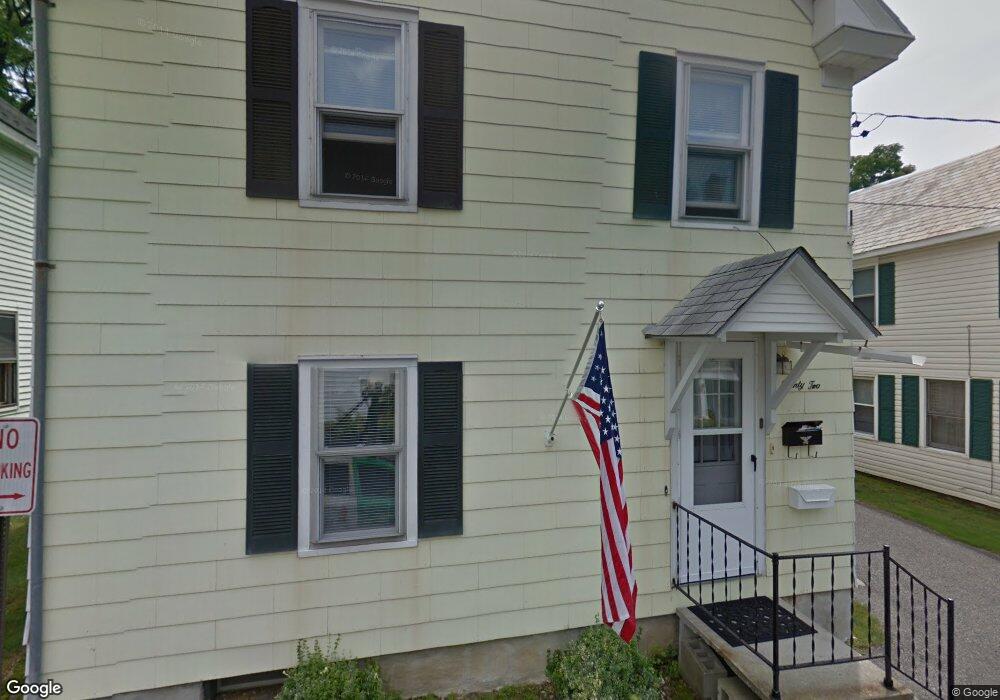
22 Cliff Ave Pittsfield, MA 01201
Estimated Value: $201,000 - $241,000
3
Beds
1
Bath
1,302
Sq Ft
$164/Sq Ft
Est. Value
About This Home
This home is located at 22 Cliff Ave, Pittsfield, MA 01201 and is currently estimated at $213,902, approximately $164 per square foot. 22 Cliff Ave is a home located in Berkshire County with nearby schools including Morningside Community School, John T. Reid Middle School, and Taconic High School.
Ownership History
Date
Name
Owned For
Owner Type
Purchase Details
Closed on
Aug 12, 1993
Sold by
Kelly Thomas F and Kelly Mary L
Bought by
Kelly Mary L
Current Estimated Value
Home Financials for this Owner
Home Financials are based on the most recent Mortgage that was taken out on this home.
Original Mortgage
$30,000
Interest Rate
7.11%
Create a Home Valuation Report for This Property
The Home Valuation Report is an in-depth analysis detailing your home's value as well as a comparison with similar homes in the area
Home Values in the Area
Average Home Value in this Area
Purchase History
| Date | Buyer | Sale Price | Title Company |
|---|---|---|---|
| Kelly Mary L | $30,000 | -- | |
| Kelly Mary L | $30,000 | -- |
Source: Public Records
Mortgage History
| Date | Status | Borrower | Loan Amount |
|---|---|---|---|
| Open | Kelly Mary L | $29,500 | |
| Closed | Kelly Mary L | $30,000 | |
| Previous Owner | Kelly Mary L | $10,000 |
Source: Public Records
Tax History Compared to Growth
Tax History
| Year | Tax Paid | Tax Assessment Tax Assessment Total Assessment is a certain percentage of the fair market value that is determined by local assessors to be the total taxable value of land and additions on the property. | Land | Improvement |
|---|---|---|---|---|
| 2025 | $3,075 | $171,400 | $45,800 | $125,600 |
| 2024 | $2,856 | $154,800 | $45,800 | $109,000 |
| 2023 | $2,576 | $140,600 | $41,400 | $99,200 |
| 2022 | $2,192 | $118,100 | $31,800 | $86,300 |
| 2021 | $2,027 | $105,300 | $31,800 | $73,500 |
| 2020 | $2,026 | $102,800 | $31,800 | $71,000 |
| 2019 | $1,930 | $99,400 | $31,800 | $67,600 |
| 2018 | $1,937 | $96,800 | $31,800 | $65,000 |
| 2017 | $1,822 | $92,800 | $30,200 | $62,600 |
| 2016 | $1,702 | $90,700 | $30,200 | $60,500 |
| 2015 | $1,638 | $90,700 | $30,200 | $60,500 |
Source: Public Records
Map
Nearby Homes
- 26 Springside Ave
- 19 Richmond Ave
- 74 Briggs Ave
- 9 Myrtle St
- 131 Lenox Ave
- 242 Wahconah St
- 252 Wahconah St
- 58 Seymour St
- 68 Orchard St
- 185 Lenox Ave
- 29 Glenwood Ave
- 40 Pecks Rd
- 33 Maplewood Ave Unit 305
- 33 Maplewood Ave Unit 103
- 24 Glenwood Ave
- 114 Danforth Ave
- 17 - 23 Linden St
- 71 Maplewood Ave
- 81 Pecks Rd
- 8 Mohegan St