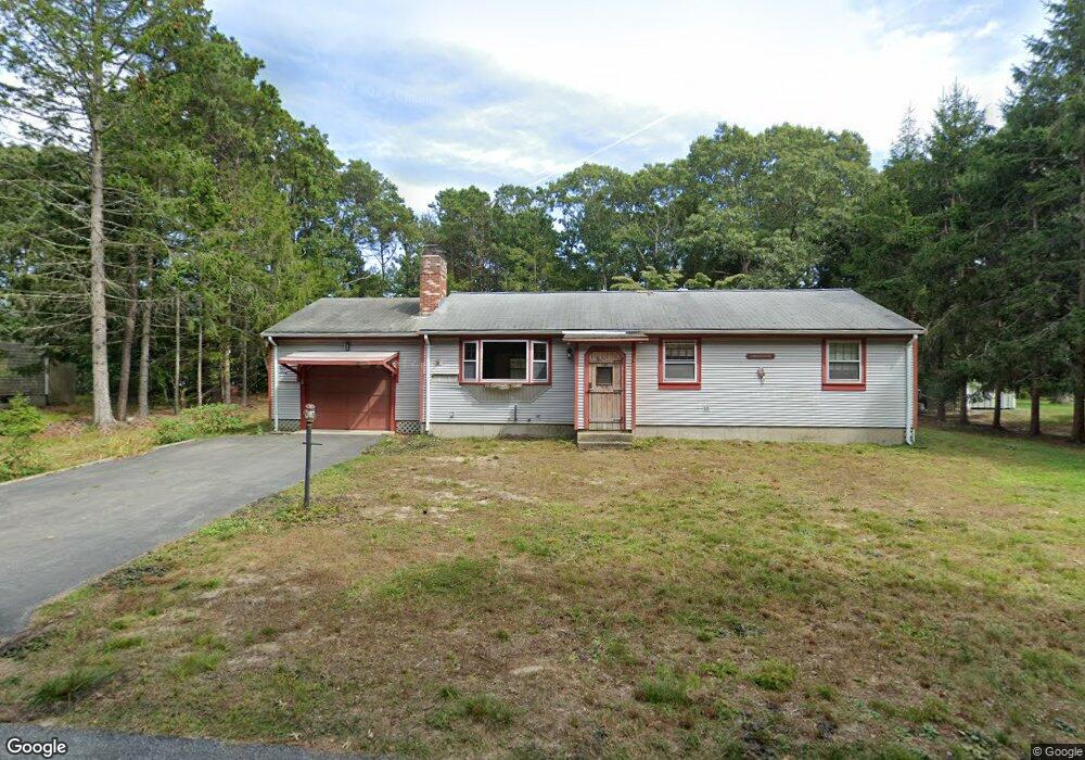
22 Cornwall Rd South Dennis, MA 02660
South Dennis NeighborhoodEstimated Value: $528,000 - $606,000
3
Beds
1
Bath
1,280
Sq Ft
$442/Sq Ft
Est. Value
About This Home
This home is located at 22 Cornwall Rd, South Dennis, MA 02660 and is currently estimated at $565,286, approximately $441 per square foot. 22 Cornwall Rd is a home located in Barnstable County with nearby schools including Dennis-Yarmouth Regional High School and St. Pius X. School.
Ownership History
Date
Name
Owned For
Owner Type
Purchase Details
Closed on
Dec 27, 2021
Sold by
Swanecamp Thomas J and Swanecamp Brian
Bought by
22 Cornwall Rd Rt
Current Estimated Value
Purchase Details
Closed on
Aug 31, 2021
Sold by
Cornwall Rt
Bought by
Swanecamp Thomas J and Swanecamp Brian
Home Financials for this Owner
Home Financials are based on the most recent Mortgage that was taken out on this home.
Original Mortgage
$291,600
Interest Rate
2.7%
Mortgage Type
Purchase Money Mortgage
Create a Home Valuation Report for This Property
The Home Valuation Report is an in-depth analysis detailing your home's value as well as a comparison with similar homes in the area
Home Values in the Area
Average Home Value in this Area
Purchase History
| Date | Buyer | Sale Price | Title Company |
|---|---|---|---|
| 22 Cornwall Rd Rt | -- | None Available | |
| Swanecamp Thomas J | $364,500 | None Available |
Source: Public Records
Mortgage History
| Date | Status | Borrower | Loan Amount |
|---|---|---|---|
| Previous Owner | Swanecamp Thomas J | $291,600 |
Source: Public Records
Tax History Compared to Growth
Tax History
| Year | Tax Paid | Tax Assessment Tax Assessment Total Assessment is a certain percentage of the fair market value that is determined by local assessors to be the total taxable value of land and additions on the property. | Land | Improvement |
|---|---|---|---|---|
| 2025 | $2,763 | $638,000 | $144,500 | $493,500 |
| 2024 | $2,606 | $593,600 | $139,000 | $454,600 |
| 2023 | $2,520 | $539,700 | $126,300 | $413,400 |
| 2022 | $2,412 | $430,700 | $126,500 | $304,200 |
| 2021 | $2,280 | $378,100 | $124,000 | $254,100 |
| 2020 | $2,164 | $354,700 | $124,000 | $230,700 |
| 2019 | $2,093 | $339,200 | $133,700 | $205,500 |
| 2018 | $1,920 | $302,800 | $115,700 | $187,100 |
| 2017 | $1,827 | $297,000 | $115,700 | $181,300 |
| 2016 | $1,636 | $250,500 | $121,500 | $129,000 |
| 2015 | $1,603 | $250,500 | $121,500 | $129,000 |
| 2014 | $1,623 | $255,600 | $104,100 | $151,500 |
Source: Public Records
Map
Nearby Homes
- 17 Margate Ln
- 52 Uncle Bobs Way
- 15 Captain Jud Rd
- 10 Joanne Dr
- 153 Bayridge Dr
- 25 Skerry Rd
- 7 Vinland Dr
- 4 Ebb Rd
- 1 Norseman Dr
- 17 Fairmount Rd
- 17 Fairmount Rd
- 6 Hawthorn St
- 62 Old Fish House Rd
- 118 Driftwood Ln
- 32 Captain Walsh Dr
- 2 Hemlock Ln
- 129 Driftwood Ln
- 13 Covey Dr
- 111 Merchant Ave
- 20 Sycamore Ln
- 16 Cornwall Rd
- 28 Cornwall Rd
- 19 Sheffield Ave
- 19 Cornwall Rd
- 25 Sheffield Ave
- 15 Sheffield Ave
- 53 Windsor Ave
- 10 Cornwall Rd
- 9 Sheffield Ave
- 33 Sheffield Ave
- 3 Margate Ln
- 48 Windsor Ave
- 20 Sheffield Ave
- 55 Windsor Ave
- 35 Windsor Ave
- 52 Windsor Ave
- 14 Sheffield Ave
- 52 Kingswear Cir
- 58 Windsor Ave
- 14 Margate Ln