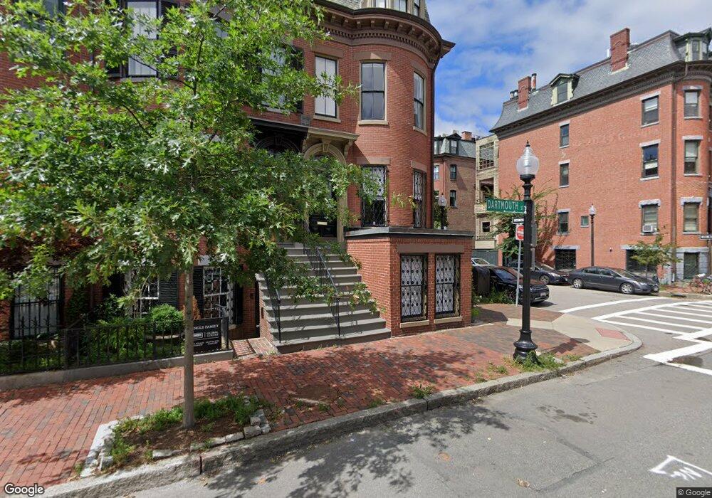
22 Dartmouth St Boston, MA 02116
South End NeighborhoodEstimated Value: $2,979,000 - $5,082,000
4
Beds
4
Baths
2,516
Sq Ft
$1,434/Sq Ft
Est. Value
About This Home
This home is located at 22 Dartmouth St, Boston, MA 02116 and is currently estimated at $3,607,096, approximately $1,433 per square foot. 22 Dartmouth St is a home located in Suffolk County with nearby schools including Kingsley Montessori School and Cathedral High School.
Ownership History
Date
Name
Owned For
Owner Type
Purchase Details
Closed on
Sep 12, 1997
Sold by
Sheehan E Jr Est
Bought by
Hill Antony J and Hill Elsa N
Current Estimated Value
Home Financials for this Owner
Home Financials are based on the most recent Mortgage that was taken out on this home.
Original Mortgage
$556,000
Interest Rate
7.31%
Mortgage Type
Commercial
Create a Home Valuation Report for This Property
The Home Valuation Report is an in-depth analysis detailing your home's value as well as a comparison with similar homes in the area
Home Values in the Area
Average Home Value in this Area
Purchase History
| Date | Buyer | Sale Price | Title Company |
|---|---|---|---|
| Hill Antony J | $695,000 | -- |
Source: Public Records
Mortgage History
| Date | Status | Borrower | Loan Amount |
|---|---|---|---|
| Open | Hill Antony J | $600,000 | |
| Closed | Hill Antony J | $409,800 | |
| Closed | Hill Antony J | $556,000 | |
| Previous Owner | Hill Antony J | $242,000 |
Source: Public Records
Tax History Compared to Growth
Tax History
| Year | Tax Paid | Tax Assessment Tax Assessment Total Assessment is a certain percentage of the fair market value that is determined by local assessors to be the total taxable value of land and additions on the property. | Land | Improvement |
|---|---|---|---|---|
| 2025 | $33,458 | $2,889,300 | $1,051,000 | $1,838,300 |
| 2024 | $29,367 | $2,694,200 | $821,300 | $1,872,900 |
| 2023 | $28,936 | $2,694,200 | $821,300 | $1,872,900 |
| 2022 | $28,728 | $2,640,400 | $804,900 | $1,835,500 |
| 2021 | $27,353 | $2,563,500 | $781,500 | $1,782,000 |
| 2020 | $26,242 | $2,485,000 | $851,400 | $1,633,600 |
| 2019 | $23,810 | $2,259,000 | $618,300 | $1,640,700 |
| 2018 | $22,133 | $2,111,900 | $618,300 | $1,493,600 |
| 2017 | $20,712 | $1,955,800 | $618,300 | $1,337,500 |
| 2016 | $19,669 | $1,788,100 | $614,700 | $1,173,400 |
| 2015 | $21,607 | $1,784,200 | $384,600 | $1,399,600 |
| 2014 | $19,510 | $1,550,900 | $384,600 | $1,166,300 |
Source: Public Records
Map
Nearby Homes
- 596 Tremont St Unit 2
- 30 Dartmouth St Unit 3
- 641 Tremont St Unit 3
- 36 Upton St Unit 3
- 85 Pembroke St Unit 1
- 667 Tremont St Unit 4
- 667 Tremont St Unit 3
- 667 Tremont St Unit 2
- 87 Pembroke St
- 2 Clarendon St Unit 401
- 2 Clarendon St Unit 606
- 201 W Brookline St
- 171 Warren Ave Unit 2
- 6 Dartmouth Place Unit 6
- 6 Dartmouth Place
- 37 Union Park Unit 2
- 377 Shawmut Ave
- 379 Shawmut Ave
- 94 Waltham St Unit 3
- 193 W Canton St Unit 2
- 20 Dartmouth St
- 22 Dartmouth St Unit 1
- 18 Dartmouth St Unit 18A
- 18 Dartmouth St Unit 1
- 16 Dartmouth St Unit 2
- 16 Dartmouth St Unit 1
- 14 Dartmouth St
- 14 Dartmouth St Unit 2
- 68 Montgomery St
- 68 Montgomery St Unit 2
- 68 Montgomery St Unit 1
- 68 Montgomery St
- 68 Montgomery St Unit 1-1
- 70 Montgomery St
- 12 Dartmouth St
- 72 Montgomery St
- 72 Montgomery St Unit 1
- 10 Dartmouth St
- 10 Dartmounth
- 74 Montgomery St