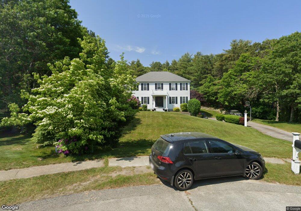
22 Dinah Path Plymouth, MA 02360
Estimated Value: $754,907 - $813,000
4
Beds
3
Baths
2,376
Sq Ft
$331/Sq Ft
Est. Value
About This Home
This home is located at 22 Dinah Path, Plymouth, MA 02360 and is currently estimated at $786,727, approximately $331 per square foot. 22 Dinah Path is a home located in Plymouth County with nearby schools including Indian Brook, Plymouth South Middle School, and Plymouth South High School.
Ownership History
Date
Name
Owned For
Owner Type
Purchase Details
Closed on
Dec 19, 2000
Sold by
Johnson Michael P and Johnson Diane L
Bought by
Crockford Russell P and Crockford Danielle D
Current Estimated Value
Purchase Details
Closed on
Apr 29, 1997
Sold by
Mulligan Michael R
Bought by
Johnson Michael P and Johnson Diane L
Purchase Details
Closed on
Nov 12, 1996
Sold by
Ercor Rt and Mulligan Patrick J
Bought by
Mulligan Michael R
Create a Home Valuation Report for This Property
The Home Valuation Report is an in-depth analysis detailing your home's value as well as a comparison with similar homes in the area
Home Values in the Area
Average Home Value in this Area
Purchase History
| Date | Buyer | Sale Price | Title Company |
|---|---|---|---|
| Crockford Russell P | $252,500 | -- | |
| Johnson Michael P | $178,000 | -- | |
| Mulligan Michael R | $52,000 | -- |
Source: Public Records
Mortgage History
| Date | Status | Borrower | Loan Amount |
|---|---|---|---|
| Open | Mulligan Michael R | $70,000 | |
| Open | Mulligan Michael R | $266,000 |
Source: Public Records
Tax History Compared to Growth
Tax History
| Year | Tax Paid | Tax Assessment Tax Assessment Total Assessment is a certain percentage of the fair market value that is determined by local assessors to be the total taxable value of land and additions on the property. | Land | Improvement |
|---|---|---|---|---|
| 2025 | $7,856 | $619,100 | $214,700 | $404,400 |
| 2024 | $7,654 | $594,700 | $210,300 | $384,400 |
| 2023 | $7,296 | $532,200 | $183,900 | $348,300 |
| 2022 | $6,604 | $428,000 | $167,200 | $260,800 |
| 2021 | $6,588 | $407,700 | $167,200 | $240,500 |
| 2020 | $6,587 | $402,900 | $162,800 | $240,100 |
| 2019 | $6,396 | $386,700 | $145,200 | $241,500 |
| 2018 | $6,079 | $369,300 | $128,200 | $241,100 |
| 2017 | $5,689 | $343,100 | $128,200 | $214,900 |
| 2016 | $5,439 | $334,300 | $117,700 | $216,600 |
| 2015 | $5,221 | $336,000 | $117,700 | $218,300 |
| 2014 | $4,982 | $329,300 | $117,700 | $211,600 |
Source: Public Records
Map
Nearby Homes
- 1096 Long Pond Rd
- 18 Westcliff Dr
- 20 Westcliff Dr Unit 20
- 1150 Long Pond Rd
- 4 Westcliff Dr Unit Golfview
- 65 Lakewood Dr
- 42 Fairway Dr Unit Golfview
- 21 Dublin Dr
- 53 White Cliff Dr
- 1 Kara's Way
- 6 Sea Cliff Dr Unit 6
- 6 Seacliff Dr Unit 6
- 12 Kara's Way
- 92 Cliffside Dr
- 92 Cliffside Dr Unit White Cliff
- 112 Cliffside Dr Unit 112
- 15 Nonantum Rd
- 2462 State Rd
- 46 Nameloc Rd
- 48 Menotomy Rd
- 21 Dinah Path
- 16 Dinah Path
- 45 Tananger Rd
- 49 Tananger Rd
- 41 Tananger Rd
- 37 Tananger Rd
- 6 White Violet Ln
- 2 White Violet Ln
- 8 Dinah Path
- 15 Dinah Path
- 1 White Violet Ln
- 11 Dinah Path
- 11 Dinah Path Unit 2
- 50 Tananger Rd
- 46 Tananger Rd
- 7 Dinah Path
- 58 Tananger Rd
- 7 White Violet Ln
- 42 Tananger Rd
- 34 Tananger Rd