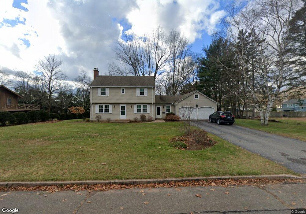
22 Duncan Rd Manchester, CT 06040
Martin NeighborhoodEstimated Value: $398,122 - $423,000
3
Beds
2
Baths
1,760
Sq Ft
$232/Sq Ft
Est. Value
About This Home
This home is located at 22 Duncan Rd, Manchester, CT 06040 and is currently estimated at $407,531, approximately $231 per square foot. 22 Duncan Rd is a home located in Hartford County with nearby schools including Martin Elementary School, Elisabeth M. Bennet Academy, and Illing Middle School.
Ownership History
Date
Name
Owned For
Owner Type
Purchase Details
Closed on
Jul 21, 2022
Sold by
Sullivan Mary P
Bought by
Carley Douglas P and Carley Sarah E
Current Estimated Value
Home Financials for this Owner
Home Financials are based on the most recent Mortgage that was taken out on this home.
Original Mortgage
$240,000
Outstanding Balance
$227,295
Interest Rate
5.23%
Mortgage Type
Purchase Money Mortgage
Estimated Equity
$180,236
Create a Home Valuation Report for This Property
The Home Valuation Report is an in-depth analysis detailing your home's value as well as a comparison with similar homes in the area
Home Values in the Area
Average Home Value in this Area
Purchase History
| Date | Buyer | Sale Price | Title Company |
|---|---|---|---|
| Carley Douglas P | $300,000 | None Available | |
| Carley Douglas P | $300,000 | None Available |
Source: Public Records
Mortgage History
| Date | Status | Borrower | Loan Amount |
|---|---|---|---|
| Open | Carley Douglas P | $240,000 | |
| Closed | Carley Douglas P | $240,000 |
Source: Public Records
Tax History
| Year | Tax Paid | Tax Assessment Tax Assessment Total Assessment is a certain percentage of the fair market value that is determined by local assessors to be the total taxable value of land and additions on the property. | Land | Improvement |
|---|---|---|---|---|
| 2025 | $7,259 | $182,300 | $47,200 | $135,100 |
| 2024 | $7,051 | $182,300 | $47,200 | $135,100 |
| 2023 | $6,782 | $182,300 | $47,200 | $135,100 |
| 2022 | $6,585 | $182,300 | $47,200 | $135,100 |
| 2021 | $6,310 | $150,500 | $40,500 | $110,000 |
| 2020 | $6,301 | $150,500 | $40,500 | $110,000 |
| 2019 | $6,276 | $150,500 | $40,500 | $110,000 |
| 2018 | $6,157 | $150,500 | $40,500 | $110,000 |
| 2017 | $5,982 | $150,500 | $40,500 | $110,000 |
| 2016 | $6,079 | $153,200 | $53,300 | $99,900 |
| 2015 | $6,036 | $153,200 | $53,300 | $99,900 |
| 2014 | $5,921 | $153,200 | $53,300 | $99,900 |
Source: Public Records
Map
Nearby Homes
- 290 Gardner St
- 300 Gardner St
- 94 Haystack Rd
- 215 Spring St
- 121 Grandview St
- 111 Eldridge St
- 202 S Main St
- 45 Eldridge St
- 443 S Main St Unit 32
- 25 Forest St Unit B
- 0 0 Line #3 St Unit 24008112
- 49 Birch St
- 67 Bissell St
- 45 Line St
- 580 S Main St
- 95 Rock Ridge
- 34 Rock Ridge
- 106 Rock Ridge
- 90 Rock Ridge
- 85 Rock Ridge
Your Personal Tour Guide
Ask me questions while you tour the home.