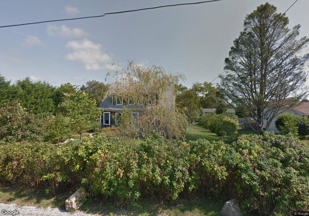
22 E View Dr Little Compton, RI 02837
Estimated Value: $786,000 - $990,000
3
Beds
2
Baths
1,814
Sq Ft
$476/Sq Ft
Est. Value
About This Home
This home is located at 22 E View Dr, Little Compton, RI 02837 and is currently estimated at $862,877, approximately $475 per square foot. 22 E View Dr is a home located in Newport County with nearby schools including Wilbur & McMahon School.
Ownership History
Date
Name
Owned For
Owner Type
Purchase Details
Closed on
Jul 17, 2024
Sold by
Brown Kenneth W and Zens Wendy P
Bought by
Kenneth W Brown T W and Kenneth Brown
Current Estimated Value
Purchase Details
Closed on
Apr 30, 1999
Sold by
Machaski Edward F
Bought by
Brown Kenneth W
Create a Home Valuation Report for This Property
The Home Valuation Report is an in-depth analysis detailing your home's value as well as a comparison with similar homes in the area
Home Values in the Area
Average Home Value in this Area
Purchase History
| Date | Buyer | Sale Price | Title Company |
|---|---|---|---|
| Kenneth W Brown T W | -- | None Available | |
| Kenneth W Brown T W | -- | None Available | |
| Brown Kenneth W | $38,000 | -- | |
| Brown Kenneth W | $38,000 | -- |
Source: Public Records
Mortgage History
| Date | Status | Borrower | Loan Amount |
|---|---|---|---|
| Previous Owner | Brown Kenneth W | $215,000 | |
| Previous Owner | Brown Kenneth W | $100,000 | |
| Previous Owner | Brown Kenneth W | $207,000 | |
| Previous Owner | Brown Kenneth W | $10,000 |
Source: Public Records
Tax History
| Year | Tax Paid | Tax Assessment Tax Assessment Total Assessment is a certain percentage of the fair market value that is determined by local assessors to be the total taxable value of land and additions on the property. | Land | Improvement |
|---|---|---|---|---|
| 2025 | $3,053 | $637,300 | $233,700 | $403,600 |
| 2024 | $2,822 | $555,600 | $203,200 | $352,400 |
| 2023 | $2,756 | $555,600 | $203,200 | $352,400 |
| 2022 | $2,722 | $555,600 | $203,200 | $352,400 |
| 2021 | $2,501 | $414,100 | $176,800 | $237,300 |
| 2020 | $2,480 | $414,100 | $176,800 | $237,300 |
| 2019 | $2,456 | $414,100 | $176,800 | $237,300 |
| 2018 | $2,204 | $369,800 | $149,200 | $220,600 |
| 2016 | $2,097 | $369,800 | $149,200 | $220,600 |
| 2015 | $2,108 | $366,600 | $150,700 | $215,900 |
| 2014 | $2,068 | $366,600 | $150,700 | $215,900 |
Source: Public Records
Map
Nearby Homes
- 89 S Shore Rd
- 128 Maple Ave
- 30 Indian Rd
- 141 S Of Commons Rd
- 49 Ocean Dr
- 138 Willow Ave
- 0 Willow Ave
- 505 Long Hwy
- 255 John Dyer Rd
- 38 Old Bull Ln
- 141 Peckham Rd
- 441 W Main Rd
- 245 John Dyer Rd
- 1 Puddingstone Cir
- 180 W Main Rd
- 140I Long Hwy
- 140 Long Hwy
- 116 Amy Hart Path
- 17 Amy Hart Path
- 17 Ferolbink Way
Your Personal Tour Guide
Ask me questions while you tour the home.