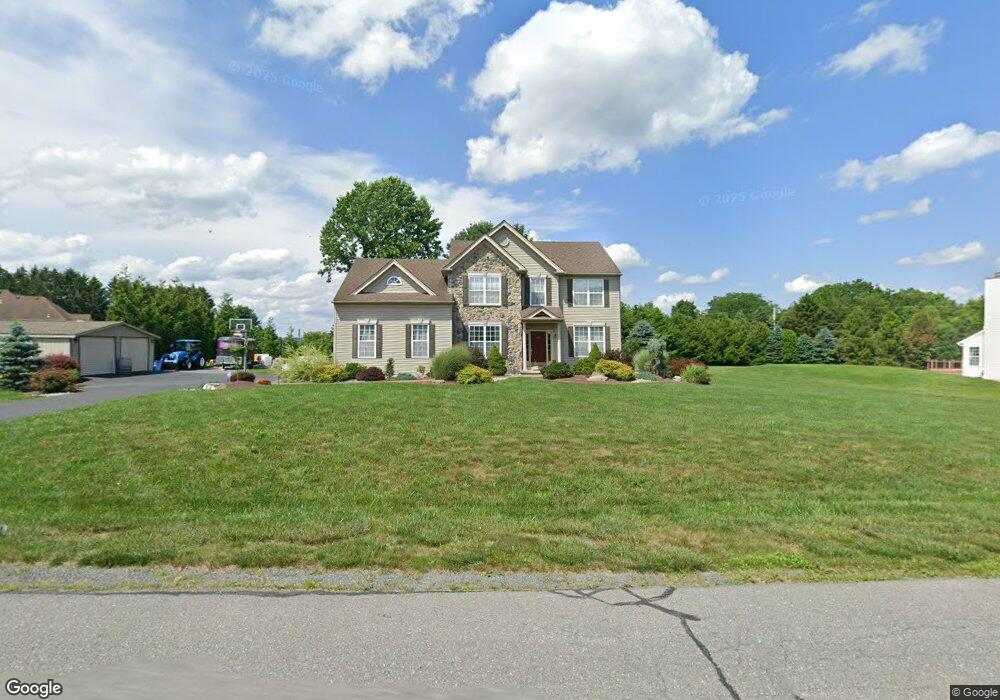
22 Eagle Dr Kunkletown, PA 18058
Estimated Value: $462,887 - $706,000
4
Beds
3
Baths
2,529
Sq Ft
$216/Sq Ft
Est. Value
About This Home
This home is located at 22 Eagle Dr, Kunkletown, PA 18058 and is currently estimated at $545,222, approximately $215 per square foot. 22 Eagle Dr is a home located in Monroe County with nearby schools including Pleasant Valley Elementary School, Pleasant Valley Intermediate School, and Pleasant Valley Middle School.
Ownership History
Date
Name
Owned For
Owner Type
Purchase Details
Closed on
May 15, 2015
Sold by
Lescinsky Charles W and Lescinsky Kristen M
Bought by
Vanthoogt Michael and Difeo Cox Marlene
Current Estimated Value
Purchase Details
Closed on
Dec 23, 2008
Sold by
Vaccarelli Christopher and Vaccarelli Erin
Bought by
Lescinsky Charles W and Lescinsky Kristen M
Home Financials for this Owner
Home Financials are based on the most recent Mortgage that was taken out on this home.
Original Mortgage
$190,000
Interest Rate
6.08%
Mortgage Type
Purchase Money Mortgage
Purchase Details
Closed on
Jul 28, 2005
Sold by
Farda Anthony
Bought by
Vaccarelli Christopher and Vaccarelli Erin
Home Financials for this Owner
Home Financials are based on the most recent Mortgage that was taken out on this home.
Original Mortgage
$218,830
Interest Rate
5.54%
Mortgage Type
New Conventional
Create a Home Valuation Report for This Property
The Home Valuation Report is an in-depth analysis detailing your home's value as well as a comparison with similar homes in the area
Home Values in the Area
Average Home Value in this Area
Purchase History
| Date | Buyer | Sale Price | Title Company |
|---|---|---|---|
| Vanthoogt Michael | $250,000 | None Available | |
| Lescinsky Charles W | $292,000 | None Available | |
| Vaccarelli Christopher | $280,572 | Penn Jersey Abstract |
Source: Public Records
Mortgage History
| Date | Status | Borrower | Loan Amount |
|---|---|---|---|
| Previous Owner | Lescinsky Charles W | $190,000 | |
| Previous Owner | Vaccarelli Christopher | $218,830 |
Source: Public Records
Tax History
| Year | Tax Paid | Tax Assessment Tax Assessment Total Assessment is a certain percentage of the fair market value that is determined by local assessors to be the total taxable value of land and additions on the property. | Land | Improvement |
|---|---|---|---|---|
| 2025 | $1,636 | $252,890 | $36,140 | $216,750 |
| 2024 | $1,163 | $252,890 | $36,140 | $216,750 |
| 2023 | $7,203 | $252,890 | $36,140 | $216,750 |
| 2022 | $6,995 | $252,890 | $36,140 | $216,750 |
| 2021 | $6,835 | $252,890 | $36,140 | $216,750 |
| 2019 | $8,724 | $49,760 | $12,000 | $37,760 |
| 2018 | $8,624 | $49,760 | $12,000 | $37,760 |
| 2017 | $8,300 | $49,760 | $12,000 | $37,760 |
| 2016 | $1,224 | $47,890 | $12,000 | $35,890 |
| 2015 | -- | $47,890 | $12,000 | $35,890 |
| 2014 | -- | $47,890 | $12,000 | $35,890 |
Source: Public Records
Map
Nearby Homes
- 969 Hideaway Hill Rd
- Lot 32 Greenview Ct
- 00 Floyd Rd
- 150 Red Oak Dr
- 361 Interchange Rd
- 208 Bryan Dr
- T425 2 Whitey B Dr
- 0 T425
- 1 Winesap Ln
- 2 T425
- CO Line Forest Dr
- 207 Scenic Dr
- 90 Halina Way
- 0 Sr 209 Unit PM-130225
- 950 Koch Rd
- 0 Victoria Arms Cir Unit PM-133039
- 160 Grassy Rd
- 142 Pine Grove Rd
- 295 Hty Rd
- 7590 Pohopoco Dr
- 120 Eagle Dr
- 123 Eagle Dr
- 115 Eagle Dr
- 722 Carney Rd
- 19 Eagle Dr
- 20 Eagle Dr
- 110 Eagle Dr
- 135 Eagle Dr
- 18 Eagle Dr
- 105 Eagle Dr
- 742 Carney Rd
- 0 Carney Rd Unit 5842686
- 0 Carney Rd Unit 3-5003
- 0 Carney Rd Unit 3-4996
- 0 Carney Rd Unit 4-2231
- 0 Carney Rd Unit 6-7019
- 0 Carney Rd Unit 4-6539
- 0 Carney Rd Unit 5-1479
- 0 Carney Rd Unit 1-284
- 0 Carney Rd Unit 80133
Your Personal Tour Guide
Ask me questions while you tour the home.