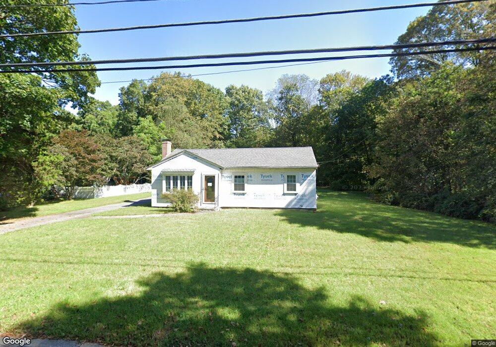
22 Eastside Rd Wrentham, MA 02093
Estimated Value: $521,000 - $641,000
3
Beds
1
Bath
1,200
Sq Ft
$483/Sq Ft
Est. Value
About This Home
This home is located at 22 Eastside Rd, Wrentham, MA 02093 and is currently estimated at $579,644, approximately $483 per square foot. 22 Eastside Rd is a home located in Norfolk County with nearby schools including Delaney Elementary School and Charles E Roderick.
Ownership History
Date
Name
Owned For
Owner Type
Purchase Details
Closed on
Apr 28, 2005
Sold by
Cory John M
Bought by
Petrucci Ronald J
Current Estimated Value
Home Financials for this Owner
Home Financials are based on the most recent Mortgage that was taken out on this home.
Original Mortgage
$285,000
Outstanding Balance
$149,650
Interest Rate
5.95%
Mortgage Type
Purchase Money Mortgage
Estimated Equity
$429,994
Purchase Details
Closed on
Aug 2, 1993
Sold by
Keirstead Ft
Bought by
Mcgonagle Joseph H
Home Financials for this Owner
Home Financials are based on the most recent Mortgage that was taken out on this home.
Original Mortgage
$105,000
Interest Rate
7.32%
Mortgage Type
Purchase Money Mortgage
Create a Home Valuation Report for This Property
The Home Valuation Report is an in-depth analysis detailing your home's value as well as a comparison with similar homes in the area
Purchase History
| Date | Buyer | Sale Price | Title Company |
|---|---|---|---|
| Petrucci Ronald J | $325,000 | -- | |
| Mcgonagle Joseph H | $125,500 | -- |
Source: Public Records
Mortgage History
| Date | Status | Borrower | Loan Amount |
|---|---|---|---|
| Open | Petrucci Ronald J | $285,000 | |
| Previous Owner | Mcgonagle Joseph H | $130,000 | |
| Previous Owner | Mcgonagle Joseph H | $140,000 | |
| Previous Owner | Mcgonagle Joseph H | $105,000 |
Source: Public Records
Tax History
| Year | Tax Paid | Tax Assessment Tax Assessment Total Assessment is a certain percentage of the fair market value that is determined by local assessors to be the total taxable value of land and additions on the property. | Land | Improvement |
|---|---|---|---|---|
| 2025 | $5,378 | $464,000 | $250,000 | $214,000 |
| 2024 | $5,016 | $418,000 | $250,000 | $168,000 |
| 2023 | $4,738 | $375,400 | $227,300 | $148,100 |
| 2022 | $4,905 | $358,800 | $221,100 | $137,700 |
| 2021 | $4,766 | $338,700 | $206,700 | $132,000 |
| 2020 | $4,088 | $286,900 | $157,800 | $129,100 |
| 2019 | $4,024 | $285,000 | $157,800 | $127,200 |
| 2018 | $3,972 | $278,900 | $158,000 | $120,900 |
| 2017 | $3,771 | $264,600 | $154,900 | $109,700 |
| 2016 | $3,701 | $259,200 | $150,400 | $108,800 |
| 2015 | $3,553 | $237,200 | $144,600 | $92,600 |
| 2014 | $3,503 | $228,800 | $139,100 | $89,700 |
Source: Public Records
Map
Nearby Homes
- 11 Earle Stewart Ln
- Loty 3-14 Earle Stewart Ln
- 12 Earle Stewart Ln
- Lot 1 - Blueberry 2 Car Plan at King Philip Estates
- Lot 8 - Blueberry 2 Car Plan at King Philip Estates
- Lot 5 - Hughes 2 car Plan at King Philip Estates
- Lot 6 - Blueberry 3 Car Plan at King Philip Estates
- 10 Earle Stewart Ln Unit Lot 5
- Lot 2 - Camden 2 Car Plan at King Philip Estates
- Lot 7 - Cedar Plan at King Philip Estates
- Lot 4 - Hemingway 2 Car Plan at King Philip Estates
- Lot 3 - Blueberry 2 Car Plan at King Philip Estates
- 319 Taunton St
- 10 Nature View Dr
- 15 Nature View Dr
- 500 Franklin St
- 155 Clark Rd Unit 155
- 287 Park St
- 50 Reed Fulton Ave Unit Lot 61
- 440 Chestnut St
- 32 Eastside Rd
- 364 South St Unit 366
- 374 South St
- 382 South St
- 35 Eastside Rd
- 42 Eastside Rd
- 25 Eastside Rd
- 15 Eastside Rd
- 15 Eastside Rd Unit 15
- 5 Eastside Rd
- 5 Eastside Rd Unit 1,1
- 52 Eastside Rd
- 346 South St
- 55 Deer Run Rd
- 363 South St
- 394 South St
- 45 Eastside Rd
- 2 Badus Brook Rd
- 361 South St
- 3 Earle Stewart Ln
Your Personal Tour Guide
Ask me questions while you tour the home.