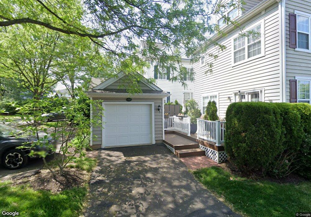
22 Edison Ln Unit 11 Doylestown, PA 18901
Estimated Value: $527,000 - $596,000
3
Beds
3
Baths
1,600
Sq Ft
$355/Sq Ft
Est. Value
About This Home
This home is located at 22 Edison Ln Unit 11, Doylestown, PA 18901 and is currently estimated at $567,731, approximately $354 per square foot. 22 Edison Ln Unit 11 is a home located in Bucks County with nearby schools including Doyle El School, Lenape Middle School, and Central Bucks High School-West.
Ownership History
Date
Name
Owned For
Owner Type
Purchase Details
Closed on
Aug 1, 2022
Sold by
Alper Matthew M
Bought by
Alper Matthew M and Alper Rina Isabel
Current Estimated Value
Purchase Details
Closed on
Nov 20, 2002
Sold by
Lantern Hill At Doylestown Lp
Bought by
Alper Matthew M
Home Financials for this Owner
Home Financials are based on the most recent Mortgage that was taken out on this home.
Original Mortgage
$180,000
Interest Rate
6.16%
Create a Home Valuation Report for This Property
The Home Valuation Report is an in-depth analysis detailing your home's value as well as a comparison with similar homes in the area
Home Values in the Area
Average Home Value in this Area
Purchase History
| Date | Buyer | Sale Price | Title Company |
|---|---|---|---|
| Alper Matthew M | -- | First Partners Abstract | |
| Alper Matthew M | $272,450 | -- |
Source: Public Records
Mortgage History
| Date | Status | Borrower | Loan Amount |
|---|---|---|---|
| Previous Owner | Alper Matthew M | $180,000 |
Source: Public Records
Tax History Compared to Growth
Tax History
| Year | Tax Paid | Tax Assessment Tax Assessment Total Assessment is a certain percentage of the fair market value that is determined by local assessors to be the total taxable value of land and additions on the property. | Land | Improvement |
|---|---|---|---|---|
| 2025 | $7,768 | $43,120 | $2,960 | $40,160 |
| 2024 | $7,768 | $43,120 | $2,960 | $40,160 |
| 2023 | $7,401 | $43,120 | $2,960 | $40,160 |
| 2022 | $7,298 | $43,120 | $2,960 | $40,160 |
| 2021 | $7,218 | $43,120 | $2,960 | $40,160 |
| 2020 | $7,138 | $43,120 | $2,960 | $40,160 |
| 2019 | $1,058 | $43,120 | $2,960 | $40,160 |
| 2018 | $6,974 | $43,120 | $2,960 | $40,160 |
| 2017 | $6,900 | $43,120 | $2,960 | $40,160 |
| 2016 | $6,900 | $43,120 | $2,960 | $40,160 |
| 2015 | -- | $43,120 | $2,960 | $40,160 |
| 2014 | -- | $43,120 | $2,960 | $40,160 |
Source: Public Records
Map
Nearby Homes
- 418 North St
- 333 Dorset Ct Unit 333
- 169 N Main St
- 146 N Church St
- 215 N Franklin St
- 90 Chapman Ave
- 146 E Court St
- 20 E Court St
- 194 Victoria Ct Unit 143
- 37 N Clinton St
- 4 Barnes Ct
- 1 Gatehouse Ln
- 121 Cottage St
- 114 Blackfriars Cir
- 100 Bishops Gate Ln Unit 67
- 69 E Oakland Ave
- 4 Old Colonial Dr Unit 254
- 155 E Oakland Ave
- 62 Constitution Ave
- 110 E Ashland St
- 24 Edison Ln Unit 10
- 20 Edison Ln Unit 12
- 2 Woodbridge Dr Unit 13
- 4 Woodbridge Dr Unit 14
- 412 Lantern Dr
- 406 Lantern Dr Unit 112
- 6 Woodbridge Dr Unit 15
- 231 Hillcrest Dr
- 410 Lantern Dr
- 410 Lantern Dr Unit 116
- 8 Woodbridge Dr Unit 16
- 18 Edison Ln Unit 7
- 404 Lantern Dr Unit 113
- 16 Edison Ln Unit 8
- 312 Lantern Dr Unit 111
- 229 Hillcrest Dr
- 14 Edison Ln Unit 9
- 408 Lantern Dr
- 233 Hillcrest Dr
- 10 Woodbridge Dr Unit 17