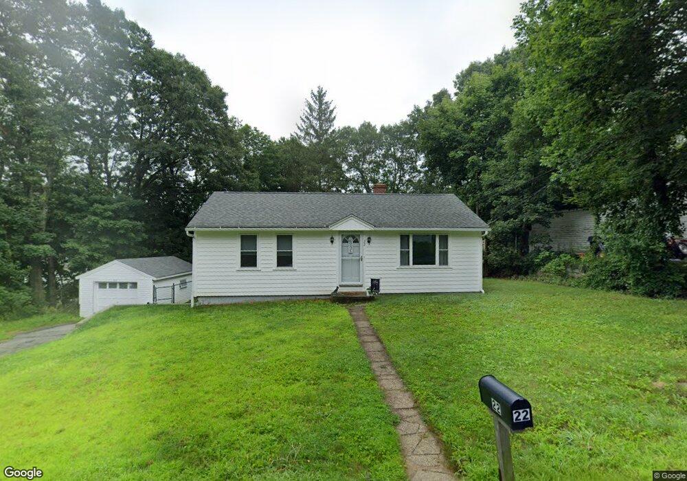
22 Edson Ave Rutland, MA 01543
Estimated Value: $376,000 - $437,000
3
Beds
1
Bath
1,064
Sq Ft
$378/Sq Ft
Est. Value
About This Home
This home is located at 22 Edson Ave, Rutland, MA 01543 and is currently estimated at $402,389, approximately $378 per square foot. 22 Edson Ave is a home located in Worcester County with nearby schools including Wachusett Regional High School.
Ownership History
Date
Name
Owned For
Owner Type
Purchase Details
Closed on
Jan 5, 2024
Sold by
Smith Laurie
Bought by
Mcavey Spencer T and Mcavey Abigail L
Current Estimated Value
Purchase Details
Closed on
Jan 13, 2017
Sold by
Johnson Christine J
Bought by
Smith Karl and Smith Laurie
Purchase Details
Closed on
Jul 14, 2000
Sold by
Duzak Ellen K and Guastella Ellen K
Bought by
Johnson Christine J
Home Financials for this Owner
Home Financials are based on the most recent Mortgage that was taken out on this home.
Original Mortgage
$100,000
Interest Rate
8.5%
Mortgage Type
Purchase Money Mortgage
Create a Home Valuation Report for This Property
The Home Valuation Report is an in-depth analysis detailing your home's value as well as a comparison with similar homes in the area
Home Values in the Area
Average Home Value in this Area
Purchase History
| Date | Buyer | Sale Price | Title Company |
|---|---|---|---|
| Mcavey Spencer T | -- | None Available | |
| Smith Karl | $60,000 | -- | |
| Johnson Christine J | $108,000 | -- |
Source: Public Records
Mortgage History
| Date | Status | Borrower | Loan Amount |
|---|---|---|---|
| Previous Owner | Johnson Christine J | $100,000 |
Source: Public Records
Tax History Compared to Growth
Tax History
| Year | Tax Paid | Tax Assessment Tax Assessment Total Assessment is a certain percentage of the fair market value that is determined by local assessors to be the total taxable value of land and additions on the property. | Land | Improvement |
|---|---|---|---|---|
| 2025 | $4,890 | $343,400 | $94,800 | $248,600 |
| 2024 | $4,458 | $300,600 | $85,000 | $215,600 |
| 2023 | $3,998 | $291,400 | $80,200 | $211,200 |
| 2022 | $3,881 | $245,800 | $67,900 | $177,900 |
| 2021 | $3,677 | $220,200 | $67,900 | $152,300 |
| 2020 | $3,591 | $203,900 | $63,900 | $140,000 |
| 2019 | $3,093 | $172,900 | $58,600 | $114,300 |
| 2018 | $2,999 | $165,400 | $58,600 | $106,800 |
| 2017 | $2,961 | $161,600 | $59,200 | $102,400 |
| 2016 | $2,692 | $155,000 | $59,100 | $95,900 |
| 2015 | $2,545 | $144,200 | $59,100 | $85,100 |
| 2014 | $2,467 | $144,200 | $59,100 | $85,100 |
Source: Public Records
Map
Nearby Homes
- 11 Lewis St
- 21 Lewis St
- 27 Lewis St
- 12 Lewis St
- 6 Lewis St
- 28 Forest Hill Dr
- 21 Highland Park Rd
- 2 Forest Hill Dr
- 85 Maple Ave Unit A
- 32 Pommogussett Rd Unit 1
- 25 Watson Ln
- 132 Fidelity Dr Unit 61
- 10 Fidelity Dr Unit 5
- 12 Fidelity Dr Unit 6
- 7 Prescott St
- 5 Miles Rd
- 10 Soucy Dr
- 10 Beechwood Dr
- 55 Pommogussett Rd
- 16 Richards Ave
- 20 Edson Ave
- 35 Birchwood Rd
- 19 Edson Ave
- 38 Birchwood Rd
- 36 Birchwood Rd
- 18 Edson Ave
- 18 Edson Ave Unit SF
- 42 Laurelwood Rd
- 40 Birchwood Rd
- 40 Birchwood Rd
- 34 Birchwood Rd
- 17 Edson Ave
- 33 Birchwood Rd
- 40 Laurelwood Rd
- 24 Edson Ave
- 38 Laurelwood Rd
- 21 Edson Ave
- 32 Birchwood Rd
- 31 Birchwood Rd
- 13 Edson Ave