Estimated Value: $718,483 - $921,000
3
Beds
2
Baths
1,520
Sq Ft
$525/Sq Ft
Est. Value
About This Home
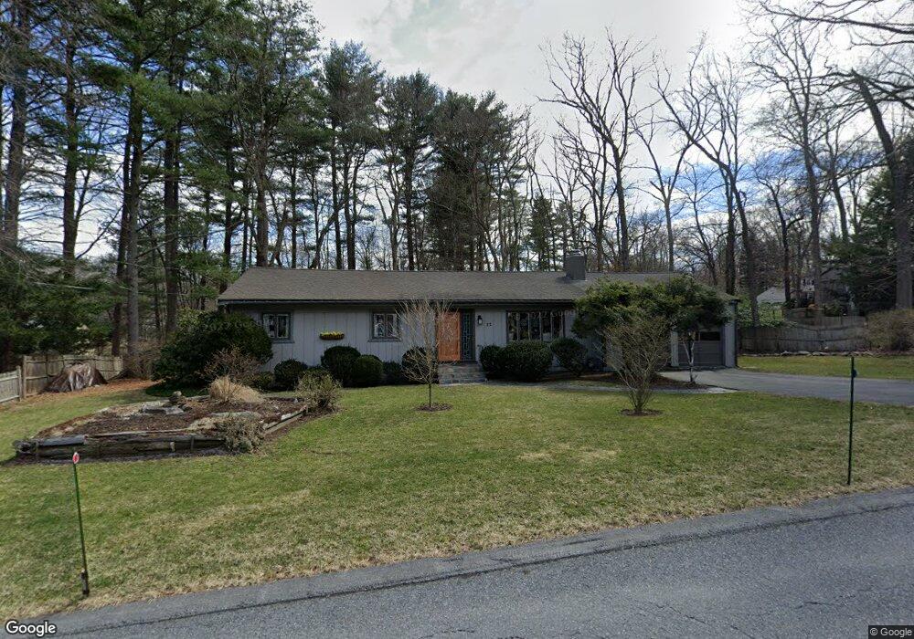
This home is located at 22 Ethan Allen Dr, Acton, MA 01720 and is currently estimated at $797,371, approximately $524 per square foot. 22 Ethan Allen Dr is a home located in Middlesex County with nearby schools including Acton-Boxborough Regional High School.
Ownership History
Date
Name
Owned For
Owner Type
Purchase Details
Closed on
Jul 7, 1989
Sold by
Hanna Kenneth T
Bought by
Kampas Paul J
Current Estimated Value
Home Financials for this Owner
Home Financials are based on the most recent Mortgage that was taken out on this home.
Original Mortgage
$167,900
Interest Rate
10.38%
Mortgage Type
Purchase Money Mortgage
Create a Home Valuation Report for This Property
The Home Valuation Report is an in-depth analysis detailing your home's value as well as a comparison with similar homes in the area
Home Values in the Area
Average Home Value in this Area
Purchase History
| Date | Buyer | Sale Price | Title Company |
|---|---|---|---|
| Kampas Paul J | $209,900 | -- |
Source: Public Records
Mortgage History
| Date | Status | Borrower | Loan Amount |
|---|---|---|---|
| Closed | Kampas Paul J | $157,500 | |
| Closed | Kampas Paul J | $160,000 | |
| Closed | Kampas Paul J | $167,900 |
Source: Public Records
Tax History
| Year | Tax Paid | Tax Assessment Tax Assessment Total Assessment is a certain percentage of the fair market value that is determined by local assessors to be the total taxable value of land and additions on the property. | Land | Improvement |
|---|---|---|---|---|
| 2025 | $11,341 | $661,300 | $343,100 | $318,200 |
| 2024 | $10,780 | $646,700 | $343,100 | $303,600 |
| 2023 | $10,294 | $586,200 | $312,000 | $274,200 |
| 2022 | $10,231 | $526,000 | $271,300 | $254,700 |
| 2021 | $9,915 | $490,100 | $251,200 | $238,900 |
| 2020 | $8,897 | $462,400 | $251,200 | $211,200 |
| 2019 | $8,436 | $435,500 | $251,200 | $184,300 |
| 2018 | $7,924 | $408,900 | $251,200 | $157,700 |
| 2017 | $7,794 | $408,900 | $251,200 | $157,700 |
| 2016 | $7,409 | $385,300 | $251,200 | $134,100 |
| 2015 | $7,420 | $389,500 | $251,200 | $138,300 |
| 2014 | $7,459 | $383,500 | $251,200 | $132,300 |
Source: Public Records
Map
Nearby Homes
- 92 Willow St Unit 3
- 92 Willow St Unit 2
- 90 Willow St Unit 1
- 134 Russet Ln Unit 134
- 280 W Acton Rd
- 631 Massachusetts Ave Unit 631
- 40 Fifers Ln
- 247 W Acton Rd
- 235 Arlington St
- 77 Wheeler Dr Unit 77
- 20 Lyons Ln Unit 20
- 6 Beacon Ct
- 40 Ridgewood Dr Unit 40
- 39 Ridgewood Dr Unit 39
- 17 W View Ln Unit 17
- 20 Joseph Reed Ln
- 30-6 Taylor Rd
- 4 Littlefield Rd
- 79 Taylor Rd
- 12 S Acton Rd
- 20 Ethan Allen Dr
- 2 Black Horse Dr
- 4 Black Horse Dr
- 7 Patrick Henry Cir
- 21 Ethan Allen Dr
- 5 Patrick Henry Cir
- 19 Ethan Allen Dr
- 23 Ethan Allen Dr
- 18 Ethan Allen Dr
- 3 Black Horse Dr
- 17 Ethan Allen Dr
- 3 Patrick Henry Cir
- 25 Ethan Allen Dr
- 2 Powder Horn Ln
- 6 Patrick Henry Cir
- 8 Black Horse Dr
- 32 Paul Revere Rd
- 3 Powder Horn Ln
- 28 Ethan Allen Dr
- 4 Patrick Henry Cir
Your Personal Tour Guide
Ask me questions while you tour the home.