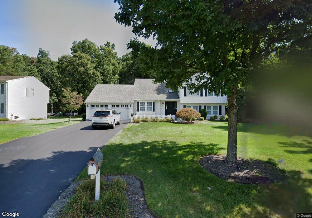
22 Fox Run Dr East Hanover, NJ 07936
Estimated Value: $957,032 - $1,095,000
--
Bed
--
Bath
2,453
Sq Ft
$417/Sq Ft
Est. Value
About This Home
This home is located at 22 Fox Run Dr, East Hanover, NJ 07936 and is currently estimated at $1,021,758, approximately $416 per square foot. 22 Fox Run Dr is a home located in Morris County with nearby schools including Frank J. Smith Elementary School, Central Elementary School, and East Hanover Middle School.
Ownership History
Date
Name
Owned For
Owner Type
Purchase Details
Closed on
Sep 12, 2021
Sold by
Campana Dean and Campana Marianne
Bought by
Radigan Jeff and Radigan Alyssa
Current Estimated Value
Home Financials for this Owner
Home Financials are based on the most recent Mortgage that was taken out on this home.
Original Mortgage
$680,000
Interest Rate
2.98%
Mortgage Type
Purchase Money Mortgage
Purchase Details
Closed on
Dec 5, 1994
Sold by
Adler Andrew
Bought by
Campana Dean and Campana Marianne
Home Financials for this Owner
Home Financials are based on the most recent Mortgage that was taken out on this home.
Original Mortgage
$210,000
Interest Rate
8.81%
Create a Home Valuation Report for This Property
The Home Valuation Report is an in-depth analysis detailing your home's value as well as a comparison with similar homes in the area
Home Values in the Area
Average Home Value in this Area
Purchase History
| Date | Buyer | Sale Price | Title Company |
|---|---|---|---|
| Radigan Jeff | $850,000 | Westcor Land Title Ins Co | |
| Radigan Jeff | $850,000 | Land Title | |
| Campana Dean | $305,000 | -- |
Source: Public Records
Mortgage History
| Date | Status | Borrower | Loan Amount |
|---|---|---|---|
| Previous Owner | Radigan Jeff | $680,000 | |
| Previous Owner | Campana Dean | $210,000 |
Source: Public Records
Tax History Compared to Growth
Tax History
| Year | Tax Paid | Tax Assessment Tax Assessment Total Assessment is a certain percentage of the fair market value that is determined by local assessors to be the total taxable value of land and additions on the property. | Land | Improvement |
|---|---|---|---|---|
| 2025 | $10,241 | $394,800 | $184,500 | $210,300 |
| 2024 | $9,850 | $394,800 | $184,500 | $210,300 |
| 2023 | $9,850 | $394,800 | $184,500 | $210,300 |
| 2022 | $8,922 | $394,800 | $184,500 | $210,300 |
| 2021 | $8,922 | $394,800 | $184,500 | $210,300 |
| 2020 | $9,436 | $394,800 | $184,500 | $210,300 |
| 2019 | $9,262 | $394,800 | $184,500 | $210,300 |
| 2018 | $8,982 | $394,800 | $184,500 | $210,300 |
| 2017 | $8,690 | $394,800 | $184,500 | $210,300 |
| 2016 | $8,571 | $394,800 | $184,500 | $210,300 |
| 2015 | $8,449 | $394,800 | $184,500 | $210,300 |
| 2014 | $8,267 | $394,800 | $184,500 | $210,300 |
Source: Public Records
Map
Nearby Homes
- 6 Coventry Ct
- 16 Windsor Way
- 78 Lincoln St
- 518 Eagle Rock Ave
- 112 Fairway Dr
- 107 Fairway Dr
- 11 Homestead Terrace
- 2 Edith Ct
- 26 Passaic Ave
- 9 Dixon Place
- 645 Ridgedale Ave Unit 6
- 38 Passaic Ave
- 526 Ridgedale Ave
- 10 Wilson Ave
- 60 Eastwood Terrace
- 64 Eastwood Terrace
- 6 Eastwood Terrace
- 8 Eastwood Terrace
- 13 Eastwood Terrace
- 10 Eastwood Terrace