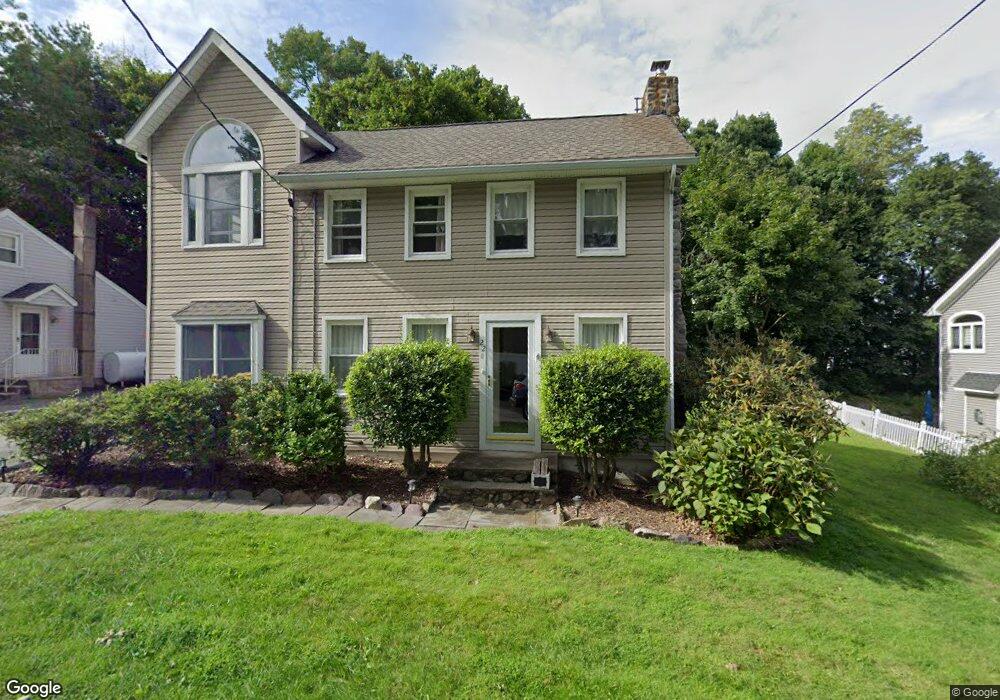
22 Grove St Boonton, NJ 07005
Estimated Value: $610,995 - $741,000
--
Bed
--
Bath
1,580
Sq Ft
$421/Sq Ft
Est. Value
About This Home
This home is located at 22 Grove St, Boonton, NJ 07005 and is currently estimated at $665,749, approximately $421 per square foot. 22 Grove St is a home located in Morris County with nearby schools including Rockaway Valley Elementary School, Our Lady of Mount Carmel School, and The Craig School.
Ownership History
Date
Name
Owned For
Owner Type
Purchase Details
Closed on
May 16, 2011
Sold by
Murtha William and Murtha Grace
Bought by
Bruderle Christopher and Strumwasser Nancy
Current Estimated Value
Home Financials for this Owner
Home Financials are based on the most recent Mortgage that was taken out on this home.
Original Mortgage
$337,250
Outstanding Balance
$233,616
Interest Rate
4.81%
Mortgage Type
New Conventional
Estimated Equity
$432,133
Purchase Details
Closed on
Mar 3, 2005
Sold by
Waldron James
Bought by
Murtha William and Murtha Grace
Purchase Details
Closed on
Apr 25, 1997
Sold by
George Edwin C and George Christina M
Bought by
Waldron James R and Waldron Janet R
Home Financials for this Owner
Home Financials are based on the most recent Mortgage that was taken out on this home.
Original Mortgage
$142,553
Interest Rate
7.85%
Mortgage Type
FHA
Create a Home Valuation Report for This Property
The Home Valuation Report is an in-depth analysis detailing your home's value as well as a comparison with similar homes in the area
Home Values in the Area
Average Home Value in this Area
Purchase History
| Date | Buyer | Sale Price | Title Company |
|---|---|---|---|
| Bruderle Christopher | $355,000 | Multiple | |
| Murtha William | $340,000 | -- | |
| Waldron James R | $145,000 | Old Republic Title |
Source: Public Records
Mortgage History
| Date | Status | Borrower | Loan Amount |
|---|---|---|---|
| Open | Bruderle Christopher | $337,250 | |
| Previous Owner | Waldron James R | $142,553 | |
| Closed | Murtha William | $0 |
Source: Public Records
Tax History Compared to Growth
Tax History
| Year | Tax Paid | Tax Assessment Tax Assessment Total Assessment is a certain percentage of the fair market value that is determined by local assessors to be the total taxable value of land and additions on the property. | Land | Improvement |
|---|---|---|---|---|
| 2025 | $8,358 | $333,500 | $189,500 | $144,000 |
| 2024 | $8,261 | $333,500 | $189,500 | $144,000 |
| 2023 | $8,261 | $333,500 | $189,500 | $144,000 |
| 2022 | $7,921 | $333,500 | $189,500 | $144,000 |
| 2021 | $7,721 | $333,500 | $189,500 | $144,000 |
| 2020 | $7,827 | $333,500 | $189,500 | $144,000 |
| 2019 | $7,721 | $333,500 | $189,500 | $144,000 |
| 2018 | $7,517 | $333,500 | $189,500 | $144,000 |
| 2017 | $7,407 | $333,500 | $189,500 | $144,000 |
| 2016 | $7,310 | $333,500 | $189,500 | $144,000 |
| 2015 | $7,310 | $333,500 | $189,500 | $144,000 |
| 2014 | $7,277 | $333,500 | $189,500 | $144,000 |
Source: Public Records
Map
Nearby Homes
- 24 Grove St
- 20 Grove St
- 18 Grove St
- 26 Grove St
- 23 Grove St
- 66 Brae Loch Dr Unit 527
- 68 Brae Loch Dr Unit 526
- 16 Grove St
- 72 Brae Loch Dr Unit 524
- 70 Brae Loch Dr Unit 525
- 45 Brae Loch Dr Unit 309
- 47 Brae Loch Dr
- 17 Grove St
- 49 Brae Loch Dr Unit 311
- 74 Brae Loch Dr Unit 523
- 43 Brae Loch Dr
- 64 Brae Loch Dr Unit 601
- 76 Brae Loch Dr
- 16 Sheridan Ln
- 41 Brae Loch Dr Unit 307