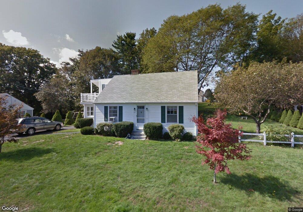
22 Grover Ave Eliot, ME 03903
South Eliot NeighborhoodEstimated Value: $528,000 - $754,000
4
Beds
2
Baths
1,420
Sq Ft
$435/Sq Ft
Est. Value
About This Home
This home is located at 22 Grover Ave, Eliot, ME 03903 and is currently estimated at $618,102, approximately $435 per square foot. 22 Grover Ave is a home located in York County with nearby schools including Marshwood High School.
Ownership History
Date
Name
Owned For
Owner Type
Purchase Details
Closed on
Aug 11, 2020
Sold by
Fisher Robert W
Bought by
Fisher Ft
Current Estimated Value
Purchase Details
Closed on
Jun 24, 2013
Sold by
Peterson Derek T
Bought by
Fisher Robert W and Fisher Helen E
Home Financials for this Owner
Home Financials are based on the most recent Mortgage that was taken out on this home.
Original Mortgage
$251,186
Interest Rate
3.45%
Mortgage Type
New Conventional
Purchase Details
Closed on
Nov 22, 2006
Sold by
Brannen William E Est and Brannen
Bought by
Peterson Derek T
Home Financials for this Owner
Home Financials are based on the most recent Mortgage that was taken out on this home.
Original Mortgage
$233,000
Interest Rate
6%
Mortgage Type
Adjustable Rate Mortgage/ARM
Create a Home Valuation Report for This Property
The Home Valuation Report is an in-depth analysis detailing your home's value as well as a comparison with similar homes in the area
Home Values in the Area
Average Home Value in this Area
Purchase History
| Date | Buyer | Sale Price | Title Company |
|---|---|---|---|
| Fisher Ft | -- | None Available | |
| Fisher Ft | -- | None Available | |
| Fisher Ft | -- | None Available | |
| Fisher Robert W | -- | -- | |
| Fisher Robert W | -- | -- | |
| Peterson Derek T | -- | -- | |
| Peterson Derek T | -- | -- | |
| Peterson Derek T | -- | -- |
Source: Public Records
Mortgage History
| Date | Status | Borrower | Loan Amount |
|---|---|---|---|
| Previous Owner | Fisher Robert W | $251,186 | |
| Previous Owner | Peterson Derek T | $233,000 |
Source: Public Records
Tax History Compared to Growth
Tax History
| Year | Tax Paid | Tax Assessment Tax Assessment Total Assessment is a certain percentage of the fair market value that is determined by local assessors to be the total taxable value of land and additions on the property. | Land | Improvement |
|---|---|---|---|---|
| 2024 | $4,056 | $342,300 | $174,900 | $167,400 |
| 2023 | $3,915 | $319,600 | $165,800 | $153,800 |
| 2022 | $3,785 | $312,800 | $165,800 | $147,000 |
| 2021 | $4,070 | $301,500 | $158,300 | $143,200 |
| 2020 | $4,166 | $283,400 | $150,800 | $132,600 |
| 2019 | $4,157 | $282,800 | $150,800 | $132,000 |
| 2018 | $4,157 | $282,800 | $150,800 | $132,000 |
| 2017 | $4,044 | $282,800 | $150,800 | $132,000 |
| 2016 | $3,973 | $282,800 | $150,800 | $132,000 |
| 2015 | $3,959 | $282,800 | $150,800 | $132,000 |
| 2014 | $3,903 | $282,800 | $150,800 | $132,000 |
| 2013 | $3,724 | $282,800 | $150,800 | $132,000 |
Source: Public Records
Map
Nearby Homes
- 493 Main St
- 124 Spinnaker Way
- 35 Leach Rd
- 201 Kearsarge Way
- 14 Birch St
- 5 Spinney Way Unit 9
- 5 Spinnaker Way Unit 5
- 25 Oak Terrace
- 27 Oak Terrace
- 19 Shearwater Dr Unit 1903
- 15 Shearwater Dr Unit 1902
- 37 Shearwater Dr Unit 1906
- 18 Shipping Ln
- 1338 Woodbury Ave Unit 10
- 20 Mendum Ave
- 1094 State Rd
- 1360 Woodbury Ave
- 27 Eden Ln Unit 4
- 19 Eden Ln Unit 2
- 15 Eden Ln Unit 1
- 26 Grover Ave
- 26 Grover Ave Unit A&B
- 20 Grover Ave
- 23 Grover Ave
- 18 Grover Ave
- 15 Grover Ave
- 28 Grover Ave
- 13 Grover Ave
- 25 Maple Ave
- 38 Maple Ave
- 36 Maple Ave
- 17 Maple Ave
- 14 Kings Hwy S
- 31 Grover Ave
- 11 Carrriage Hill Rd Unit 12
- 3 Dove Ln
- 12 Grover Ave
- 25 Grover Ave
- 11 Carriage Hill Road #A Unit A
- 23 Maple Ave