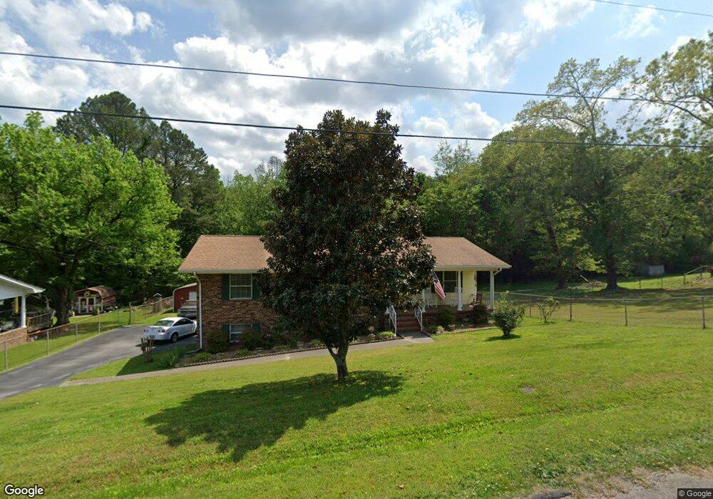
22 Hickory Cir Rossville, GA 30741
Estimated Value: $226,000 - $319,000
3
Beds
2
Baths
2,608
Sq Ft
$100/Sq Ft
Est. Value
About This Home
This home is located at 22 Hickory Cir, Rossville, GA 30741 and is currently estimated at $260,589, approximately $99 per square foot. 22 Hickory Cir is a home located in Walker County with nearby schools including Cherokee Ridge Elementary School, Rossville Middle School, and Ridgeland High School.
Ownership History
Date
Name
Owned For
Owner Type
Purchase Details
Closed on
Jul 12, 2006
Sold by
Keith Edward G
Bought by
Turner Gilberta
Current Estimated Value
Purchase Details
Closed on
Feb 22, 2002
Sold by
Touchstone Debra Montea
Bought by
Keith Edward G and Keith Brenda J
Purchase Details
Closed on
Aug 17, 2001
Sold by
Touchstone Garland Nelson
Bought by
Touchstone Debra Montea
Purchase Details
Closed on
Jun 30, 1998
Sold by
Hayes George D and Hayes Beatrice
Bought by
Touchstone Garland Nelson
Purchase Details
Closed on
Oct 19, 1966
Bought by
Hayes George D and Hayes Beatrice
Create a Home Valuation Report for This Property
The Home Valuation Report is an in-depth analysis detailing your home's value as well as a comparison with similar homes in the area
Home Values in the Area
Average Home Value in this Area
Purchase History
| Date | Buyer | Sale Price | Title Company |
|---|---|---|---|
| Turner Gilberta | $126,500 | -- | |
| Keith Edward G | $18,500 | -- | |
| Touchstone Debra Montea | -- | -- | |
| Touchstone Garland Nelson | $82,500 | -- | |
| Hayes George D | -- | -- |
Source: Public Records
Tax History Compared to Growth
Tax History
| Year | Tax Paid | Tax Assessment Tax Assessment Total Assessment is a certain percentage of the fair market value that is determined by local assessors to be the total taxable value of land and additions on the property. | Land | Improvement |
|---|---|---|---|---|
| 2024 | $212 | $96,690 | $3,384 | $93,306 |
| 2023 | $213 | $91,732 | $3,384 | $88,348 |
| 2022 | $445 | $78,578 | $3,384 | $75,194 |
| 2021 | $140 | $57,406 | $3,384 | $54,022 |
| 2020 | $153 | $47,770 | $3,384 | $44,386 |
| 2019 | $155 | $47,770 | $3,384 | $44,386 |
| 2018 | $1,264 | $47,770 | $3,384 | $44,386 |
| 2017 | $489 | $47,770 | $3,384 | $44,386 |
| 2016 | $489 | $47,770 | $3,384 | $44,386 |
| 2015 | $495 | $44,430 | $3,744 | $40,686 |
| 2014 | $393 | $44,430 | $3,744 | $40,686 |
| 2013 | $1,264 | $44,429 | $3,744 | $40,685 |
Source: Public Records
Map
Nearby Homes
- 3 Fisher Rd
- 321 Jewell Ln
- 25 Carolyn Ln
- 32 Kent Dr
- 24 Newman Dr
- 13 Travis Rd
- 4 Newman Dr
- 2 & 4 Newman Dr
- 2 Newman Dr
- 30 Talley Hill Ln
- 0 Sunset Cir Unit 1517664
- 0 Sunset Cir Unit 1524868
- 57 Circle Dr
- 51 Circle Dr
- 408 N Jenkins Rd
- 55 Saddlebred Way
- 105 Saddlebred Way
- Whitman Plan at The Stables
- Davidson Plan at The Stables
- Aspen Plan at The Stables