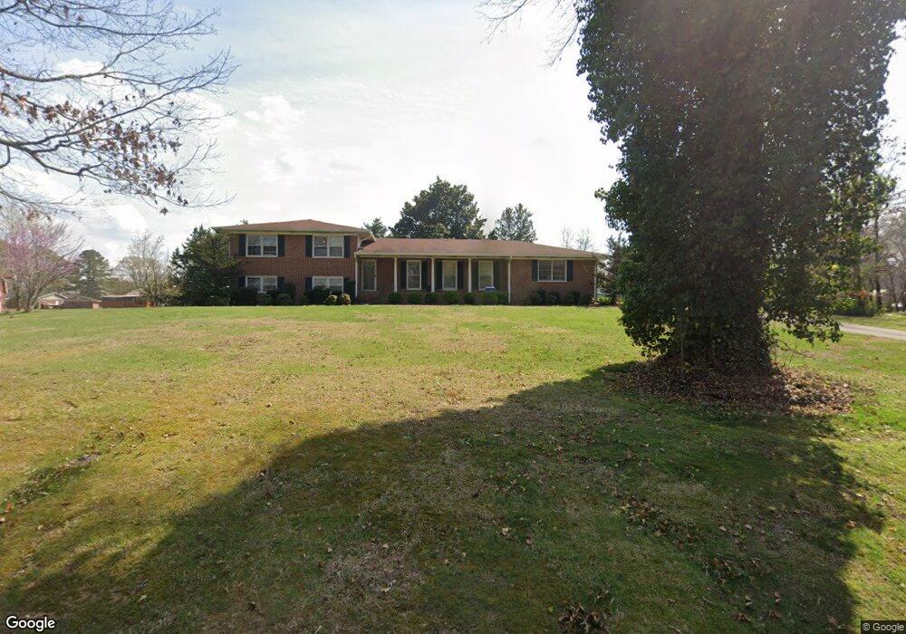
22 Hillside Dr Rockmart, GA 30153
Estimated Value: $347,000 - $372,851
4
Beds
4
Baths
2,524
Sq Ft
$142/Sq Ft
Est. Value
About This Home
This home is located at 22 Hillside Dr, Rockmart, GA 30153 and is currently estimated at $359,213, approximately $142 per square foot. 22 Hillside Dr is a home located in Polk County with nearby schools including Rockmart Middle School.
Ownership History
Date
Name
Owned For
Owner Type
Purchase Details
Closed on
Jul 18, 2014
Sold by
Jefferson Hatch Properti
Bought by
Worfford Thyra Y
Current Estimated Value
Home Financials for this Owner
Home Financials are based on the most recent Mortgage that was taken out on this home.
Original Mortgage
$142,373
Outstanding Balance
$111,817
Interest Rate
5.25%
Mortgage Type
FHA
Estimated Equity
$247,396
Purchase Details
Closed on
Jul 16, 2013
Sold by
Redmond 1St Class Properti
Bought by
Jefferson & Hatch Properties L
Purchase Details
Closed on
Jun 4, 2013
Sold by
Baker John E
Bought by
Redmond 1St Class Properties I
Purchase Details
Closed on
Apr 6, 2004
Sold by
Baker Ruth W (*Reserves Life Estate)
Bought by
Baker John E***
Purchase Details
Closed on
Jun 29, 1981
Sold by
Baker George and Baker Ruth
Bought by
Baker Ruth W
Purchase Details
Closed on
Jan 1, 1902
Bought by
Baker George and Baker Ruth
Purchase Details
Closed on
Jan 1, 1901
Bought by
Baker George and Baker Ruth
Create a Home Valuation Report for This Property
The Home Valuation Report is an in-depth analysis detailing your home's value as well as a comparison with similar homes in the area
Home Values in the Area
Average Home Value in this Area
Purchase History
| Date | Buyer | Sale Price | Title Company |
|---|---|---|---|
| Worfford Thyra Y | $145,000 | -- | |
| Jefferson & Hatch Properties L | $66,500 | -- | |
| Redmond 1St Class Properties I | $54,340 | -- | |
| Baker John E*** | -- | -- | |
| Baker Ruth W | -- | -- | |
| Baker George | -- | -- | |
| Baker George | -- | -- |
Source: Public Records
Mortgage History
| Date | Status | Borrower | Loan Amount |
|---|---|---|---|
| Open | Worfford Thyra Y | $142,373 |
Source: Public Records
Tax History
| Year | Tax Paid | Tax Assessment Tax Assessment Total Assessment is a certain percentage of the fair market value that is determined by local assessors to be the total taxable value of land and additions on the property. | Land | Improvement |
|---|---|---|---|---|
| 2025 | $2,541 | $112,918 | $8,000 | $104,918 |
| 2024 | $2,442 | $116,825 | $8,000 | $108,825 |
| 2023 | $1,956 | $82,430 | $8,000 | $74,430 |
| 2022 | $1,752 | $73,816 | $8,000 | $65,816 |
| 2021 | $1,775 | $73,816 | $8,000 | $65,816 |
| 2020 | $1,778 | $73,816 | $8,000 | $65,816 |
| 2019 | $1,513 | $56,328 | $9,000 | $47,328 |
| 2018 | $1,445 | $52,437 | $9,000 | $43,437 |
| 2017 | $1,427 | $52,437 | $9,000 | $43,437 |
| 2016 | $1,427 | $52,437 | $9,000 | $43,437 |
| 2015 | $1,436 | $52,608 | $9,000 | $43,608 |
| 2014 | $729 | $48,364 | $8,317 | $40,048 |
Source: Public Records
Map
Nearby Homes
- 184 Morgan Ln
- 214 Horseshoe Cir
- 865 Morgan Valley Rd
- 60 Lee St
- 479 Morgan Valley Rd
- 1714 Cedartown Hwy
- 92 Autumn Path
- 0 Pine Mountain St Unit 10620510
- 0 Pine Mountain St Unit 10620492
- 65 Wheeler Rd
- 831 Government Farm Rd
- 1 Pine Mountain Rd
- 135 2nd St
- 816 Government Farm Rd
- 740 Calloway Dr
- 601 Calloway Dr
- 702 Calloway Dr
- 907 Stringer Rd
- 271 Mccowan Cir
- 202 Gordon St
- 24 Hillside Dr
- 430 Horseshoe Cir
- 20 Hillside Dr
- 113 Burton Dr
- 111 Burton Dr
- 26 Hillside Dr
- 14 Hillside Dr
- 17 Hillside Dr
- 23 Hillside Dr
- 109 Burton Dr
- 25 Hillside Dr
- 0 Hillside Dr
- 0 Hillside Dr Unit 10241883
- 0 Hillside Dr Unit 7325062
- 0 Hillside Dr Unit 8125839
- 0 Hillside Dr Unit 8276047
- 0 Hillside Dr Unit 6852876
- 0 Hillside Dr Unit 8942065
- 0 Hillside Dr Unit 5923805
- 118 Burton Dr
Your Personal Tour Guide
Ask me questions while you tour the home.