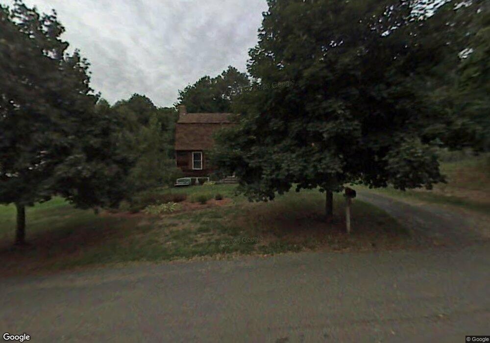
22 Humphrey Ln West Springfield, MA 01089
Estimated Value: $430,199 - $499,000
3
Beds
2
Baths
1,872
Sq Ft
$246/Sq Ft
Est. Value
About This Home
This home is located at 22 Humphrey Ln, West Springfield, MA 01089 and is currently estimated at $460,800, approximately $246 per square foot. 22 Humphrey Ln is a home located in Hampden County with nearby schools including West Springfield High School and St Thomas The Apostle School.
Ownership History
Date
Name
Owned For
Owner Type
Purchase Details
Closed on
Oct 31, 1985
Bought by
Prout Michael
Current Estimated Value
Create a Home Valuation Report for This Property
The Home Valuation Report is an in-depth analysis detailing your home's value as well as a comparison with similar homes in the area
Home Values in the Area
Average Home Value in this Area
Purchase History
| Date | Buyer | Sale Price | Title Company |
|---|---|---|---|
| Prout Michael | $102,700 | -- |
Source: Public Records
Mortgage History
| Date | Status | Borrower | Loan Amount |
|---|---|---|---|
| Open | Prout Michael | $10,000 | |
| Closed | Prout Michael | $80,000 | |
| Closed | Prout Michael | $10,000 |
Source: Public Records
Tax History
| Year | Tax Paid | Tax Assessment Tax Assessment Total Assessment is a certain percentage of the fair market value that is determined by local assessors to be the total taxable value of land and additions on the property. | Land | Improvement |
|---|---|---|---|---|
| 2025 | $5,474 | $368,100 | $128,900 | $239,200 |
| 2024 | $5,194 | $350,700 | $128,900 | $221,800 |
| 2023 | $5,023 | $323,200 | $128,900 | $194,300 |
| 2022 | $4,599 | $291,800 | $116,900 | $174,900 |
| 2021 | $4,485 | $265,400 | $109,500 | $155,900 |
| 2020 | $4,487 | $264,100 | $109,500 | $154,600 |
| 2019 | $4,479 | $264,100 | $109,500 | $154,600 |
| 2018 | $4,503 | $264,100 | $109,500 | $154,600 |
| 2017 | $4,503 | $264,100 | $109,500 | $154,600 |
| 2016 | $4,497 | $264,700 | $105,400 | $159,300 |
| 2015 | $4,411 | $259,600 | $103,300 | $156,300 |
| 2014 | $1,072 | $259,600 | $103,300 | $156,300 |
Source: Public Records
Map
Nearby Homes
- 88 Verdugo St
- 65 Verdugo St
- 240 Morton St
- 61 Clarence St
- 62 Talcott Ave
- 65 Churchill Rd
- 750 Amostown Rd
- 0 Ahiska Rd Unit 73477754
- 32 Glenview Dr
- 1996 Westfield St
- 81 Chestnut St
- 32 Maple St
- 791 Morgan Rd
- 31 North Blvd
- 128 Hampden St
- 115 Grove St
- 34 High Meadow Dr
- 917 Elm St
- 36 Shady Brook
- 24 Hampden St
- 30 Humphrey Ln
- 315 Lancaster Ave
- 307 Lancaster Ave
- 325 Lancaster Ave
- 38 Humphrey Ln
- 293 Lancaster Ave
- 19 Humphrey Ln
- 29 Humphrey Ln
- 335 Lancaster Ave
- 39 Humphrey Ln
- 318 Lancaster Ave Unit 1
- 314 Ely Ave
- 281 Lancaster Ave
- 324 Ely Ave
- 9 Albert St
- 345 Lancaster Ave
- 324 Lancaster Ave
- 334 Ely Ave
- 332 Lancaster Ave
- 296 Ely Ave
Your Personal Tour Guide
Ask me questions while you tour the home.