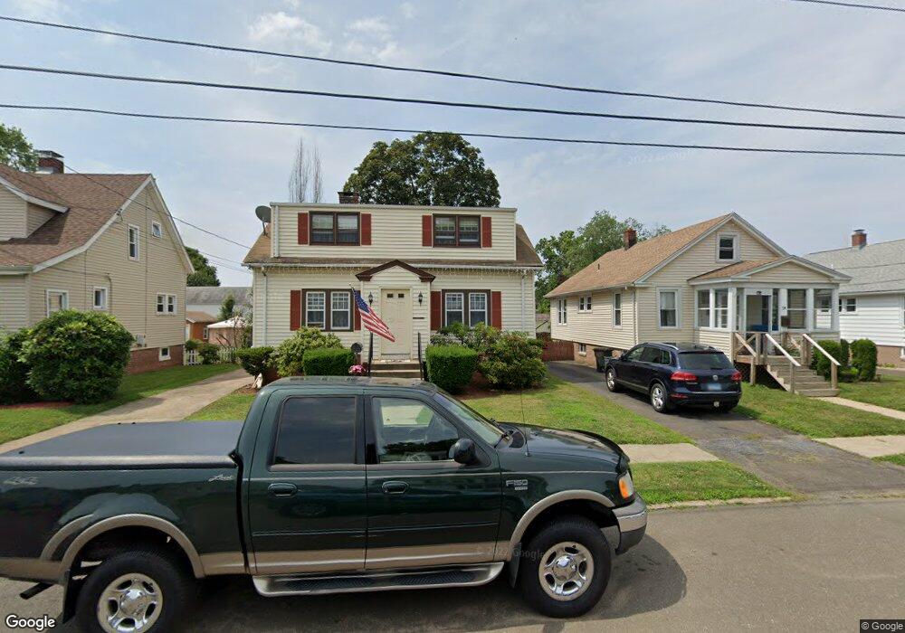
22 Iver Ave East Haven, CT 06512
Estimated Value: $312,000 - $326,000
3
Beds
1
Bath
1,270
Sq Ft
$249/Sq Ft
Est. Value
About This Home
This home is located at 22 Iver Ave, East Haven, CT 06512 and is currently estimated at $316,714, approximately $249 per square foot. 22 Iver Ave is a home located in New Haven County with nearby schools including East Haven High School, All Nations Christian Academy, and Pathway School.
Ownership History
Date
Name
Owned For
Owner Type
Purchase Details
Closed on
Feb 1, 2017
Sold by
Napolitano Frank
Bought by
Lund Kristin
Current Estimated Value
Home Financials for this Owner
Home Financials are based on the most recent Mortgage that was taken out on this home.
Original Mortgage
$150,350
Outstanding Balance
$124,236
Interest Rate
4.3%
Mortgage Type
Purchase Money Mortgage
Estimated Equity
$192,478
Purchase Details
Closed on
Jul 2, 1964
Bought by
Napolitano Michael A and Napolitano Katherine
Create a Home Valuation Report for This Property
The Home Valuation Report is an in-depth analysis detailing your home's value as well as a comparison with similar homes in the area
Home Values in the Area
Average Home Value in this Area
Purchase History
| Date | Buyer | Sale Price | Title Company |
|---|---|---|---|
| Lund Kristin | $155,000 | -- | |
| Napolitano Michael A | -- | -- |
Source: Public Records
Mortgage History
| Date | Status | Borrower | Loan Amount |
|---|---|---|---|
| Open | Napolitano Michael A | $150,350 | |
| Previous Owner | Napolitano Michael A | $69,600 |
Source: Public Records
Tax History Compared to Growth
Tax History
| Year | Tax Paid | Tax Assessment Tax Assessment Total Assessment is a certain percentage of the fair market value that is determined by local assessors to be the total taxable value of land and additions on the property. | Land | Improvement |
|---|---|---|---|---|
| 2025 | $4,515 | $135,030 | $44,240 | $90,790 |
| 2024 | $4,515 | $135,030 | $44,240 | $90,790 |
| 2023 | $4,213 | $135,030 | $44,240 | $90,790 |
| 2022 | $4,213 | $135,030 | $44,240 | $90,790 |
| 2021 | $3,815 | $111,400 | $45,490 | $65,910 |
| 2020 | $3,815 | $111,400 | $45,490 | $65,910 |
| 2019 | $3,612 | $111,400 | $45,490 | $65,910 |
| 2018 | $3,615 | $111,400 | $45,490 | $65,910 |
| 2017 | $3,515 | $111,400 | $45,490 | $65,910 |
| 2016 | $3,677 | $116,540 | $44,230 | $72,310 |
| 2015 | $3,677 | $116,540 | $44,230 | $72,310 |
| 2014 | $3,735 | $116,540 | $44,230 | $72,310 |
Source: Public Records
Map
Nearby Homes