
Seller's Agent in 2021
Laura Meier
Compass
(508) 208-5215
18 in this area
28 Total Sales
Estimated Value: $1,160,000 - $1,233,000
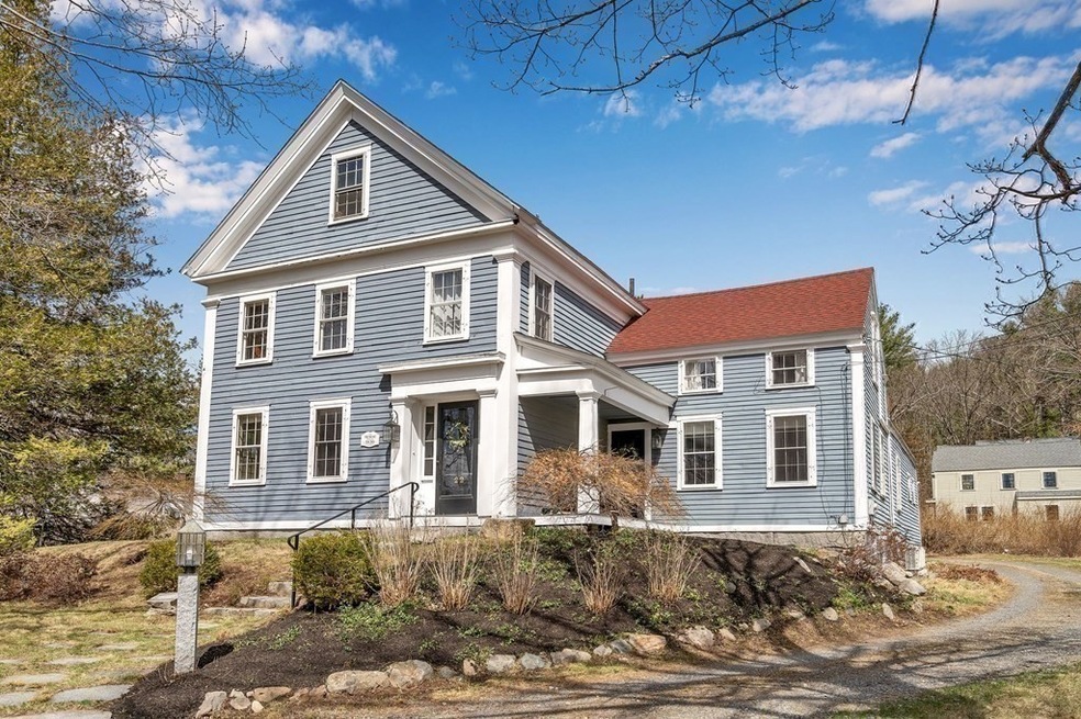
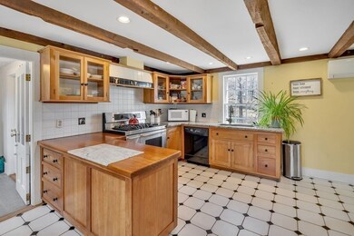
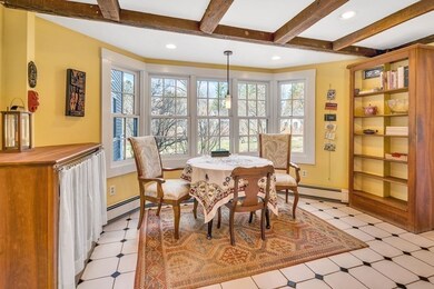
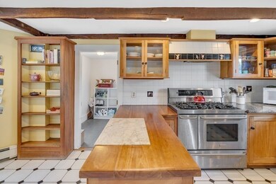
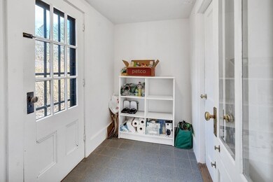
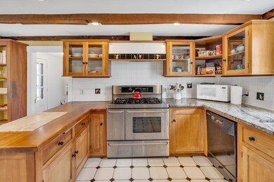
Charm-filled Circa 1830 Colonial Farmhouse on 1.06 BEAUTIFUL level acres with a classic 40 x 20 Post & Beam New England "As-Is" Barn. Privately sited off a side street, yet within walking distance to all shops and services from the King Philip Historic District neighborhood. Abundant windows allow for ample natural light. Oversized rooms and high ceilings are rare for this era. Four Bedroom septic allows for expansion possibilities. Walk up unfinished attic and unfinished basement. Updated Country kitchen opens to private patio and gardens with dramatic views. Garage parking plus separate Indoor parking for two vehicles in the barn. Beautiful original wood floors. Gas Heat/two Cooling zones. Solar panels on Barn roof provide ample electricity; no electric bills in 2020! A true gem ready for the next owner to love. Fantastic Yard and Setting! Offers Due to Listing Agent by Noon on Tuesday, April 6th, 2021.
Last Buyer's Agent
Laura McKenna
Barrett Sotheby's International Realty
| Date | Buyer | Sale Price | Title Company |
|---|---|---|---|
| Wachs Jordan | $880,000 | None Available | |
| Loomis John D | $602,500 | -- | |
| West Newton Sb | $78,000 | -- |
| Date | Status | Borrower | Loan Amount |
|---|---|---|---|
| Open | Wachs Jordan | $229,000 | |
| Closed | Wachs Jordan | $100,000 | |
| Open | Wachs Jordan | $630,000 | |
| Previous Owner | West Newton Sb | $120,000 | |
| Previous Owner | Jacobson Gary R | $50,000 | |
| Previous Owner | Jacobson Gary R | $100,000 | |
| Previous Owner | Grisafi Paula L | $250,000 | |
| Previous Owner | West Newton Sb | $40,000 |
| Date | Event | Price | Change | Sq Ft Price |
|---|---|---|---|---|
| 06/30/2021 06/30/21 | Sold | $880,000 | +17.3% | $330 / Sq Ft |
| 04/06/2021 04/06/21 | Pending | -- | -- | -- |
| 04/01/2021 04/01/21 | For Sale | $749,900 | -- | $281 / Sq Ft |
| Year | Tax Paid | Tax Assessment Tax Assessment Total Assessment is a certain percentage of the fair market value that is determined by local assessors to be the total taxable value of land and additions on the property. | Land | Improvement |
|---|---|---|---|---|
| 2025 | $15,223 | $1,039,800 | $441,800 | $598,000 |
| 2024 | $14,436 | $988,100 | $429,000 | $559,100 |
| 2023 | $13,032 | $826,400 | $397,400 | $429,000 |
| 2022 | $12,063 | $668,300 | $365,000 | $303,300 |
| 2021 | $12,744 | $676,800 | $365,000 | $311,800 |
| 2020 | $12,487 | $676,800 | $365,000 | $311,800 |
| 2019 | $12,121 | $676,800 | $365,000 | $311,800 |
| 2018 | $12,060 | $672,600 | $389,000 | $283,600 |
| 2017 | $11,247 | $634,000 | $370,200 | $263,800 |
| 2016 | $10,986 | $617,200 | $356,200 | $261,000 |
| 2015 | $10,523 | $597,900 | $342,600 | $255,300 |
| 2014 | $10,499 | $582,300 | $332,600 | $249,700 |
Seller's Agent in 2021
Laura Meier
Compass
(508) 208-5215
18 in this area
28 Total Sales
L
Buyer's Agent in 2021
Laura McKenna
Barrett Sotheby's International Realty
Source: MLS Property Information Network (MLS PIN)
MLS Number: 72806982
APN: SUDB-000009K-000000-000039
Disclaimer: Certain information contained herein is derived from information provided by parties other than Homes.com. All information provided is deemed reliable, but is not guaranteed to be accurate and should be independently verified.
![]() The property listing data and information, or the Images, set forth herein were provided to MLS Property Information Network, Inc. from third party sources, including sellers, lessors and public records, and were compiled by MLS Property Information Network, Inc. The property listing data and information, and the Images, are for the personal, non-commercial use of consumers having a good faith interest in purchasing or leasing listed properties of the type displayed to them and may not be used for any purpose other than to identify prospective properties which such consumers may have a good faith interest in purchasing or leasing. MLS Property Information Network, Inc. and its subscribers disclaim any and all representations and warranties as to the accuracy of the property listing data and information, or as to the accuracy of any of the Images, set forth herein.
The property listing data and information, or the Images, set forth herein were provided to MLS Property Information Network, Inc. from third party sources, including sellers, lessors and public records, and were compiled by MLS Property Information Network, Inc. The property listing data and information, and the Images, are for the personal, non-commercial use of consumers having a good faith interest in purchasing or leasing listed properties of the type displayed to them and may not be used for any purpose other than to identify prospective properties which such consumers may have a good faith interest in purchasing or leasing. MLS Property Information Network, Inc. and its subscribers disclaim any and all representations and warranties as to the accuracy of the property listing data and information, or as to the accuracy of any of the Images, set forth herein.