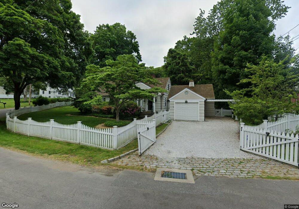
22 Larbert Rd Southport, CT 06890
Southport NeighborhoodEstimated Value: $1,368,203 - $1,919,000
4
Beds
3
Baths
2,425
Sq Ft
$679/Sq Ft
Est. Value
About This Home
This home is located at 22 Larbert Rd, Southport, CT 06890 and is currently estimated at $1,646,301, approximately $678 per square foot. 22 Larbert Rd is a home located in Fairfield County with nearby schools including Mill Hill School, Roger Ludlowe Middle School, and Fairfield Ludlowe High School.
Ownership History
Date
Name
Owned For
Owner Type
Purchase Details
Closed on
Jun 18, 2008
Sold by
William V Roberti Ret and Robert William V
Bought by
Daniell Minda P
Current Estimated Value
Home Financials for this Owner
Home Financials are based on the most recent Mortgage that was taken out on this home.
Original Mortgage
$675,000
Outstanding Balance
$434,251
Interest Rate
6.1%
Estimated Equity
$1,212,050
Purchase Details
Closed on
Sep 29, 2000
Sold by
Petoek Andrew and Petoek Bernadette E
Bought by
Roberti William and Roberti Christina G
Purchase Details
Closed on
Aug 31, 1999
Sold by
Miriam Cole Ret and Cole Martin C
Bought by
Petock Andrew and Petock Bernadette E
Create a Home Valuation Report for This Property
The Home Valuation Report is an in-depth analysis detailing your home's value as well as a comparison with similar homes in the area
Home Values in the Area
Average Home Value in this Area
Purchase History
| Date | Buyer | Sale Price | Title Company |
|---|---|---|---|
| Daniell Minda P | $960,000 | -- | |
| Daniell Minda P | $960,000 | -- | |
| Roberti William | $482,275 | -- | |
| Roberti William V | $482,275 | -- | |
| Petock Andrew | $437,500 | -- | |
| Petock Andrew | $437,500 | -- |
Source: Public Records
Mortgage History
| Date | Status | Borrower | Loan Amount |
|---|---|---|---|
| Open | Petock Andrew | $675,000 | |
| Closed | Petock Andrew | $675,000 |
Source: Public Records
Tax History Compared to Growth
Tax History
| Year | Tax Paid | Tax Assessment Tax Assessment Total Assessment is a certain percentage of the fair market value that is determined by local assessors to be the total taxable value of land and additions on the property. | Land | Improvement |
|---|---|---|---|---|
| 2025 | $15,408 | $542,710 | $359,310 | $183,400 |
| 2024 | $15,142 | $542,710 | $359,310 | $183,400 |
| 2023 | $14,930 | $542,710 | $359,310 | $183,400 |
| 2022 | $14,783 | $542,710 | $359,310 | $183,400 |
| 2021 | $14,642 | $542,710 | $359,310 | $183,400 |
| 2020 | $15,482 | $577,920 | $364,420 | $213,500 |
| 2019 | $15,482 | $577,920 | $364,420 | $213,500 |
| 2018 | $15,234 | $577,920 | $364,420 | $213,500 |
| 2017 | $14,922 | $577,920 | $364,420 | $213,500 |
| 2016 | $14,708 | $577,920 | $364,420 | $213,500 |
| 2015 | $14,714 | $593,530 | $409,990 | $183,540 |
| 2014 | $14,482 | $593,530 | $409,990 | $183,540 |
Source: Public Records
Map
Nearby Homes
- 28 Mill Hill Rd Unit 28
- 2 Elmwood Dr Unit 2
- 153 Pease Ave
- 53 Hilltop Dr
- 100 Overhill Rd
- 844 Mill Hill Terrace
- 88 Overhill Rd
- 476 Mill Hill Terrace
- 85 Patrick Dr
- 944 Pequot Ave
- 260 Willow St
- 209 S Pine Creek Rd
- 57 Beaumont Place
- 305 S Gate Ln
- 647 Bronson Rd
- 775 Sasco Hill Rd
- 828 Sasco Hill Rd
- 21 Beaumont St
- 154 Gorham Rd
- 43 Helen St
- 23 Larbert Rd
- 56 Larbert Rd
- 11 Larbert Rd
- 31 Larbert Rd
- 170 Pequot Ave
- 49 Larbert Rd
- 156 Pequot Ave
- 125 Pequot Ave Unit 1st Rear
- 125 Pequot Ave
- 125 Pequot Ave Unit 1F
- 125 Pequot Ave Unit 2Rear
- 125 Pequot Ave Unit 2 Front
- 61 Larbert Rd
- 276 Taintor Dr
- 142 Pequot Ave
- 122 Pequot Ave
- 248 Taintor Dr
- 310 Taintor Dr
- 287 Taintor Dr
- 214 Taintor Dr