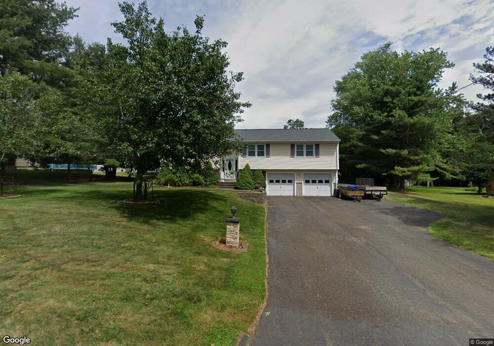
22 Laurel Hill Rd Branford, CT 06405
Estimated Value: $522,000 - $534,092
3
Beds
2
Baths
1,444
Sq Ft
$364/Sq Ft
Est. Value
About This Home
This home is located at 22 Laurel Hill Rd, Branford, CT 06405 and is currently estimated at $526,273, approximately $364 per square foot. 22 Laurel Hill Rd is a home located in New Haven County with nearby schools including Francis Walsh Intermediate School, Branford High School, and St Mary School.
Ownership History
Date
Name
Owned For
Owner Type
Purchase Details
Closed on
Jun 18, 2008
Sold by
Bates Robert N and Bates Joan D
Bought by
Olszewski John J
Current Estimated Value
Home Financials for this Owner
Home Financials are based on the most recent Mortgage that was taken out on this home.
Original Mortgage
$165,000
Outstanding Balance
$106,150
Interest Rate
6.1%
Estimated Equity
$420,123
Purchase Details
Closed on
Apr 10, 2003
Sold by
Hevrin Helen P
Bought by
Bates Robert N and Bates Joan D
Home Financials for this Owner
Home Financials are based on the most recent Mortgage that was taken out on this home.
Original Mortgage
$114,000
Interest Rate
5.86%
Create a Home Valuation Report for This Property
The Home Valuation Report is an in-depth analysis detailing your home's value as well as a comparison with similar homes in the area
Home Values in the Area
Average Home Value in this Area
Purchase History
| Date | Buyer | Sale Price | Title Company |
|---|---|---|---|
| Olszewski John J | $315,000 | -- | |
| Bates Robert N | $220,000 | -- |
Source: Public Records
Mortgage History
| Date | Status | Borrower | Loan Amount |
|---|---|---|---|
| Open | Bates Robert N | $165,000 | |
| Previous Owner | Bates Robert N | $114,000 |
Source: Public Records
Tax History Compared to Growth
Tax History
| Year | Tax Paid | Tax Assessment Tax Assessment Total Assessment is a certain percentage of the fair market value that is determined by local assessors to be the total taxable value of land and additions on the property. | Land | Improvement |
|---|---|---|---|---|
| 2025 | $7,156 | $334,400 | $92,700 | $241,700 |
| 2024 | $5,706 | $187,200 | $78,300 | $108,900 |
| 2023 | $5,595 | $187,200 | $78,300 | $108,900 |
| 2022 | $5,513 | $187,200 | $78,300 | $108,900 |
| 2021 | $5,513 | $187,200 | $78,300 | $108,900 |
| 2020 | $5,414 | $187,200 | $78,300 | $108,900 |
| 2019 | $5,587 | $192,200 | $81,800 | $110,400 |
| 2018 | $5,505 | $192,200 | $81,800 | $110,400 |
| 2017 | $5,472 | $192,200 | $81,800 | $110,400 |
| 2016 | $5,268 | $192,200 | $81,800 | $110,400 |
| 2015 | $5,176 | $192,200 | $81,800 | $110,400 |
| 2014 | $4,954 | $188,800 | $78,300 | $110,500 |
Source: Public Records
Map
Nearby Homes
- 47 Jerimoth Dr Unit 47
- 103 Fresh Meadow Rd Unit 103
- 113 Island View Terrace
- 240 Austin Ryer Ln Unit 240
- 38 Foxbridge Village Rd
- 379 Brushy Plain Rd
- 226 Austin Ryer Ln Unit 226
- 100 Hemlock Rd Unit 4-2
- 8 Autumn Ridge Rd
- 53 Brushy Plain Rd Unit 4E
- 175 Cherry Hill Rd
- 13 Brushy Plain Rd
- 9 Mirage Dr
- 27 Hickory Hill Ln
- 11 Williams Rd
- 22 Hickory Hill Ln
- 184 Cherry Hill Rd Unit Lot 4
- 180 Cherry Hill Rd Unit Lot 5
- 107 Chestnut St
- 251 N Main St
- 18 Laurel Hill Rd
- 26 Laurel Hill Rd
- 11 Crestwood Rd
- 15 Crestwood Rd
- 19 Laurel Hill Rd
- 11 Laurel Hill Rd
- 30 Laurel Hill Rd
- 0 Crestwood Rd Unit N319441
- 0 Crestwood Rd
- 10 Laurel Hill Rd
- 14 Crestwood Rd
- 9 Laurel Hill Rd
- 26 Crestwood Rd
- 22 Crestwood Rd
- 30 Crestwood Rd
- 2 Red Rock Rd
- 14 Richill Rd
- 18 Richill Rd
- 10 Richill Rd
- 241 Brushy Plain Rd