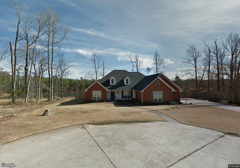
22 Lauren Ln Texarkana, TX 75503
Estimated Value: $442,848 - $502,000
--
Bed
--
Bath
3,030
Sq Ft
$154/Sq Ft
Est. Value
About This Home
This home is located at 22 Lauren Ln, Texarkana, TX 75503 and is currently estimated at $467,462, approximately $154 per square foot. 22 Lauren Ln is a home located in Bowie County with nearby schools including Red Lick Elementary School and Red Lick Middle School.
Ownership History
Date
Name
Owned For
Owner Type
Purchase Details
Closed on
May 19, 2014
Sold by
Telg Blair E and Telg Dana M
Bought by
Pack Andrew and Pack Kelly
Current Estimated Value
Home Financials for this Owner
Home Financials are based on the most recent Mortgage that was taken out on this home.
Original Mortgage
$257,450
Outstanding Balance
$196,573
Interest Rate
4.38%
Mortgage Type
New Conventional
Estimated Equity
$270,889
Purchase Details
Closed on
Sep 9, 2010
Sold by
Cartus Financial Corp
Bought by
Telg Blair E and Telg Dana N
Home Financials for this Owner
Home Financials are based on the most recent Mortgage that was taken out on this home.
Original Mortgage
$200,000
Interest Rate
4.42%
Create a Home Valuation Report for This Property
The Home Valuation Report is an in-depth analysis detailing your home's value as well as a comparison with similar homes in the area
Home Values in the Area
Average Home Value in this Area
Purchase History
| Date | Buyer | Sale Price | Title Company |
|---|---|---|---|
| Pack Andrew | $257,450 | None Available | |
| Telg Blair E | -- | None Available |
Source: Public Records
Mortgage History
| Date | Status | Borrower | Loan Amount |
|---|---|---|---|
| Open | Pack Andrew | $257,450 | |
| Previous Owner | Telg Blair E | $200,000 |
Source: Public Records
Tax History Compared to Growth
Tax History
| Year | Tax Paid | Tax Assessment Tax Assessment Total Assessment is a certain percentage of the fair market value that is determined by local assessors to be the total taxable value of land and additions on the property. | Land | Improvement |
|---|---|---|---|---|
| 2025 | $5,906 | $441,426 | $29,000 | $412,426 |
| 2024 | $5,906 | $420,857 | $29,000 | $400,689 |
| 2023 | $6,663 | $382,597 | $0 | $0 |
| 2022 | $6,196 | $371,701 | $29,000 | $342,701 |
| 2021 | $5,911 | $316,195 | $29,000 | $287,195 |
| 2020 | $5,717 | $302,803 | $29,000 | $273,803 |
| 2019 | $5,651 | $290,031 | $29,000 | $261,031 |
| 2018 | $5,459 | $280,192 | $29,000 | $251,192 |
| 2017 | $5,325 | $275,390 | $29,000 | $246,390 |
| 2016 | $5,058 | $261,587 | $28,500 | $233,087 |
| 2015 | $4,811 | $259,328 | $28,500 | $230,828 |
| 2014 | $4,811 | $257,139 | $28,500 | $228,639 |
Source: Public Records
Map
Nearby Homes
- TBD Noah Ave
- 0 Ava Ln
- 24 Silver Hill Dr
- 8163 Coyote Trail
- 21 Red Oak Ln
- 12 Red Oak Ln
- 1529 Akin Rd
- 193 Bronco Dr
- 185 Bronco Dr
- TBD Arnold Ln
- 38 King Rd
- 8905 River Ridge Dr
- 15 Akin Oak Dr
- 8908 River Ridge Dr
- 60 Akin Oak Dr
- 45 Akin Oak Dr
- 3201 Jason Ln
- 52 Chesterfield Cir
- 10 Akin Oak Dr
- 23 Steeple View