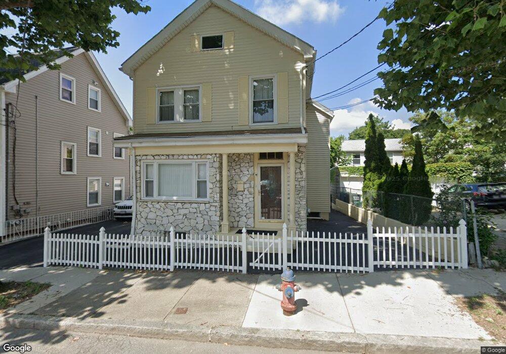
22 Loring St Somerville, MA 02143
Spring Hill NeighborhoodEstimated Value: $1,203,000 - $1,524,000
1
Bed
2
Baths
900
Sq Ft
$1,464/Sq Ft
Est. Value
About This Home
This home is located at 22 Loring St, Somerville, MA 02143 and is currently estimated at $1,317,862, approximately $1,464 per square foot. 22 Loring St is a home located in Middlesex County with nearby schools including Somerville High School and Saint Theresa School.
Ownership History
Date
Name
Owned For
Owner Type
Purchase Details
Closed on
Oct 1, 1992
Sold by
Caputo John and Caputo Carole N
Bought by
Singh Pargan
Current Estimated Value
Home Financials for this Owner
Home Financials are based on the most recent Mortgage that was taken out on this home.
Original Mortgage
$94,400
Interest Rate
7.83%
Mortgage Type
Purchase Money Mortgage
Create a Home Valuation Report for This Property
The Home Valuation Report is an in-depth analysis detailing your home's value as well as a comparison with similar homes in the area
Home Values in the Area
Average Home Value in this Area
Purchase History
| Date | Buyer | Sale Price | Title Company |
|---|---|---|---|
| Singh Pargan | $118,000 | -- |
Source: Public Records
Mortgage History
| Date | Status | Borrower | Loan Amount |
|---|---|---|---|
| Open | Singh Pargan | $120,000 | |
| Closed | Singh Pargan | $15,900 | |
| Closed | Singh Pargan | $94,400 |
Source: Public Records
Tax History
| Year | Tax Paid | Tax Assessment Tax Assessment Total Assessment is a certain percentage of the fair market value that is determined by local assessors to be the total taxable value of land and additions on the property. | Land | Improvement |
|---|---|---|---|---|
| 2025 | $11,669 | $1,069,600 | $569,100 | $500,500 |
| 2024 | $10,962 | $1,042,000 | $569,100 | $472,900 |
| 2023 | $10,338 | $999,800 | $569,100 | $430,700 |
| 2022 | $9,606 | $943,600 | $542,000 | $401,600 |
| 2021 | $9,041 | $887,200 | $516,100 | $371,100 |
| 2020 | $8,503 | $842,700 | $496,300 | $346,400 |
| 2019 | $8,309 | $772,200 | $431,600 | $340,600 |
| 2018 | $7,026 | $621,200 | $392,300 | $228,900 |
| 2017 | $6,774 | $580,500 | $370,100 | $210,400 |
| 2016 | $5,933 | $473,500 | $270,800 | $202,700 |
| 2015 | $5,933 | $470,500 | $269,400 | $201,100 |
Source: Public Records
Map
Nearby Homes
- 1 Loring St Unit 3
- 109 Summer St Unit 1
- 397 Somerville Ave
- 8 Avon St Unit 10
- 23 Park St Unit 2
- 10 Avon St Unit 16
- 379 Somerville Ave
- 555 Somerville Ave Unit 2
- 47 Dane St
- 34 Summer St
- 75 School St
- 17 Monmouth St
- 30 A Summer St
- 43 Park St Unit 18
- 373 Somerville Ave Unit D
- 60 Bow St Unit E
- 14 Carlton St Unit B
- 367 Somerville Ave Unit G
- 42 Bow St Unit 5
- 31 Vinal Ave Unit 2
- 18 Loring St
- 18 Loring St
- 18 Loring St Unit 1
- 18 Loring St Unit 2-3
- 26 Loring St Unit 2
- 26 Loring St Unit 26
- 26 Loring St
- 26-1 Loring St Unit 26
- 26 Loring St Unit 1
- 15 Park Place
- 17 Park Place Unit C
- 17 Park Place Unit B
- 17 Park Place Unit A
- 17 Park Place
- 17 Park Place Unit 1
- 14 Loring St
- 14 Loring St Unit 14
- 14 Loring St Unit 1
- 19 Loring St
- 9 Park Place
Your Personal Tour Guide
Ask me questions while you tour the home.