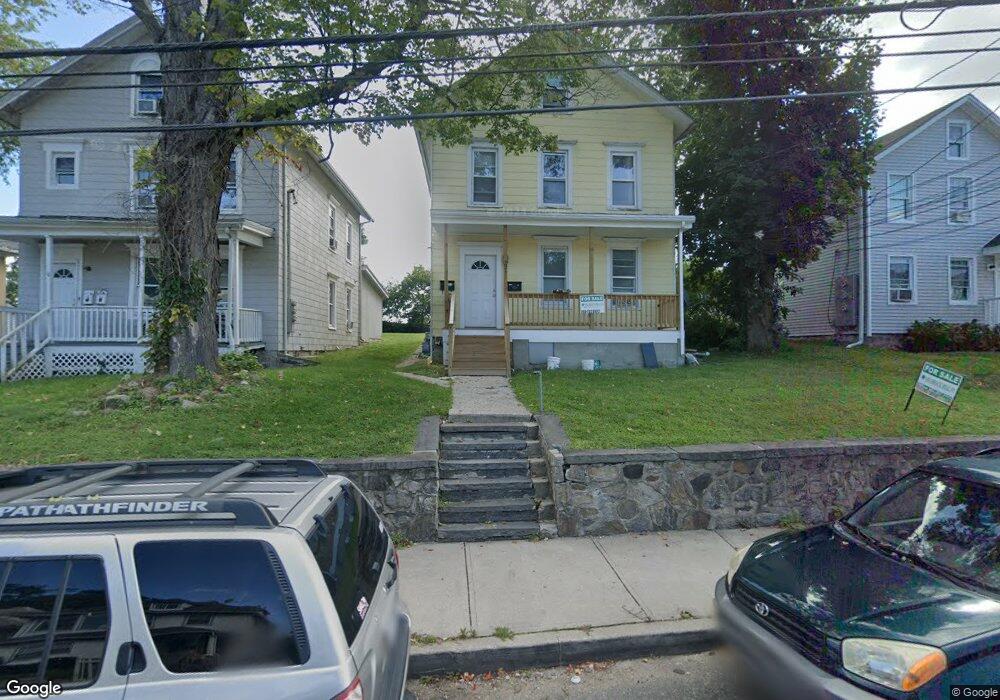
22 Lowe St Norwalk, CT 06854
Brookside NeighborhoodEstimated Value: $576,660 - $718,000
4
Beds
2
Baths
1,674
Sq Ft
$381/Sq Ft
Est. Value
About This Home
This home is located at 22 Lowe St, Norwalk, CT 06854 and is currently estimated at $638,415, approximately $381 per square foot. 22 Lowe St is a home located in Fairfield County with nearby schools including Brookside Elementary School, Roton Middle School, and Brien Mcmahon High School.
Ownership History
Date
Name
Owned For
Owner Type
Purchase Details
Closed on
Jul 3, 2014
Sold by
Behr Brant
Bought by
Sono Capital Llc
Current Estimated Value
Purchase Details
Closed on
Jan 13, 1999
Sold by
Potter Cecile
Bought by
Behr Brant
Home Financials for this Owner
Home Financials are based on the most recent Mortgage that was taken out on this home.
Original Mortgage
$130,100
Interest Rate
6.7%
Create a Home Valuation Report for This Property
The Home Valuation Report is an in-depth analysis detailing your home's value as well as a comparison with similar homes in the area
Home Values in the Area
Average Home Value in this Area
Purchase History
| Date | Buyer | Sale Price | Title Company |
|---|---|---|---|
| Sono Capital Llc | -- | -- | |
| Sono Capital Llc | -- | -- | |
| Behr Brant | $134,500 | -- | |
| Behr Brant | $134,500 | -- |
Source: Public Records
Mortgage History
| Date | Status | Borrower | Loan Amount |
|---|---|---|---|
| Open | Behr Brant | $143,000 | |
| Previous Owner | Behr Brant | $175,850 | |
| Previous Owner | Behr Brant | $130,100 |
Source: Public Records
Tax History
| Year | Tax Paid | Tax Assessment Tax Assessment Total Assessment is a certain percentage of the fair market value that is determined by local assessors to be the total taxable value of land and additions on the property. | Land | Improvement |
|---|---|---|---|---|
| 2025 | $8,292 | $346,950 | $117,940 | $229,010 |
| 2024 | $8,169 | $346,950 | $117,940 | $229,010 |
| 2023 | $5,570 | $222,050 | $97,000 | $125,050 |
| 2022 | $5,450 | $222,050 | $97,000 | $125,050 |
| 2021 | $5,323 | $222,050 | $97,000 | $125,050 |
| 2020 | $5,319 | $222,050 | $97,000 | $125,050 |
| 2019 | $5,177 | $222,050 | $97,000 | $125,050 |
| 2018 | $4,244 | $159,530 | $82,860 | $76,670 |
| 2017 | $4,097 | $159,530 | $82,860 | $76,670 |
| 2016 | $4,058 | $159,530 | $82,860 | $76,670 |
| 2015 | $4,047 | $159,530 | $82,860 | $76,670 |
| 2014 | $3,995 | $159,530 | $82,860 | $76,670 |
Source: Public Records
Map
Nearby Homes
- 225 Flax Hill Rd Unit 2
- 12 Arbor Ct
- 187 Flax Hill Rd Unit D5
- 28 Chestnut St
- 6 Norton Place
- 15 Madison St Unit B7
- 10 Keith St
- 72 Chestnut St Unit 6
- 47 Taylor Ave
- 115 Flax Hill Rd Unit 10
- 6 W Couch St
- 49 Day St Unit 209
- 8 Michael St
- 5 Mcallister Ave
- 24 Scribner Ave
- 7 Moscariello Place
- 94 Washington St Unit 6
- 94 Washington St Unit 20
- 18 Auburn St
- 83 Washington St Unit 3C
- 20 Lowe St
- 24 Lowe St
- 18 Lowe St
- 13 Cleveland Terrace
- 28 Lowe St
- 11 Cleveland Terrace
- 16 Lowe St
- 16 Lowe St Unit 2ND F
- 15 Cleveland Terrace
- 30 Lowe St
- 17 Cleveland Terrace
- 19 Lowe St Unit 2
- 19 Lowe St Unit 1
- 19 Lowe St Unit Lower
- 1 Cleveland Terrace
- 23 Lowe St
- 14 Lowe St
- 15 Lowe St
- 25 Lowe St
- 16 Hamilton Ave
Your Personal Tour Guide
Ask me questions while you tour the home.