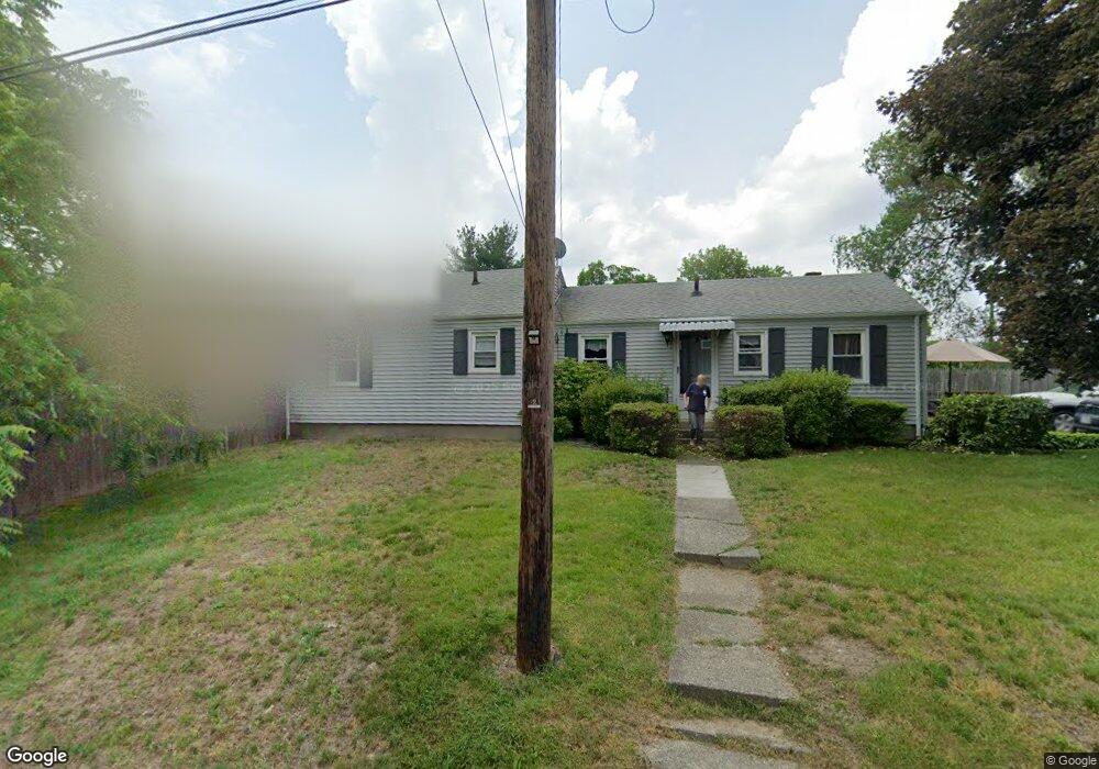
22 Main St Unit 1 Shrewsbury, MA 01545
Estimated Value: $395,000 - $424,364
2
Beds
1
Bath
1,350
Sq Ft
$303/Sq Ft
Est. Value
About This Home
This home is located at 22 Main St Unit 1, Shrewsbury, MA 01545 and is currently estimated at $408,591, approximately $302 per square foot. 22 Main St Unit 1 is a home located in Worcester County with nearby schools including Calvin Coolidge Elementary School, Sherwood Middle School, and Oak Middle School.
Ownership History
Date
Name
Owned For
Owner Type
Purchase Details
Closed on
Jan 13, 2005
Sold by
Martocchio Cheryl A and Martocchio William A
Bought by
Martocchio Lt and Martocchio
Current Estimated Value
Purchase Details
Closed on
Aug 1, 1977
Bought by
Lt Martocchio and Martocchio, William A
Create a Home Valuation Report for This Property
The Home Valuation Report is an in-depth analysis detailing your home's value as well as a comparison with similar homes in the area
Home Values in the Area
Average Home Value in this Area
Purchase History
| Date | Buyer | Sale Price | Title Company |
|---|---|---|---|
| Martocchio Lt | -- | -- | |
| Martocchio Lt | -- | -- | |
| Martocchio Lt | -- | -- | |
| Lt Martocchio | $27,300 | -- |
Source: Public Records
Mortgage History
| Date | Status | Borrower | Loan Amount |
|---|---|---|---|
| Previous Owner | Lt Martocchio | $70,000 | |
| Previous Owner | Lt Martocchio | $50,000 |
Source: Public Records
Tax History Compared to Growth
Tax History
| Year | Tax Paid | Tax Assessment Tax Assessment Total Assessment is a certain percentage of the fair market value that is determined by local assessors to be the total taxable value of land and additions on the property. | Land | Improvement |
|---|---|---|---|---|
| 2025 | $44 | $368,400 | $210,300 | $158,100 |
| 2024 | $3,943 | $318,500 | $200,300 | $118,200 |
| 2023 | $3,992 | $304,300 | $200,300 | $104,000 |
| 2022 | $3,663 | $259,600 | $167,800 | $91,800 |
| 2021 | $3,337 | $253,000 | $167,800 | $85,200 |
| 2020 | $3,068 | $246,000 | $167,800 | $78,200 |
| 2019 | $2,985 | $237,500 | $163,600 | $73,900 |
| 2018 | $2,851 | $225,200 | $156,400 | $68,800 |
| 2017 | $2,699 | $210,400 | $141,600 | $68,800 |
| 2016 | $2,522 | $194,000 | $125,200 | $68,800 |
| 2015 | $2,451 | $185,700 | $113,300 | $72,400 |
Source: Public Records
Map
Nearby Homes
- 1 Temple Ct
- 655 Plantation St Unit 17 Bldg B
- 56 Ireta Rd
- 5A Wigwam Hill Dr Unit A
- 64 Wauwinet Rd
- 10 Crane Cir
- 163 N Lake Ave Unit A
- 163 N Lake Ave
- 15 Eaglehead Terrace Unit 2
- 15 Eaglehead Terrace Unit 5
- 19 Eaglehead Terrace Unit 2
- 19 Eaglehead Terrace Unit 4
- 5 Fyrbeck Ave
- 190 Dominion Rd
- 15 Eagle Dr
- 7 Tern Dr
- 46 Dominion Rd
- 307 Main St
- 40 Phillips Ave
- 22 Ridge Rd
- 22 (Old) Main St
- 18 Main St
- 19 Oakland Ave
- 16 Main St
- 16 Main St Unit 1
- 26 Main St
- 17 Oakland Ave
- 17 Oakland Ave Unit B
- 26 Oakland Ave
- 26 Oakland Ave Unit 1
- 30 Oakland Ave
- 24 Oakland Ave
- 22A Oakland Ave
- 22 Oakland Ave
- 20 Oakland Ave
- 20B Oakland Ave
- 20B Oakland Ave
- 20 Oakland Ave Unit C
- 20B Oakland Ave Unit B
- 12 Main St