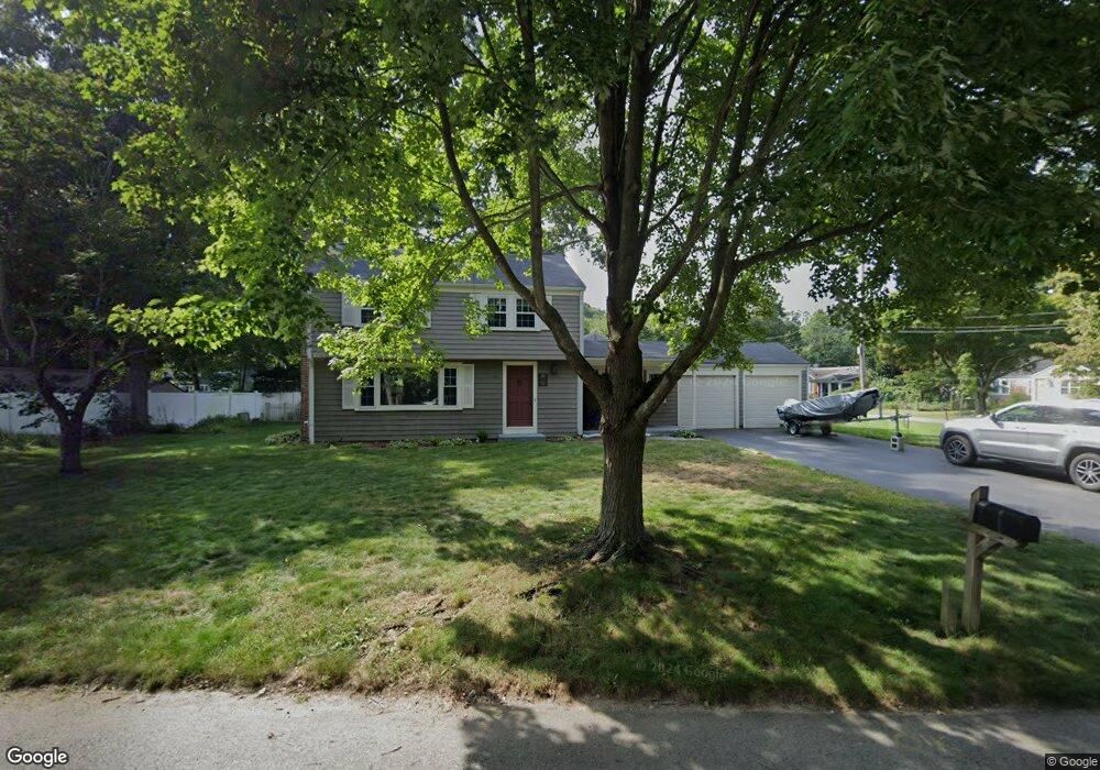
22 Manning Dr Barrington, RI 02806
North Barrington NeighborhoodEstimated Value: $669,915 - $687,000
3
Beds
2
Baths
1,596
Sq Ft
$426/Sq Ft
Est. Value
About This Home
This home is located at 22 Manning Dr, Barrington, RI 02806 and is currently estimated at $680,479, approximately $426 per square foot. 22 Manning Dr is a home located in Bristol County with nearby schools including Barrington High School, St Luke Elementary School, and Barrington Christian Academy.
Create a Home Valuation Report for This Property
The Home Valuation Report is an in-depth analysis detailing your home's value as well as a comparison with similar homes in the area
Home Values in the Area
Average Home Value in this Area
Tax History
| Year | Tax Paid | Tax Assessment Tax Assessment Total Assessment is a certain percentage of the fair market value that is determined by local assessors to be the total taxable value of land and additions on the property. | Land | Improvement |
|---|---|---|---|---|
| 2025 | $8,974 | $585,000 | $275,000 | $310,000 |
| 2024 | $8,629 | $585,000 | $275,000 | $310,000 |
| 2023 | $9,358 | $461,000 | $221,000 | $240,000 |
| 2022 | $9,059 | $461,000 | $221,000 | $240,000 |
| 2021 | $8,828 | $461,000 | $221,000 | $240,000 |
| 2020 | $7,754 | $371,000 | $149,000 | $222,000 |
| 2019 | $7,457 | $371,000 | $149,000 | $222,000 |
| 2018 | $7,235 | $371,000 | $149,000 | $222,000 |
| 2017 | $6,552 | $327,600 | $128,500 | $199,100 |
| 2016 | $6,044 | $327,600 | $128,500 | $199,100 |
| 2015 | $5,979 | $327,600 | $128,500 | $199,100 |
| 2014 | $5,517 | $301,500 | $131,100 | $170,400 |
Source: Public Records
Map
Nearby Homes
Your Personal Tour Guide
Ask me questions while you tour the home.