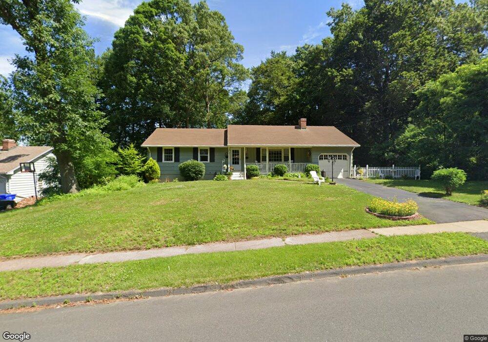
22 Manning Ln East Hartford, CT 06118
Estimated Value: $351,000 - $374,946
3
Beds
2
Baths
1,248
Sq Ft
$292/Sq Ft
Est. Value
About This Home
This home is located at 22 Manning Ln, East Hartford, CT 06118 and is currently estimated at $363,987, approximately $291 per square foot. 22 Manning Ln is a home located in Hartford County with nearby schools including Governor William Pitkin School, East Hartford Middle School, and East Hartford High School.
Ownership History
Date
Name
Owned For
Owner Type
Purchase Details
Closed on
Nov 13, 2020
Sold by
Rivera Pablo
Bought by
Howey Shawn M and Howey Ashley
Current Estimated Value
Home Financials for this Owner
Home Financials are based on the most recent Mortgage that was taken out on this home.
Original Mortgage
$241,544
Outstanding Balance
$214,940
Interest Rate
2.8%
Mortgage Type
VA
Estimated Equity
$149,047
Purchase Details
Closed on
Oct 16, 1991
Sold by
Jerome Francesca A and Jerome Thomas A
Bought by
Jerome Diane M and Jerome John E
Home Financials for this Owner
Home Financials are based on the most recent Mortgage that was taken out on this home.
Original Mortgage
$75,000
Interest Rate
9.06%
Mortgage Type
Unknown
Create a Home Valuation Report for This Property
The Home Valuation Report is an in-depth analysis detailing your home's value as well as a comparison with similar homes in the area
Home Values in the Area
Average Home Value in this Area
Purchase History
| Date | Buyer | Sale Price | Title Company |
|---|---|---|---|
| Howey Shawn M | $246,000 | None Available | |
| Jerome Diane M | $115,000 | -- | |
| Jerome Diane M | $115,000 | -- |
Source: Public Records
Mortgage History
| Date | Status | Borrower | Loan Amount |
|---|---|---|---|
| Open | Howey Shawn M | $241,544 | |
| Previous Owner | Jerome Diane M | $71,500 | |
| Previous Owner | Jerome Diane M | $75,000 | |
| Previous Owner | Jerome Diane M | $23,000 |
Source: Public Records
Tax History Compared to Growth
Tax History
| Year | Tax Paid | Tax Assessment Tax Assessment Total Assessment is a certain percentage of the fair market value that is determined by local assessors to be the total taxable value of land and additions on the property. | Land | Improvement |
|---|---|---|---|---|
| 2025 | $7,153 | $155,830 | $51,380 | $104,450 |
| 2024 | $6,857 | $155,830 | $51,380 | $104,450 |
| 2023 | $6,629 | $155,830 | $51,380 | $104,450 |
| 2022 | $6,389 | $155,830 | $51,380 | $104,450 |
| 2021 | $5,768 | $116,870 | $38,930 | $77,940 |
| 2020 | $5,834 | $116,870 | $38,930 | $77,940 |
| 2019 | $5,739 | $116,870 | $38,930 | $77,940 |
| 2018 | $5,570 | $116,870 | $38,930 | $77,940 |
| 2017 | $5,499 | $116,870 | $38,930 | $77,940 |
| 2016 | $5,330 | $116,230 | $35,390 | $80,840 |
| 2015 | $5,330 | $116,230 | $35,390 | $80,840 |
| 2014 | $5,277 | $116,230 | $35,390 | $80,840 |
Source: Public Records
Map
Nearby Homes
- 34 Naomi Dr
- 49 Deborah Dr Unit 123
- 6 Judy Dr
- 0 Deborah Dr Unit 115
- 0 Deborah Dr Unit 117 24077631
- 218 Wakefield Cir Unit 218
- 122 Janet Dr
- 50 Hilton Dr
- 77 Madison St
- 30 Shaughnessy Dr
- 441 Forest St
- 42 Patton St
- 164 Roxbury Rd
- 334 Forbes St
- 21 Forest Ln
- 1060 Forbes St
- 642 Silver Ln
- 436 Brewer St
- 127 Ridgewood Rd
- 12 Carpenter Dr