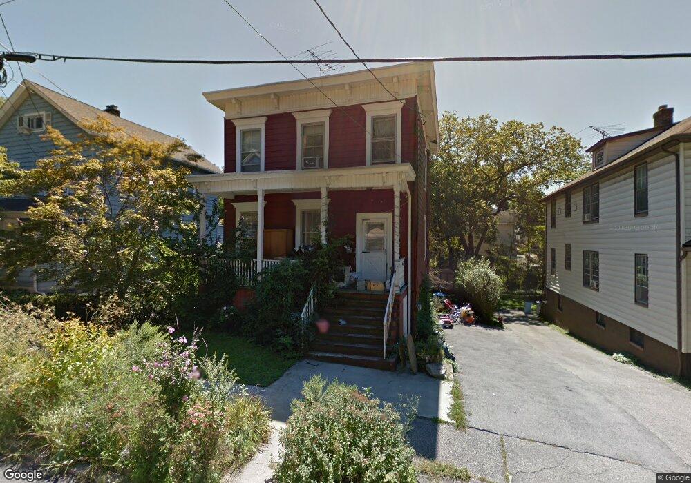
22 Maple St Sleepy Hollow, NY 10591
Estimated Value: $803,000 - $1,144,000
4
Beds
1
Bath
1,500
Sq Ft
$627/Sq Ft
Est. Value
About This Home
This home is located at 22 Maple St, Sleepy Hollow, NY 10591 and is currently estimated at $941,133, approximately $627 per square foot. 22 Maple St is a home located in Westchester County with nearby schools including John Paulding School, W L Morse School, and Washington Irving Interm School.
Ownership History
Date
Name
Owned For
Owner Type
Purchase Details
Closed on
Feb 4, 2022
Sold by
Alexander Moghadam
Bought by
Frost Allison K and Frost Thomas
Current Estimated Value
Home Financials for this Owner
Home Financials are based on the most recent Mortgage that was taken out on this home.
Original Mortgage
$707,750
Outstanding Balance
$657,200
Interest Rate
3.55%
Mortgage Type
New Conventional
Estimated Equity
$283,933
Purchase Details
Closed on
Jul 8, 2016
Sold by
Campbell Barry T
Bought by
Moghadam Alexander and Moghadam Namvar
Purchase Details
Closed on
Dec 28, 2001
Sold by
Roy John and Roy John J
Bought by
Campbell Barry T
Create a Home Valuation Report for This Property
The Home Valuation Report is an in-depth analysis detailing your home's value as well as a comparison with similar homes in the area
Home Values in the Area
Average Home Value in this Area
Purchase History
| Date | Buyer | Sale Price | Title Company |
|---|---|---|---|
| Frost Allison K | $745,000 | Thoroughbred Title | |
| Moghadam Alexander | $525,000 | Attorney | |
| Campbell Barry T | $247,500 | Stewart Title Insurance Co |
Source: Public Records
Mortgage History
| Date | Status | Borrower | Loan Amount |
|---|---|---|---|
| Open | Frost Allison K | $707,750 |
Source: Public Records
Tax History Compared to Growth
Tax History
| Year | Tax Paid | Tax Assessment Tax Assessment Total Assessment is a certain percentage of the fair market value that is determined by local assessors to be the total taxable value of land and additions on the property. | Land | Improvement |
|---|---|---|---|---|
| 2024 | $19,418 | $112,000 | $47,400 | $64,600 |
| 2023 | $18,110 | $112,000 | $47,400 | $64,600 |
| 2022 | $17,926 | $112,000 | $47,400 | $64,600 |
| 2021 | $17,462 | $107,800 | $47,400 | $60,400 |
| 2020 | $17,179 | $107,800 | $47,400 | $60,400 |
| 2019 | $1,772 | $107,800 | $47,400 | $60,400 |
| 2018 | $13,087 | $98,000 | $47,400 | $50,600 |
| 2017 | -- | $98,000 | $47,400 | $50,600 |
| 2016 | $13,104 | $98,000 | $47,400 | $50,600 |
| 2015 | -- | $5,500 | $850 | $4,650 |
| 2014 | -- | $5,500 | $850 | $4,650 |
| 2013 | -- | $5,500 | $850 | $4,650 |
Source: Public Records
Map
Nearby Homes
- 37 Devries Ave
- 57 Cobb Ln
- 46 Andrews Ln
- 34 Andrews Ln
- 42 Andrews Ln
- 29 Woodland Ave
- 4 Lighthouse Landing Unit 318
- 4 Lighthouse Landing Unit 208
- 4 Lighthouse Landing Unit 224
- 4 Lighthouse Landing Unit 301
- 4 Lighthouse Landing Unit PH518
- 4 Lighthouse Landing Unit PH515
- 4 Lighthouse Landing Unit PH520
- 4 Lighthouse Landing Unit PH519
- 4 Lighthouse Landing Unit 209
- 4 Lighthouse Landing Unit 203
- 4 Lighthouse Landing Unit TH02
- 4 Lighthouse Landing Unit 421
- 4 Lighthouse Landing Unit 414
- 4 Lighthouse Landing Unit 319