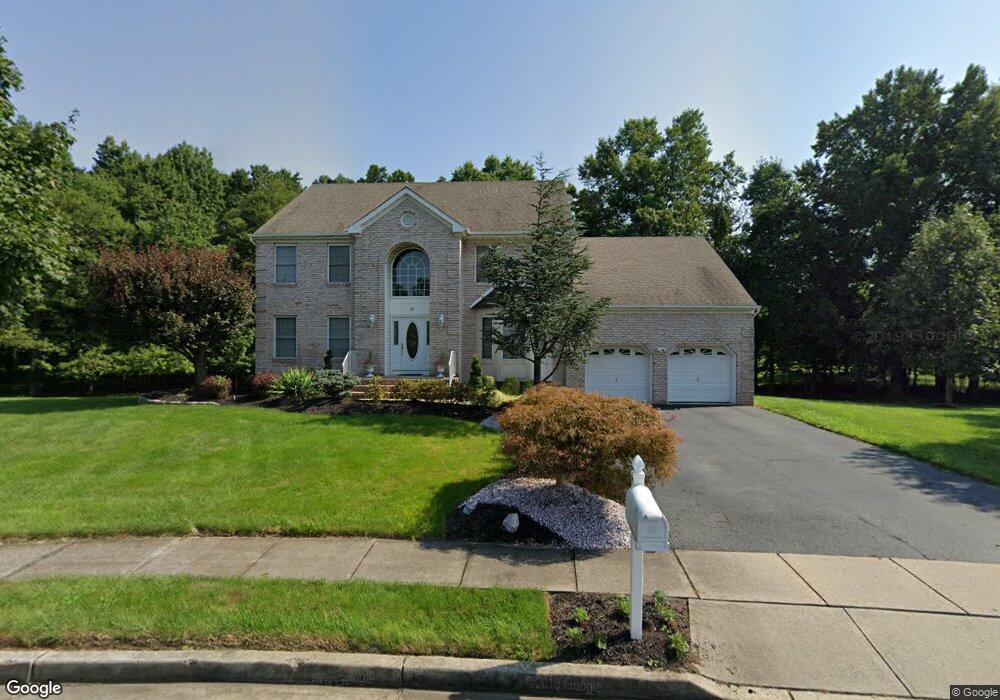
22 Mayercik Ct Edison, NJ 08820
Estimated Value: $967,975 - $1,351,000
--
Bed
--
Bath
2,766
Sq Ft
$422/Sq Ft
Est. Value
About This Home
This home is located at 22 Mayercik Ct, Edison, NJ 08820 and is currently estimated at $1,168,244, approximately $422 per square foot. 22 Mayercik Ct is a home located in Middlesex County with nearby schools including Woodbrook Elementary School, Woodrow Wilson Middle School, and J.P. Stevens High School.
Ownership History
Date
Name
Owned For
Owner Type
Purchase Details
Closed on
Jun 28, 2024
Sold by
Pignatello Michael A and Pignatello Lisa
Bought by
Pignatello Jessica and Pignatello Samantha
Current Estimated Value
Purchase Details
Closed on
Dec 18, 1997
Sold by
Ferraro Building
Bought by
Pignatello Michael and Pignatello Lisa
Home Financials for this Owner
Home Financials are based on the most recent Mortgage that was taken out on this home.
Original Mortgage
$225,000
Interest Rate
7.09%
Create a Home Valuation Report for This Property
The Home Valuation Report is an in-depth analysis detailing your home's value as well as a comparison with similar homes in the area
Home Values in the Area
Average Home Value in this Area
Purchase History
| Date | Buyer | Sale Price | Title Company |
|---|---|---|---|
| Pignatello Jessica | -- | None Listed On Document | |
| Pignatello Michael | $305,000 | -- |
Source: Public Records
Mortgage History
| Date | Status | Borrower | Loan Amount |
|---|---|---|---|
| Previous Owner | Pignatello Michael | $225,000 |
Source: Public Records
Tax History Compared to Growth
Tax History
| Year | Tax Paid | Tax Assessment Tax Assessment Total Assessment is a certain percentage of the fair market value that is determined by local assessors to be the total taxable value of land and additions on the property. | Land | Improvement |
|---|---|---|---|---|
| 2025 | $18,067 | $303,500 | $99,400 | $204,100 |
| 2024 | $17,970 | $303,500 | $99,400 | $204,100 |
| 2023 | $17,970 | $303,500 | $99,400 | $204,100 |
| 2022 | $17,976 | $303,500 | $99,400 | $204,100 |
| 2021 | $17,248 | $303,500 | $99,400 | $204,100 |
| 2020 | $17,752 | $303,500 | $99,400 | $204,100 |
| 2019 | $16,413 | $303,500 | $99,400 | $204,100 |
| 2018 | $16,668 | $303,500 | $99,400 | $204,100 |
| 2017 | $16,316 | $303,500 | $99,400 | $204,100 |
| 2016 | $15,345 | $303,500 | $99,400 | $204,100 |
| 2015 | $14,762 | $303,500 | $99,400 | $204,100 |
| 2014 | $14,343 | $303,500 | $99,400 | $204,100 |
Source: Public Records
Map
Nearby Homes
- 144 Coppertree Ct
- 118 Coppertree Ct
- 83 Park Gate Dr
- 13 Gate House Ln
- 66 Gate House Ln
- 29 Gate House Ln
- 31 Gate House Ln Unit 31
- 34 Stonewall Dr
- 3889 Park Ave
- 10 Clemmens Ct
- 1 Newburgh Dr
- 5 Prestwick Way Unit 5
- 71 Inverness Dr
- 74 Pheasant Run
- 47 Pheasant Run
- 8 Stephenville Pkwy
- 9 Westwood Cir
- 3945 Park Ave
- 4 David Ct
- 16 Stephenville Pkwy
- 18 Mayercik Ct
- 19 Mayercik Ct
- 26 Mayercik Ct
- 14 Mayercik Ct
- 11 Mayercik Ct
- 10 Mayercik Ct
- 31 Mayercik Ct
- 30 Mayercik Ct
- 49 Mayercik Ct
- 6 Mayercik Ct
- 62 Mayercik Ct
- 58 Mayercik Ct
- 34 Mayercik Ct
- 2 Mayercik Ct
- 38 Mayercik Ct
- 54 Mayercik Ct
- 50 Mayercik Ct
- 42 Mayercik Ct
- 46-46 N 46 Mayercik Ct
- 46 Mayercik Ct