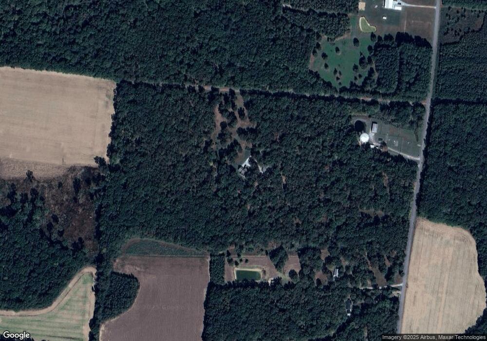
22 Molly Ln Taft, AL 38488
Estimated Value: $563,000 - $693,000
Studio
2
Baths
1,202
Sq Ft
$515/Sq Ft
Est. Value
About This Home
This home is located at 22 Molly Ln, Taft, AL 38488 and is currently estimated at $618,917, approximately $514 per square foot. 22 Molly Ln is a home located in Lincoln County with nearby schools including Blanche School, Lincoln Central Academy, and Lincoln County High School.
Ownership History
Date
Name
Owned For
Owner Type
Purchase Details
Closed on
May 6, 2021
Sold by
Sowards Jeffrey and Sowards Loree Beth
Bought by
Mellies Daniel and Mellies Taylor
Current Estimated Value
Home Financials for this Owner
Home Financials are based on the most recent Mortgage that was taken out on this home.
Original Mortgage
$275,000
Outstanding Balance
$248,156
Interest Rate
3.1%
Mortgage Type
New Conventional
Estimated Equity
$370,761
Purchase Details
Closed on
Nov 10, 2017
Sold by
Schrader Byron Neal and Schrader Cheryl A
Bought by
Sowards Jeffrey and Sowards Loree Beth
Purchase Details
Closed on
Jul 22, 1992
Bought by
Schrader Byron N Cheryl A
Create a Home Valuation Report for This Property
The Home Valuation Report is an in-depth analysis detailing your home's value as well as a comparison with similar homes in the area
Purchase History
| Date | Buyer | Sale Price | Title Company |
|---|---|---|---|
| Mellies Daniel | $500,000 | None Available | |
| Mellies Daniel | $500,000 | None Available | |
| Sowards Jeffrey | $400,000 | None Available | |
| Sowards Jeffrey | $400,000 | None Available | |
| Schrader Byron N Cheryl A | $32,700 | -- | |
| Schrader Byron N Cheryl A | $32,700 | -- |
Source: Public Records
Mortgage History
| Date | Status | Borrower | Loan Amount |
|---|---|---|---|
| Open | Mellies Daniel | $275,000 | |
| Closed | Mellies Daniel | $275,000 |
Source: Public Records
Tax History Compared to Growth
Tax History
| Year | Tax Paid | Tax Assessment Tax Assessment Total Assessment is a certain percentage of the fair market value that is determined by local assessors to be the total taxable value of land and additions on the property. | Land | Improvement |
|---|---|---|---|---|
| 2025 | $1,260 | $66,300 | $0 | $0 |
| 2024 | $1,260 | $66,300 | $18,375 | $47,925 |
| 2023 | $1,132 | $39,275 | $8,800 | $30,475 |
| 2022 | $786 | $37,375 | $8,800 | $28,575 |
| 2021 | $786 | $59,750 | $31,175 | $28,575 |
| 2020 | $786 | $37,375 | $8,800 | $28,575 |
| 2019 | $786 | $37,375 | $8,800 | $28,575 |
| 2018 | $787 | $31,725 | $6,950 | $24,775 |
| 2017 | $710 | $30,325 | $5,550 | $24,775 |
| 2016 | $710 | $30,325 | $5,550 | $24,775 |
| 2015 | -- | $30,325 | $5,550 | $24,775 |
| 2014 | $594 | $30,325 | $5,550 | $24,775 |
Source: Public Records
Map
Nearby Homes
- 136 Pepper Rd
- 0 Ardmore Hwy Unit RTC2914673
- 8369 State Line Rd
- 8055 State Line Rd
- 123 Jones Rd
- 7 Scott Orchard Rd
- 87 Ballard Hollow Rd
- 1612 Ardmore Hwy
- 102 Treva Ln
- 0 Old Railroad Bed Rd Unit RTC2941746
- 0 Old Railroad Bed Rd Unit RTC2941749
- 0 Old Railroad Bed Rd Unit RTC2921051
- 131 Water Tank Rd
- 2166, 2150,2154 State Line Rd
- 131 Jo Mar Rd
- 114 Treva Ln
- 118 Treva Ln
- 40 Blanche Rd
- 124 Randall Mullins Rd
- 351 Randall Mullins Rd
- 22 Molly Ln
- 93 Pepper Rd
- 75 Pepper Rd
- 95 Pepper Rd
- 0 Pepper Rd
- 0 Pepper Rd Unit RTC3002558
- 0 Pepper Rd Unit RTC3002547
- 0 Pepper Rd Unit 1074738
- 103 Pepper Rd
- 109 Pepper Rd
- 57 Pepper Rd
- 111 Pepper Rd
- 117 Pepper Rd
- 49 Pepper Rd
- 119 Pepper Rd
- 70 Pepper Rd
- 41 Pepper Rd
- 2570 Pepper Rd
- 126 Pepper Rd
- 1185 Old Railroad Bed Rd
