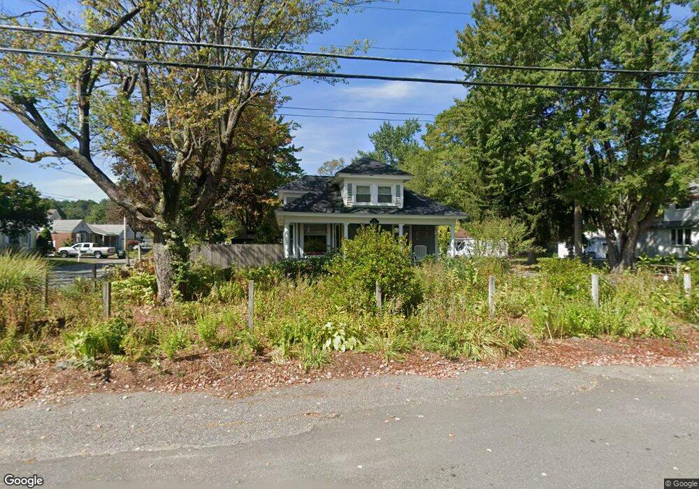
22 Nile St Leominster, MA 01453
Estimated Value: $422,000 - $448,000
3
Beds
2
Baths
1,410
Sq Ft
$310/Sq Ft
Est. Value
About This Home
This home is located at 22 Nile St, Leominster, MA 01453 and is currently estimated at $437,265, approximately $310 per square foot. 22 Nile St is a home located in Worcester County with nearby schools including Leominster High School, St. Leo School, and St. Anna Catholic School.
Ownership History
Date
Name
Owned For
Owner Type
Purchase Details
Closed on
Feb 12, 2021
Sold by
Trenouth Laurel
Bought by
Laurel H Trenouth Lt
Current Estimated Value
Purchase Details
Closed on
Feb 29, 2008
Sold by
Roffee Kathleen
Bought by
Trenouth Laurel H
Purchase Details
Closed on
Apr 2, 2004
Sold by
Daly John V and Daley Kathleen Ar
Bought by
Roffee Kathleen
Purchase Details
Closed on
Apr 7, 1997
Sold by
Tessier Mary Jane
Bought by
Daly John and Daly Kathleen A
Create a Home Valuation Report for This Property
The Home Valuation Report is an in-depth analysis detailing your home's value as well as a comparison with similar homes in the area
Home Values in the Area
Average Home Value in this Area
Purchase History
| Date | Buyer | Sale Price | Title Company |
|---|---|---|---|
| Laurel H Trenouth Lt | -- | None Available | |
| Trenouth Laurel H | $215,000 | -- | |
| Roffee Kathleen | -- | -- | |
| Daly John | $80,500 | -- |
Source: Public Records
Mortgage History
| Date | Status | Borrower | Loan Amount |
|---|---|---|---|
| Previous Owner | Daly John | $28,745 | |
| Previous Owner | Daly John | $11,260 | |
| Previous Owner | Daly John | $40,000 | |
| Previous Owner | Daly John | $20,000 |
Source: Public Records
Tax History Compared to Growth
Tax History
| Year | Tax Paid | Tax Assessment Tax Assessment Total Assessment is a certain percentage of the fair market value that is determined by local assessors to be the total taxable value of land and additions on the property. | Land | Improvement |
|---|---|---|---|---|
| 2025 | $4,922 | $350,800 | $123,200 | $227,600 |
| 2024 | $4,685 | $322,900 | $117,300 | $205,600 |
| 2023 | $4,553 | $293,000 | $102,000 | $191,000 |
| 2022 | $4,337 | $261,900 | $88,700 | $173,200 |
| 2021 | $4,208 | $232,100 | $69,100 | $163,000 |
| 2020 | $3,284 | $217,700 | $69,100 | $148,600 |
| 2019 | $3,973 | $214,300 | $65,700 | $148,600 |
| 2018 | $4,216 | $191,500 | $63,900 | $127,600 |
| 2017 | $3,500 | $177,400 | $59,600 | $117,800 |
| 2016 | $3,284 | $167,700 | $59,600 | $108,100 |
| 2015 | $3,396 | $174,700 | $59,600 | $115,100 |
| 2014 | $3,311 | $175,300 | $63,800 | $111,500 |
Source: Public Records
Map
Nearby Homes
- 12 Lindell Ave
- 45 Fruit St Unit A
- 45 Fruit St Unit B
- 57 Liberty St Unit 2
- 58 Lindell Ave
- 76 Belmont Rd
- 59 Kenniston St
- 54 Green St Unit 119
- 150 Washington St
- 12 Whitman St Unit 12
- 66 Hamilton St Unit 3
- 14 Fernwood Dr Unit D
- 43 High St
- 23 High St
- 98 Washington St
- 17 Fernwood Dr Unit G
- 17 Fernwood Dr Unit D
- 51 Fox Meadow Rd Unit C
- 55 Fox Meadow Rd Unit H
- 44 Hale St