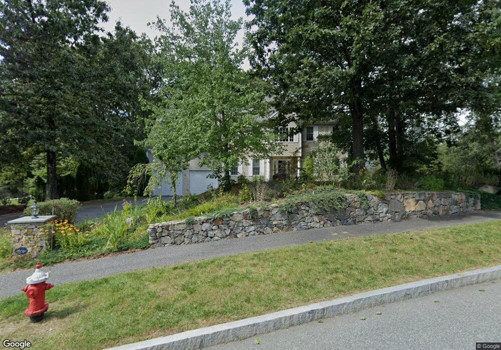
22 Old Cart Path Holliston, MA 01746
Estimated Value: $997,000 - $1,151,000
4
Beds
3
Baths
2,858
Sq Ft
$371/Sq Ft
Est. Value
About This Home
This home is located at 22 Old Cart Path, Holliston, MA 01746 and is currently estimated at $1,060,560, approximately $371 per square foot. 22 Old Cart Path is a home located in Middlesex County with nearby schools including Miller Elementary School, Robert H. Adams Middle School, and Holliston High School.
Ownership History
Date
Name
Owned For
Owner Type
Purchase Details
Closed on
Jun 30, 2021
Sold by
Penchansky Sandy M and Penchansky Susan B
Bought by
Edelglass David A and Edelglass Jessica R
Current Estimated Value
Home Financials for this Owner
Home Financials are based on the most recent Mortgage that was taken out on this home.
Original Mortgage
$652,000
Outstanding Balance
$591,589
Interest Rate
2.9%
Mortgage Type
Purchase Money Mortgage
Estimated Equity
$468,971
Purchase Details
Closed on
May 29, 2002
Sold by
Highlands At Holliston
Bought by
Penchansky Susan B and Penchansky Sandy M
Home Financials for this Owner
Home Financials are based on the most recent Mortgage that was taken out on this home.
Original Mortgage
$260,000
Interest Rate
7%
Mortgage Type
Purchase Money Mortgage
Create a Home Valuation Report for This Property
The Home Valuation Report is an in-depth analysis detailing your home's value as well as a comparison with similar homes in the area
Home Values in the Area
Average Home Value in this Area
Purchase History
| Date | Buyer | Sale Price | Title Company |
|---|---|---|---|
| Edelglass David A | $815,000 | None Available | |
| Penchansky Susan B | $520,000 | -- |
Source: Public Records
Mortgage History
| Date | Status | Borrower | Loan Amount |
|---|---|---|---|
| Open | Edelglass David A | $652,000 | |
| Previous Owner | Penchansky Susan B | $260,000 |
Source: Public Records
Tax History Compared to Growth
Tax History
| Year | Tax Paid | Tax Assessment Tax Assessment Total Assessment is a certain percentage of the fair market value that is determined by local assessors to be the total taxable value of land and additions on the property. | Land | Improvement |
|---|---|---|---|---|
| 2025 | $12,387 | $845,500 | $273,400 | $572,100 |
| 2024 | $12,345 | $819,700 | $273,400 | $546,300 |
| 2023 | $11,880 | $771,400 | $273,400 | $498,000 |
| 2022 | $11,344 | $652,700 | $273,400 | $379,300 |
| 2021 | $11,383 | $637,700 | $258,400 | $379,300 |
| 2020 | $11,510 | $610,600 | $253,700 | $356,900 |
| 2019 | $11,354 | $603,000 | $246,100 | $356,900 |
| 2018 | $11,258 | $603,000 | $246,100 | $356,900 |
| 2017 | $11,147 | $601,900 | $258,800 | $343,100 |
| 2016 | $10,990 | $584,900 | $241,800 | $343,100 |
| 2015 | $10,506 | $542,100 | $194,700 | $347,400 |
Source: Public Records
Map
Nearby Homes
- 306 Trailside Way
- 63 Trailside Way Unit 63
- 67 Spyglass Hill Dr
- 147 Turner Rd Unit 80
- 157 Leland Farm Rd
- 152 Turner Rd Unit 43
- 152 Turner Rd Unit 14
- 59 Turner Rd
- 74 Meeting House Path
- 72 Meeting House Path
- 84 E Bluff Rd
- 97 Meeting House Path Unit 97
- 277 Meeting House Path
- 95 Brooksmont Dr Unit 26
- 133 Brooksmont Dr Unit 43
- 151 Mohawk Path
- 2 Adams Rd Unit 2
- 1 Adams Rd
- 9 Adams Rd
- 131 Jennings Rd
- 26 Old Cart Path
- 18 Old Cart Path
- 70 Old Cart Path
- 66 Old Cart Path
- 84 Old Cart Path
- 88 Old Cart Path
- 23 Old Cart Path
- 27 Old Cart Path
- 10 Old Cart Path
- 38 Old Cart Path
- 19 Old Cart Path
- 6 Old Cart Path
- 31 Old Cart Path
- 11 Old Cart Path
- 81 Old Cart Path
- 15 Old Cart Path
- 19 Tea Party Ln
- 15 Tea Party Ln
- Lot 43 Old Cart Path
- 682 Concord St