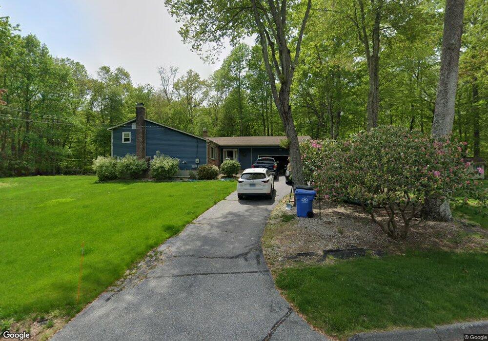
22 Osprey Dr Gales Ferry, CT 06335
Estimated Value: $426,000 - $512,000
4
Beds
2
Baths
1,522
Sq Ft
$306/Sq Ft
Est. Value
About This Home
This home is located at 22 Osprey Dr, Gales Ferry, CT 06335 and is currently estimated at $465,769, approximately $306 per square foot. 22 Osprey Dr is a home located in New London County with nearby schools including Ledyard Middle School, Ledyard High School, and Academy Of St Therese.
Ownership History
Date
Name
Owned For
Owner Type
Purchase Details
Closed on
Oct 1, 2001
Sold by
Subak Edward J and Andino Martha M
Bought by
Nunes Ted M and Nunes Kristen L
Current Estimated Value
Purchase Details
Closed on
Jun 30, 1988
Sold by
Shinego Michael
Bought by
Subak Edward
Create a Home Valuation Report for This Property
The Home Valuation Report is an in-depth analysis detailing your home's value as well as a comparison with similar homes in the area
Home Values in the Area
Average Home Value in this Area
Purchase History
| Date | Buyer | Sale Price | Title Company |
|---|---|---|---|
| Nunes Ted M | $215,000 | -- | |
| Subak Edward | $228,000 | -- |
Source: Public Records
Mortgage History
| Date | Status | Borrower | Loan Amount |
|---|---|---|---|
| Open | Subak Edward | $50,000 | |
| Closed | Subak Edward | $25,000 |
Source: Public Records
Tax History Compared to Growth
Tax History
| Year | Tax Paid | Tax Assessment Tax Assessment Total Assessment is a certain percentage of the fair market value that is determined by local assessors to be the total taxable value of land and additions on the property. | Land | Improvement |
|---|---|---|---|---|
| 2025 | $6,827 | $183,820 | $53,970 | $129,850 |
| 2024 | $6,450 | $183,190 | $53,970 | $129,220 |
| 2023 | $6,331 | $183,190 | $53,970 | $129,220 |
| 2022 | $6,195 | $183,190 | $53,970 | $129,220 |
| 2021 | $6,155 | $183,190 | $53,970 | $129,220 |
| 2020 | $6,213 | $177,660 | $56,490 | $121,170 |
| 2019 | $6,229 | $177,660 | $56,490 | $121,170 |
| 2018 | $6,092 | $177,660 | $56,490 | $121,170 |
| 2017 | $5,781 | $177,660 | $56,490 | $121,170 |
| 2016 | $5,667 | $177,660 | $56,490 | $121,170 |
| 2015 | $5,401 | $177,660 | $56,490 | $121,170 |
| 2014 | $5,446 | $182,140 | $56,490 | $125,650 |
Source: Public Records
Map
Nearby Homes
- 1010 Long Cove Rd
- 932 Long Cove Rd Unit TRLR 4
- 1513 Connecticut 12
- 17 Inchcliffe Dr
- 11 Marty's Way
- 25 Marty's Way
- 27 Marty's Way
- 16 Marty's Way
- 18 Marty's Way
- 31 Richard Rd
- 39 Ash Dr Unit 9
- 1260 Route 12
- 95 Murphys Dr Unit 95
- 9 Reservoir View
- 14 Woodland Ln
- 47 Norman Dr
- 7 Briarwood Ct
- 7 Harvard Rd
- 1211 Gold Star Hwy
- 2 Garden Ct
- 24 Osprey Dr
- 3 Whippoorwill Dr
- 26 Osprey Dr
- 25 Osprey Dr
- 16 Osprey Dr
- 28 Osprey Dr
- 2 Whippoorwill Dr
- 5 Whippoorwill Dr
- 17 Osprey Dr
- 14 Osprey Dr
- 27 Osprey Dr
- 4 Whippoorwill Dr
- 15 Osprey Dr
- 71 Pheasant Run Dr
- 12 Osprey Dr
- 13 Osprey Dr
- 9 Whippoorwill Dr
- 32 Osprey Dr
- 69 Pheasant Run Dr
- 6 Whippoorwill Dr