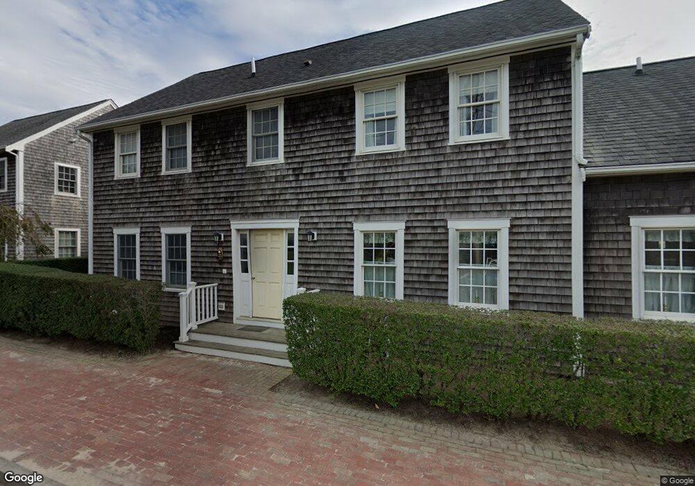
22 Park Cir Unit A Nantucket, MA 02554
Estimated Value: $1,089,000 - $1,284,109
3
Beds
3
Baths
1,406
Sq Ft
$854/Sq Ft
Est. Value
About This Home
This home is located at 22 Park Cir Unit A, Nantucket, MA 02554 and is currently estimated at $1,200,777, approximately $854 per square foot. 22 Park Cir Unit A is a home located in Nantucket County with nearby schools including Nantucket Elementary School, Cyrus Peirce Middle School, and Nantucket High School.
Ownership History
Date
Name
Owned For
Owner Type
Purchase Details
Closed on
Dec 3, 2009
Sold by
Watson Thomas M
Bought by
22A Park Cir Nt and Perryann Llc Tr
Current Estimated Value
Purchase Details
Closed on
Jun 10, 2005
Sold by
Cliff Acquisitions Llc
Bought by
Watson Thomas M
Home Financials for this Owner
Home Financials are based on the most recent Mortgage that was taken out on this home.
Original Mortgage
$447,200
Interest Rate
5.79%
Mortgage Type
Purchase Money Mortgage
Create a Home Valuation Report for This Property
The Home Valuation Report is an in-depth analysis detailing your home's value as well as a comparison with similar homes in the area
Home Values in the Area
Average Home Value in this Area
Purchase History
| Date | Buyer | Sale Price | Title Company |
|---|---|---|---|
| 22A Park Cir Nt | $277,000 | -- | |
| Watson Thomas M | $559,000 | -- |
Source: Public Records
Mortgage History
| Date | Status | Borrower | Loan Amount |
|---|---|---|---|
| Previous Owner | Watson Thomas M | $447,200 | |
| Previous Owner | Watson Thomas M | $55,900 |
Source: Public Records
Tax History Compared to Growth
Tax History
| Year | Tax Paid | Tax Assessment Tax Assessment Total Assessment is a certain percentage of the fair market value that is determined by local assessors to be the total taxable value of land and additions on the property. | Land | Improvement |
|---|---|---|---|---|
| 2025 | $3,528 | $1,075,700 | $0 | $1,075,700 |
| 2023 | $2,311 | $720,000 | $0 | $720,000 |
| 2022 | $2,322 | $620,900 | $0 | $620,900 |
| 2021 | $2,149 | $591,900 | $0 | $591,900 |
| 2020 | $2,242 | $649,900 | $0 | $649,900 |
| 2019 | $2,184 | $649,900 | $0 | $649,900 |
| 2018 | $1,923 | $544,800 | $0 | $544,800 |
| 2017 | $1,836 | $541,600 | $0 | $541,600 |
| 2016 | $1,820 | $541,600 | $0 | $541,600 |
| 2015 | $1,245 | $344,800 | $0 | $344,800 |
| 2014 | $1,296 | $344,800 | $0 | $344,800 |
Source: Public Records
Map
Nearby Homes
- 25B Park Cir Unit 25B
- 24 MacYs Ln
- 103A Old Rd S
- 2 Goldenrod Ct
- 10 Beach Grass Rd
- 5 Upper Tawpawshaw Rd
- 33 Goldfinch Dr
- 11 Killdeer Ln
- 6 Dovekie Ct
- 6 Honeysuckle Dr
- 19 Honeysuckle Dr
- 14 Beach Grass Rd
- 20 Evergreen Way
- 59 Polpis Rd
- 20 Nancy Ann Ln
- 7 Moors End Ln
- 13 Nancy Ann Ln
- 15 Nancy Ann Ln
- 4 Fawn Ln
- 13 Fawn Ln
- 22 Park Cir Unit B
- 17 Park Cir Unit B
- 17 Park Cir Unit A
- 14 Park Cir Unit B
- 14 Park Cir Unit A
- 22 Park Cir Unit 1.22A
- 22 Park Cir Unit 1.22B
- 17 Park Cir Unit 1.17B
- 17 Park Cir Unit 1.17A
- 14 Park Cir Unit 14A
- 14 Park Cir Unit 14B (2.1)
- 17 Park Cir Unit 17A
- 22A Park Cir
- 10 Park Cir Unit B
- 18 Park Cir Unit A
- 18 Park Cir Unit B
- 15 Park Cir Unit B
- 15 Park Cir Unit A
- 19 Park Cir Unit B
- 19 Park Cir Unit A