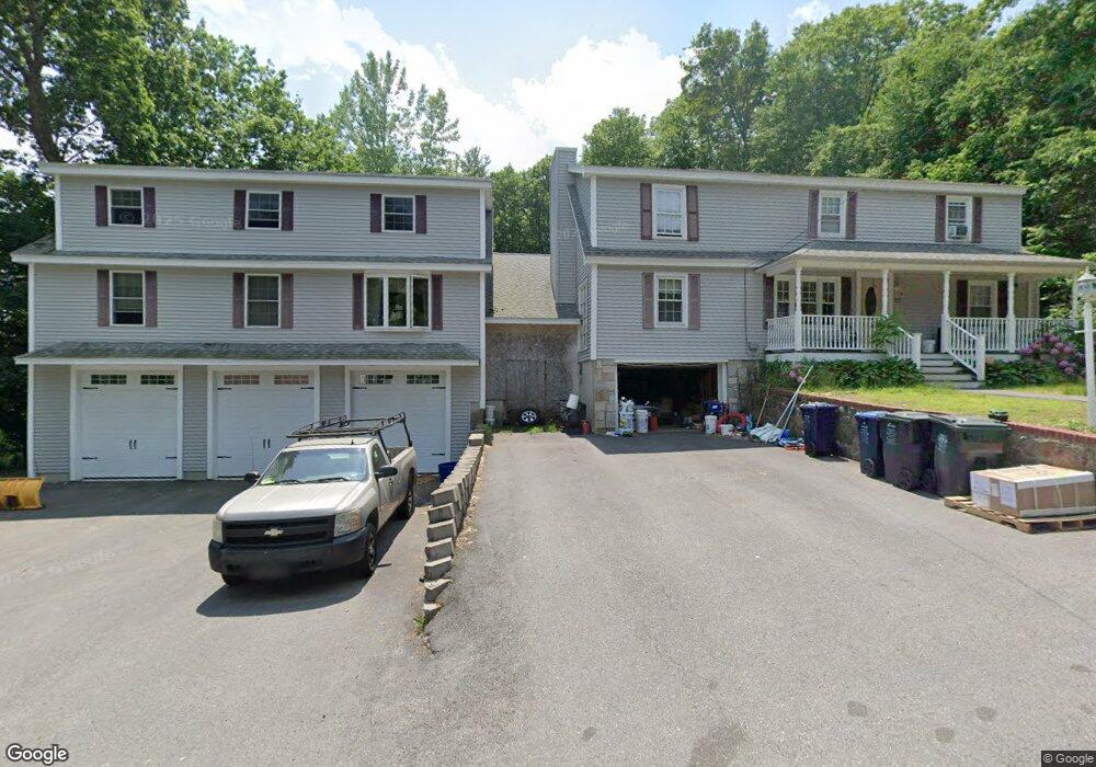
22 Passaconaway Dr Dracut, MA 01826
Estimated Value: $636,000 - $1,103,000
4
Beds
2
Baths
1,600
Sq Ft
$562/Sq Ft
Est. Value
About This Home
This home is located at 22 Passaconaway Dr, Dracut, MA 01826 and is currently estimated at $898,845, approximately $561 per square foot. 22 Passaconaway Dr is a home located in Middlesex County with nearby schools including Brookside Elementary School, Richardson Middle School, and Dracut Senior High School.
Ownership History
Date
Name
Owned For
Owner Type
Purchase Details
Closed on
Apr 7, 2005
Sold by
Powers David R
Bought by
Powers David R
Current Estimated Value
Purchase Details
Closed on
Dec 1, 1998
Sold by
First Eastern Mtg Corp
Bought by
Powers David R and Powers Helen
Home Financials for this Owner
Home Financials are based on the most recent Mortgage that was taken out on this home.
Original Mortgage
$100,450
Interest Rate
6.83%
Mortgage Type
Purchase Money Mortgage
Purchase Details
Closed on
Mar 3, 1998
Sold by
Chilson Randy J
Bought by
First Eastern Mtg Corp
Purchase Details
Closed on
Jan 28, 1994
Sold by
Shugrue Leon T
Bought by
Chilson Randy J
Home Financials for this Owner
Home Financials are based on the most recent Mortgage that was taken out on this home.
Original Mortgage
$104,400
Interest Rate
7.11%
Mortgage Type
Purchase Money Mortgage
Create a Home Valuation Report for This Property
The Home Valuation Report is an in-depth analysis detailing your home's value as well as a comparison with similar homes in the area
Home Values in the Area
Average Home Value in this Area
Purchase History
| Date | Buyer | Sale Price | Title Company |
|---|---|---|---|
| Powers David R | -- | -- | |
| Powers David R | $100,500 | -- | |
| First Eastern Mtg Corp | $103,500 | -- | |
| Chilson Randy J | $116,000 | -- |
Source: Public Records
Mortgage History
| Date | Status | Borrower | Loan Amount |
|---|---|---|---|
| Previous Owner | Chilson Randy J | $100,450 | |
| Previous Owner | Chilson Randy J | $104,400 |
Source: Public Records
Tax History
| Year | Tax Paid | Tax Assessment Tax Assessment Total Assessment is a certain percentage of the fair market value that is determined by local assessors to be the total taxable value of land and additions on the property. | Land | Improvement |
|---|---|---|---|---|
| 2025 | $9,054 | $894,700 | $226,800 | $667,900 |
| 2024 | $8,687 | $831,300 | $216,000 | $615,300 |
| 2023 | $8,368 | $722,600 | $187,900 | $534,700 |
| 2022 | $8,414 | $684,600 | $170,800 | $513,800 |
| 2021 | $6,436 | $627,000 | $155,200 | $471,800 |
| 2020 | $7,828 | $586,400 | $150,500 | $435,900 |
| 2019 | $5,937 | $579,200 | $143,300 | $435,900 |
| 2018 | $5,472 | $495,400 | $143,300 | $352,100 |
| 2017 | $6,402 | $495,400 | $143,300 | $352,100 |
| 2016 | $6,160 | $415,100 | $137,800 | $277,300 |
| 2015 | $5,973 | $400,100 | $137,800 | $262,300 |
| 2014 | $5,624 | $388,100 | $137,800 | $250,300 |
Source: Public Records
Map
Nearby Homes
- 17 Spare St
- 1905 Lakeview Ave
- 43 & 53 5th St
- 29 Mill St Unit B
- 13 Dallas Dr Unit 305
- 13 Dallas Dr Unit 107
- 53 Vinal St
- 9 Cornstalk Ln
- 70 Faith Ave
- 94 Tennis Plaza Rd Unit 10
- 74 Tennis Plaza Rd Unit 34
- 83 Turgeon Ave
- 154 New Boston Rd
- 91 Frederick St Unit 77
- 42 Frederick St Unit 9
- 40 Westfall Rd
- 4 Wilshire Ln Unit 4
- 4 Wilshire Ln
- 6 Wilshire Ln Unit 6
- 1 Elm Grove Ave
- 1408 Mammoth Rd
- 38 Passaconaway Dr
- 1422 Mammoth Rd
- 25 Passaconaway Dr
- 1406 Mammoth Rd
- 19 Passaconaway Dr
- 1400 Mammoth Rd
- 1394 Mammoth Rd
- 15 Passaconaway Dr
- 43 Passaconaway Dr
- 1430 Mammoth Rd
- 1378 Mammoth Rd
- 56 Passaconaway Dr
- 1405 Mammoth Rd
- 9 O St
- 1395 Mammoth Rd
- 1376 Mammoth Rd
- 1434 Mammoth Rd
- 51 Passaconaway Dr
- 1383 Mammoth Rd
Your Personal Tour Guide
Ask me questions while you tour the home.