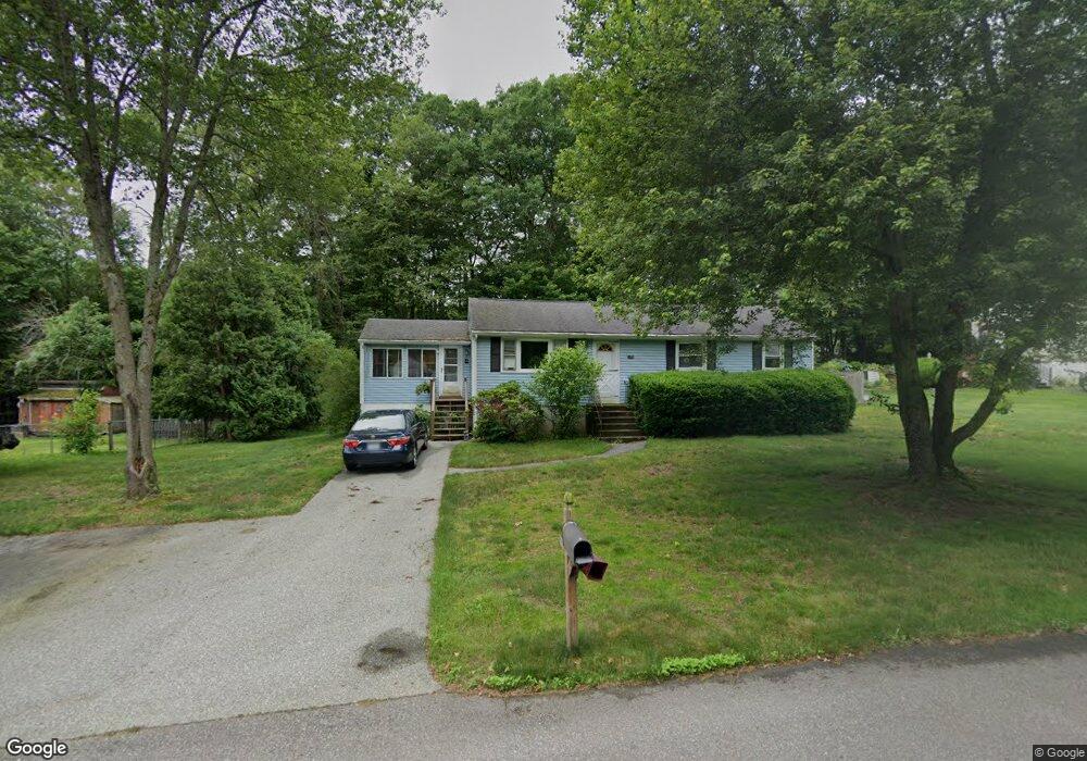
22 Peter Rd MerriMacK, NH 03054
Estimated Value: $492,000 - $540,000
About This Home
This home is located at 22 Peter Rd, MerriMacK, NH 03054 and is currently estimated at $520,009, approximately $348 per square foot. 22 Peter Rd is a home located in Hillsborough County with nearby schools including Thorntons Ferry School, Merrimack Middle School, and James Mastricola Upper Elementary School.
Ownership History
We collect this data history from publicly available records. To have your information removed, we recommend requesting removal directly through your county’s website.
Purchase Details
Purchase Details
Home Values in the Area
Average Home Value in this Area
Purchase History
We collect this data history from publicly available records. To have your information removed, we recommend requesting removal directly through your county’s website.
| Date | Buyer | Sale Price | Title Company |
|---|---|---|---|
| -- | -- | ||
| -- | -- |
Tax History
We collect this data history from publicly available records. To have your information removed, we recommend requesting removal directly through your county’s website.
| Year | Tax Paid | Tax Assessment Tax Assessment Total Assessment is a certain percentage of the fair market value that is determined by local assessors to be the total taxable value of land and additions on the property. | Land | Improvement |
|---|---|---|---|---|
| 2025 | $7,425 | $335,800 | $197,800 | $138,000 |
| 2024 | $6,948 | $335,800 | $197,800 | $138,000 |
| 2023 | $6,531 | $335,800 | $197,800 | $138,000 |
| 2022 | $5,831 | $335,500 | $197,800 | $137,700 |
| 2021 | $5,761 | $335,500 | $197,800 | $137,700 |
| 2020 | $5,782 | $240,300 | $131,900 | $108,400 |
| 2019 | $5,798 | $240,300 | $131,900 | $108,400 |
| 2018 | $5,796 | $240,300 | $131,900 | $108,400 |
| 2017 | $5,616 | $240,300 | $131,900 | $108,400 |
| 2016 | $5,476 | $240,300 | $131,900 | $108,400 |
| 2015 | $5,503 | $222,600 | $119,900 | $102,700 |
| 2014 | $5,362 | $222,600 | $119,900 | $102,700 |
| 2013 | $5,322 | $222,600 | $119,900 | $102,700 |
Map
- 103 Jay Rd
- 22 Erik St
- 4 Tinker Rd
- 82 Amherst St
- 3 Greenleaf St
- 3 Roedean Dr Unit UC101
- 3 Roedean Dr Unit 208
- 120 Camp Sargent Rd
- 2 Roedean Dr Unit UA301
- 256 Stonebridge Dr
- 264 Stonebridge Dr
- 7 Blackstone Dr Unit U36
- 481 Boston Post Rd
- 6 Maryann Ln
- 8 Ferncroft Dr
- 19 Baymeadow Dr
- 52 Thornton Rd W
- 1 County Rd
- 24 Scott Dr
- 3 Beech St
Ask me questions while you tour the home.