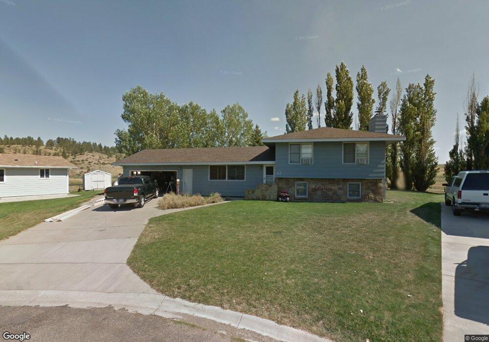
22 Plum Ct Colstrip, MT 59323
Estimated Value: $194,531 - $258,000
3
Beds
2
Baths
1,176
Sq Ft
$191/Sq Ft
Est. Value
About This Home
This home is located at 22 Plum Ct, Colstrip, MT 59323 and is currently estimated at $224,633, approximately $191 per square foot. 22 Plum Ct is a home located in Rosebud County with nearby schools including Pine Butte Elementary School and Frank Brattin Middle School.
Ownership History
Date
Name
Owned For
Owner Type
Purchase Details
Closed on
May 2, 2025
Sold by
Sessions Scott R and Sessions Shawna L
Bought by
Sessions Shawna L
Current Estimated Value
Home Financials for this Owner
Home Financials are based on the most recent Mortgage that was taken out on this home.
Original Mortgage
$80,000
Interest Rate
6.76%
Mortgage Type
New Conventional
Purchase Details
Closed on
Oct 1, 2009
Sold by
Hayes Thomas M
Bought by
Sessions Scott R and Sessions Shawna L
Purchase Details
Closed on
Mar 27, 2008
Sold by
Montoya Daniel A and Reatha Montoya E
Bought by
Hayes Thomas M
Create a Home Valuation Report for This Property
The Home Valuation Report is an in-depth analysis detailing your home's value as well as a comparison with similar homes in the area
Purchase History
| Date | Buyer | Sale Price | Title Company |
|---|---|---|---|
| Sessions Shawna L | -- | Mortgage Connect Lp | |
| Sessions Shawna L | -- | Mortgage Connect Lp | |
| Sessions Scott R | -- | -- | |
| Hayes Thomas M | -- | -- |
Source: Public Records
Mortgage History
| Date | Status | Borrower | Loan Amount |
|---|---|---|---|
| Previous Owner | Sessions Shawna L | $80,000 |
Source: Public Records
Tax History
| Year | Tax Paid | Tax Assessment Tax Assessment Total Assessment is a certain percentage of the fair market value that is determined by local assessors to be the total taxable value of land and additions on the property. | Land | Improvement |
|---|---|---|---|---|
| 2025 | $935 | $160,800 | $0 | $0 |
| 2024 | $1,137 | $132,000 | $0 | $0 |
| 2023 | $1,078 | $132,000 | $0 | $0 |
| 2022 | $933 | $124,100 | $0 | $0 |
| 2021 | $618 | $124,100 | $0 | $0 |
| 2020 | $844 | $126,800 | $0 | $0 |
| 2019 | $751 | $126,800 | $0 | $0 |
| 2018 | $871 | $156,600 | $0 | $0 |
| 2017 | $777 | $156,600 | $0 | $0 |
| 2016 | $785 | $150,500 | $0 | $0 |
| 2015 | $527 | $150,500 | $0 | $0 |
| 2014 | $384 | $66,780 | $0 | $0 |
Source: Public Records
Map
Nearby Homes
Your Personal Tour Guide
Ask me questions while you tour the home.