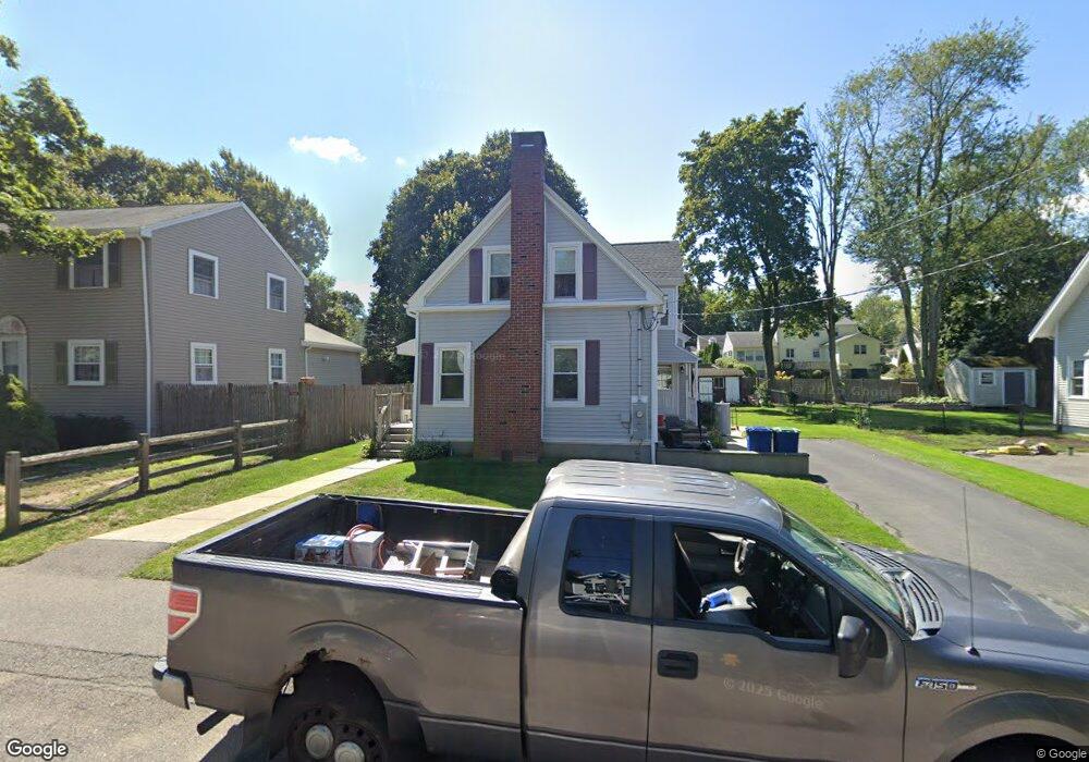
22 Plymouth Rd Braintree, MA 02184
Braintree Highlands NeighborhoodEstimated Value: $648,000 - $755,000
3
Beds
2
Baths
1,474
Sq Ft
$476/Sq Ft
Est. Value
About This Home
This home is located at 22 Plymouth Rd, Braintree, MA 02184 and is currently estimated at $701,087, approximately $475 per square foot. 22 Plymouth Rd is a home located in Norfolk County with nearby schools including Braintree High School, Boston Higashi School, and Lighthouse Baptist Christian Academy.
Ownership History
Date
Name
Owned For
Owner Type
Purchase Details
Closed on
Jun 10, 2019
Sold by
Sheehan Christine A and Sheehan Joseph V
Bought by
22 Plymouth Road Rt
Current Estimated Value
Purchase Details
Closed on
Aug 25, 1999
Sold by
Ryder Dev Corp
Bought by
Stokes Marc F and Stokes Lisa A
Home Financials for this Owner
Home Financials are based on the most recent Mortgage that was taken out on this home.
Original Mortgage
$175,250
Interest Rate
7.53%
Mortgage Type
Purchase Money Mortgage
Purchase Details
Closed on
Mar 30, 1979
Bought by
Sheehan Joseph and Sheehan Christine
Create a Home Valuation Report for This Property
The Home Valuation Report is an in-depth analysis detailing your home's value as well as a comparison with similar homes in the area
Home Values in the Area
Average Home Value in this Area
Purchase History
| Date | Buyer | Sale Price | Title Company |
|---|---|---|---|
| 22 Plymouth Road Rt | -- | -- | |
| Stokes Marc F | $237,500 | -- | |
| Sheehan Joseph | -- | -- |
Source: Public Records
Mortgage History
| Date | Status | Borrower | Loan Amount |
|---|---|---|---|
| Previous Owner | Sheehan Joseph | $175,250 |
Source: Public Records
Tax History Compared to Growth
Tax History
| Year | Tax Paid | Tax Assessment Tax Assessment Total Assessment is a certain percentage of the fair market value that is determined by local assessors to be the total taxable value of land and additions on the property. | Land | Improvement |
|---|---|---|---|---|
| 2025 | $6,053 | $606,500 | $322,700 | $283,800 |
| 2024 | $5,440 | $573,800 | $293,000 | $280,800 |
| 2023 | $5,159 | $528,600 | $263,300 | $265,300 |
| 2022 | $4,951 | $497,600 | $237,800 | $259,800 |
| 2021 | $4,571 | $459,400 | $214,900 | $244,500 |
| 2020 | $4,231 | $429,100 | $195,300 | $233,800 |
| 2019 | $4,083 | $404,700 | $186,800 | $217,900 |
| 2018 | $3,990 | $378,600 | $169,900 | $208,700 |
| 2017 | $3,843 | $357,800 | $161,400 | $196,400 |
| 2016 | $3,743 | $340,900 | $152,900 | $188,000 |
| 2015 | $3,313 | $299,300 | $127,400 | $171,900 |
| 2014 | $3,211 | $281,200 | $122,300 | $158,900 |
Source: Public Records
Map
Nearby Homes
- 16 Winthrop Ave
- 61 Woodside Ave
- 1579 Washington St
- 661 North St
- 7 Drake St
- 700 North St
- 184 Richard Rd
- 116 Cardinal Ct
- 44 Livoli Ave
- 469 North St
- 38 Mcdevitt Rd
- 1501 Liberty St
- 115 Richard Rd
- 1696 Liberty St
- 26 Highland Ave
- 6 E Division St
- 15 Highland Ave
- 1307 Washington St
- 614 Pond St Unit 1217
- 614 Pond St Unit 2104
- 24 Plymouth Rd
- 20 Plymouth Rd
- 16 Plymouth Rd
- 26 Plymouth Rd
- 29 Wampatuck Rd
- 33 Wampatuck Rd
- 17 Wampatuck Rd
- 15 Plymouth Rd
- 11 Wampatuck Rd
- 39 Wampatuck Rd
- 10 Plymouth Rd
- 28 Plymouth Rd
- 41 Wampatuck Rd
- 1773 Washington St
- 1769 Washington St
- 5 Wampatuck Rd
- 24 Wampatuck Rd
- 20 Wampatuck Rd
- 28 Wampatuck Rd
- 32 Wampatuck Rd