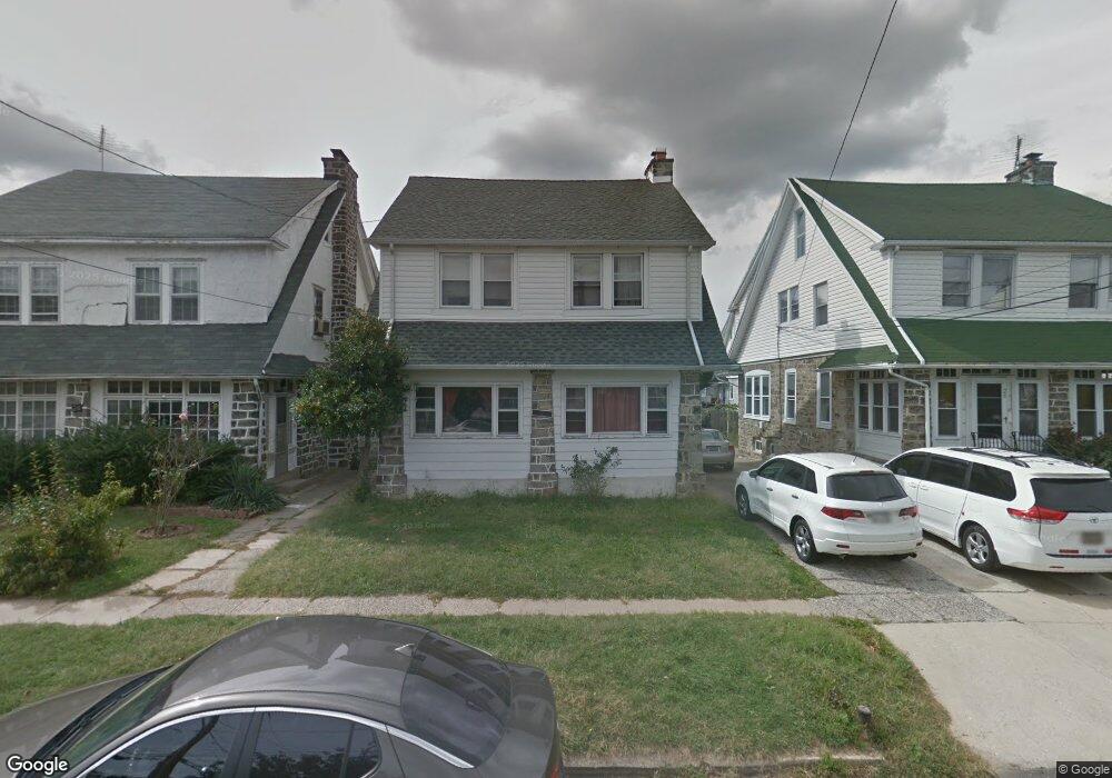
22 Powell Ln Upper Darby, PA 19082
Estimated Value: $249,149 - $335,000
4
Beds
1
Bath
1,780
Sq Ft
$161/Sq Ft
Est. Value
About This Home
This home is located at 22 Powell Ln, Upper Darby, PA 19082 and is currently estimated at $285,787, approximately $160 per square foot. 22 Powell Ln is a home located in Delaware County with nearby schools including Upper Darby Kdg Center, Upper Darby High School, and St. Frances Cabrini Catholic School.
Ownership History
Date
Name
Owned For
Owner Type
Purchase Details
Closed on
Aug 30, 2005
Sold by
Mut Koeun
Bought by
Lar Laradiane and Lar Tiffany
Current Estimated Value
Purchase Details
Closed on
Apr 19, 1994
Sold by
Kolea Judith A and Patterson Patricia M
Bought by
Mut Koeun
Home Financials for this Owner
Home Financials are based on the most recent Mortgage that was taken out on this home.
Original Mortgage
$52,500
Interest Rate
7.6%
Create a Home Valuation Report for This Property
The Home Valuation Report is an in-depth analysis detailing your home's value as well as a comparison with similar homes in the area
Home Values in the Area
Average Home Value in this Area
Purchase History
| Date | Buyer | Sale Price | Title Company |
|---|---|---|---|
| Lar Laradiane | -- | -- | |
| Mut Koeun | $82,500 | T A Title Insurance Company |
Source: Public Records
Mortgage History
| Date | Status | Borrower | Loan Amount |
|---|---|---|---|
| Closed | Mut Koeun | $52,500 |
Source: Public Records
Tax History
| Year | Tax Paid | Tax Assessment Tax Assessment Total Assessment is a certain percentage of the fair market value that is determined by local assessors to be the total taxable value of land and additions on the property. | Land | Improvement |
|---|---|---|---|---|
| 2025 | $5,433 | $128,470 | $31,250 | $97,220 |
| 2024 | $5,433 | $128,470 | $31,250 | $97,220 |
| 2023 | $5,382 | $128,470 | $31,250 | $97,220 |
| 2022 | $5,237 | $128,470 | $31,250 | $97,220 |
| 2021 | $7,062 | $128,470 | $31,250 | $97,220 |
| 2020 | $4,707 | $72,760 | $18,470 | $54,290 |
| 2019 | $4,624 | $72,760 | $18,470 | $54,290 |
| 2018 | $4,571 | $72,760 | $0 | $0 |
| 2017 | $4,452 | $72,760 | $0 | $0 |
| 2016 | $407 | $72,760 | $0 | $0 |
| 2015 | $407 | $72,760 | $0 | $0 |
| 2014 | $407 | $72,760 | $0 | $0 |
Source: Public Records
Map
Nearby Homes
Your Personal Tour Guide
Ask me questions while you tour the home.