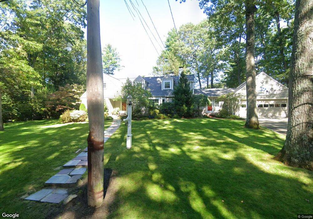
22 Redington Rd Needham, MA 02492
Estimated Value: $1,544,000 - $2,109,000
3
Beds
3
Baths
2,320
Sq Ft
$792/Sq Ft
Est. Value
About This Home
This home is located at 22 Redington Rd, Needham, MA 02492 and is currently estimated at $1,836,967, approximately $791 per square foot. 22 Redington Rd is a home located in Norfolk County with nearby schools including Newman Elementary School, High Rock Middle School, and Pollard Middle School.
Ownership History
Date
Name
Owned For
Owner Type
Purchase Details
Closed on
Mar 27, 2013
Sold by
Waters Mary C
Bought by
Mcw Rt and Waters
Current Estimated Value
Purchase Details
Closed on
Oct 15, 2012
Sold by
Mcw Rt and Waters
Bought by
Waters Mary C
Create a Home Valuation Report for This Property
The Home Valuation Report is an in-depth analysis detailing your home's value as well as a comparison with similar homes in the area
Home Values in the Area
Average Home Value in this Area
Purchase History
| Date | Buyer | Sale Price | Title Company |
|---|---|---|---|
| Mcw Rt | -- | -- | |
| Mcw Rt | -- | -- | |
| Waters Mary C | -- | -- | |
| Waters Mary C | -- | -- |
Source: Public Records
Mortgage History
| Date | Status | Borrower | Loan Amount |
|---|---|---|---|
| Previous Owner | Waters Mary C | $90,000 | |
| Previous Owner | Waters Mary C | $30,000 |
Source: Public Records
Tax History Compared to Growth
Tax History
| Year | Tax Paid | Tax Assessment Tax Assessment Total Assessment is a certain percentage of the fair market value that is determined by local assessors to be the total taxable value of land and additions on the property. | Land | Improvement |
|---|---|---|---|---|
| 2025 | $17,578 | $1,658,300 | $1,114,400 | $543,900 |
| 2024 | $14,717 | $1,175,500 | $625,300 | $550,200 |
| 2023 | $14,783 | $1,133,700 | $625,300 | $508,400 |
| 2022 | $14,283 | $1,068,300 | $580,300 | $488,000 |
| 2021 | $13,920 | $1,068,300 | $580,300 | $488,000 |
| 2020 | $13,419 | $1,074,400 | $580,300 | $494,100 |
| 2019 | $12,601 | $1,017,000 | $529,200 | $487,800 |
| 2018 | $12,082 | $1,017,000 | $529,200 | $487,800 |
| 2017 | $11,329 | $952,800 | $529,200 | $423,600 |
| 2016 | $11,050 | $957,500 | $529,200 | $428,300 |
| 2015 | $10,810 | $957,500 | $529,200 | $428,300 |
| 2014 | $10,486 | $900,900 | $482,700 | $418,200 |
Source: Public Records
Map
Nearby Homes
- 154 Laurel Dr
- 158 Laurel Dr
- 6 Redington Rd
- 164 Laurel Dr
- 150 Laurel Dr
- 150 Laurel Dr Unit 150
- 150 Laurel Dr
- 28 Redington Rd
- 172 Laurel Dr
- 144 Laurel Dr
- 11 Redington Rd
- 180 Laurel Dr
- 140 Laurel Dr
- 51 Redington Rd
- 415 Warren St
- 134 Laurel Dr
- 409 Warren St Unit 2B
- 155 Laurel Dr
- 159 Laurel Dr
- 149 Laurel Dr